Galimuyod

Last updated
Galimuyod
Municipality of Galimuyod
Galimuyod Ilocos Sur.png
Motto: 
Guyod Galimuyod!
Ph locator ilocos sur galimuyod.png
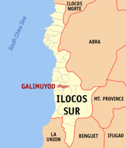
Map of Ilocos Sur with Galimuyod highlighted
OpenStreetMap
Galimuyod
Philippines location map (square).svg
Red pog.svg
Galimuyod
Location within the Philippines
Coordinates: 17°11′N120°28′E / 17.18°N 120.47°E / 17.18; 120.47
Country Philippines
Region Ilocos Region
Province Ilocos Sur
District 2nd district
Barangays 24 (see Barangays)
Government
[1]
  Type Sangguniang Bayan
   Mayor Jessie B. Balingsat
   Vice Mayor Kulapu R. Trinidad
   Representative Kristine Singson-Meehan
   Municipal Council
Members
  • Marlon Combas
  • Minard N. Tumacdang
  • Maricel T. Balingsat
  • Beberly Joy D. Dario
  • Willy Gadingan
  • Florendo G. Olanio
  • Raymund M. Balbin
  • Jose D. Balbino Jr.
   Electorate 7,458 voters (2025)
Area
[2]
  Total
34.40 km2 (13.28 sq mi)
Elevation
39 m (128 ft)
Highest elevation
250 m (820 ft)
Lowest elevation
0 m (0 ft)
Population
 (2024 census) [3]
  Total
10,263
  Density300/km2 (770/sq mi)
   Households
2,496
Economy
   Income class 4th municipal income class
   Poverty incidence
22.78
% (2021) [4]
   Revenue 501.4 million (2022)
   Assets 1,424 million (2022)
   Expenditure 225.9 million (2022)
   Liabilities 67.18 million (2022)
Service provider
  ElectricityIlocos Sur Electric Cooperative (ISECO)
Time zone UTC+8 (PST)
ZIP code
2709
PSGC
IDD : area code +63(0)77
Native languages Ilocano
Tagalog

Galimuyod, officially the Municipality of Galimuyod (Ilocano : Ili ti Galimuyod; Filipino : Bayan ng Galimuyod), is a municipality in the province of Ilocos Sur, Philippines. According to the 2020 census, it had a population of 10,244 people. [5]

Contents

Etymology

The town, formerly known as Cabisilan, was once the largest barrio of Candon during the Spanish Colonial Era. A land dispute between them and the residents of neighboring Sapang - another barrio of Candon - was settled through a "gin-nuyod" (Ilocano for "tug-of-war") contest, a common game during those days. The people of Cabisilan won, allowing the settlement to become the center of barrios near it. The old folks renamed the barrio Galimuyod, from the Ilocano words tali ("rope") and ginuyod ("pulled").[ citation needed ]

Geography

Galimuyod is situated 62.37 kilometres (38.75 mi) from the provincial capital Vigan, and 344.66 kilometres (214.16 mi) from the country's capital city of Manila.

Barangays

Galimuyod is politically subdivided into 24 barangays. [6] Each barangay consists of puroks and some have sitios.

  • Abaya
  • Baracbac
  • Bidbiday
  • Bitong
  • Borobor
  • Calimugtong
  • Calongbuyan
  • Calumbaya
  • Daldagan
  • Kilang
  • Legaspi
  • Mabayag
  • Matanubong
  • Mckinley
  • Nagsingcaoan
  • Oaig-Daya
  • Pagangpang
  • Patac
  • Poblacion
  • Rubio
  • Sabangan-Bato
  • Sacaang
  • San Vicente
  • Sapang

Climate

Climate data for Galimuyod, Ilocos Sur
MonthJanFebMarAprMayJunJulAugSepOctNovDecYear
Mean daily maximum °C (°F)30
(86)
31
(88)
32
(90)
34
(93)
32
(90)
31
(88)
30
(86)
30
(86)
30
(86)
31
(88)
31
(88)
30
(86)
31
(88)
Mean daily minimum °C (°F)19
(66)
19
(66)
21
(70)
23
(73)
24
(75)
25
(77)
24
(75)
24
(75)
24
(75)
22
(72)
21
(70)
19
(66)
22
(72)
Average precipitation mm (inches)10
(0.4)
10
(0.4)
14
(0.6)
23
(0.9)
80
(3.1)
103
(4.1)
121
(4.8)
111
(4.4)
119
(4.7)
144
(5.7)
39
(1.5)
15
(0.6)
789
(31.2)
Average rainy days5.23.96.29.118.521.422.919.819.816.210.56.1159.6
Source: Meteoblue (modeled/calculated data, not measured locally) [7]

Demographics

Population census of Galimuyod
YearPop.±% p.a.
1918 2,849    
1939 3,063+0.35%
1948 3,418+1.23%
1960 4,670+2.63%
1970 5,288+1.25%
YearPop.±% p.a.
1975 6,281+3.51%
1980 6,576+0.92%
1990 7,941+1.90%
1995 8,477+1.23%
2000 8,879+1.00%
YearPop.±% p.a.
2007 10,310+2.08%
2010 10,011−1.07%
2015 10,748+1.36%
2020 10,244−1.01%
2024 10,263+0.04%
Source: Philippine Statistics Authority [8] [9] [10] [11] [12]

In the 2020 census, Galimuyod had a population of 10,244. [13] The population density was 300 inhabitants per square kilometre (780/sq mi).

Government

Local government

Galimuyod, belonging to the second congressional district of the province of Ilocos Sur, is governed by a mayor designated as its local chief executive and by a municipal council as its legislative body in accordance with the Local Government Code. The mayor, vice mayor, and the councilors are elected directly by the people through an election which is being held every three years.

Elected officials

Members of the Municipal Council
(2019–2022) [14]
PositionName
CongressmanKristine Singson-Meehan
MayorJessie B. Balingsat
Vice-MayorKulapu R. Trinidad
CouncilorsMinard N. Tumacdang
Maricel T. Balingsat
Beberly Joy D. Dario
Moises Galangco
Florendo G. Olanio
Raymund M. Balbin
Willy Gadingan

Education

The Salcedo-Galimuyod-Sigay-Del Pilar Schools District Office governs all private and public schools within the municipality of Galimuyod. The Schools District Office (SDO) also oversees the operations of all schools situated in Salcedo, Sigay, and Gregorio del Pilar. [15]

Primary and elementary schools

Secondary schools

References

  1. Municipality of Galimuyod | (DILG)
  2. "2015 Census of Population, Report No. 3 – Population, Land Area, and Population Density" (PDF). Philippine Statistics Authority. Quezon City, Philippines. August 2016. ISSN   0117-1453. Archived (PDF) from the original on May 25, 2021. Retrieved July 16, 2021.
  3. "2024 Census of Population (POPCEN) Population Counts Declared Official by the President". Philippine Statistics Authority. 17 July 2025. Retrieved 18 July 2025.
  4. "PSA Releases the 2021 City and Municipal Level Poverty Estimates". Philippine Statistics Authority. 2 April 2024. Retrieved 28 April 2024.
  5. "2024 Census of Population (POPCEN) Population Counts Declared Official by the President". Philippine Statistics Authority. 17 July 2025. Retrieved 18 July 2025.
  6. "Province:". PSGC Interactive. Quezon City, Philippines: Philippine Statistics Authority . Retrieved 12 November 2016.
  7. "Galimuyod: Average Temperatures and Rainfall". Meteoblue. Retrieved 14 May 2020.
  8. "2024 Census of Population (POPCEN) Population Counts Declared Official by the President". Philippine Statistics Authority. 17 July 2025. Retrieved 18 July 2025.
  9. Census of Population (2015). "Region I (Ilocos Region)". Total Population by Province, City, Municipality and Barangay. Philippine Statistics Authority . Retrieved 20 June 2016.
  10. Census of Population and Housing (2010). "Region I (Ilocos Region)" (PDF). Total Population by Province, City, Municipality and Barangay. National Statistics Office . Retrieved 29 June 2016.
  11. Censuses of Population (1903–2007). "Region I (Ilocos Region)". Table 1. Population Enumerated in Various Censuses by Province/Highly Urbanized City: 1903 to 2007. National Statistics Office.
  12. "Province of". Municipality Population Data. Local Water Utilities Administration Research Division. Retrieved 17 December 2016.
  13. "2024 Census of Population (POPCEN) Population Counts Declared Official by the President". Philippine Statistics Authority. 17 July 2025. Retrieved 18 July 2025.
  14. "2019 National and Local Elections" (PDF). Commission on Elections. Retrieved March 11, 2022.
  15. "Masterlist of Schools" (PDF). Department of Education. January 15, 2021. Retrieved April 17, 2025.