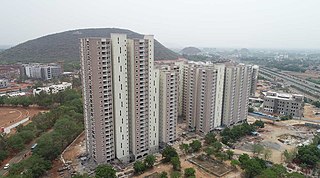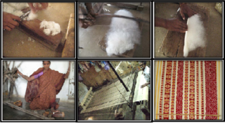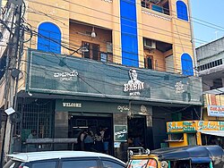
Krishna district is a district in the coastal Andhra Region in Indian state of Andhra Pradesh, with Machilipatnam as its administrative headquarters. It is surrounded on the East by Bay of Bengal, West by Guntur, Bapatla and North by Eluru and NTR districts and South again by Bay of Bengal.

Mahabubnagar, formerly known as Rukmammapeta and Palamooru is a city in Mahabubnagar District of the Indian state of Telangana named after the 6th Nizam, Mahboob Ali Khan. It is the headquarters of Mahabubnagar mandal in Mahabubnagar revenue division. The city is also the largest in the district with an area of 39.64 km2 (15.31 sq mi) and 7th most populous in the state.

Vijayawada, formerly known as Bezawada, is the second largest city in the Indian state of Andhra Pradesh. It is located on the banks of the Krishna River surrounded by the hills of the Eastern Ghats, known as the Indrakeeladri Hills. The city is home to the important Hindu shrine of Kanaka Durga Temple. It geographically lies on the center spot of Andhra Pradesh. The city has been described as the commercial, political, cultural and educational capital of Andhra Pradesh. It is the administrative headquarters of NTR district. The Prakasam Barrage across the Krishna River connects the NTR and Guntur districts.

Kadapa district is one of the twenty six districts in the Indian state of Andhra Pradesh. In 2022 reorganisation of Andhra Pradesh districts, the district boundary is largely restricted to Kadapa parliamentary constituency area. It is also one of the eight districts in the Rayalaseema region. Kadapa is the administrative headquarters for this district.

Kurnool district is one of the eight districts in the Rayalaseema region of the Indian state of Andhra Pradesh after the districts are reorganised in April 2022. It is located in the north western part of the state and is bounded by Nandyal district in the east, Anantapur district in the south, Raichur district of Karnataka in the northwest, Bellary district of Karnataka in the west, and Jogulamba Gadwal district of Telangana in the north. It has a population of 2,271,686 based on the 2011 census. The city of Kurnool is the headquarters of the district.

Prakasamdistrict is one of the twelve districts in the coastal Andhra region of the Indian state of Andhra Pradesh. It was formed in 1970 and reorganised on 4 April 2022. The headquarters of the district is Ongole. It is located on the western shore of Bay of Bengal and is bounded by Bapatla district and Palnadu districts in the north, Nandyal district in the west, Kadapa and Nellore districts in the south. A part of north west region also borders with Nagarkurnool district of Telangana. It is the largest district in the state with an area of 14,322 km2 (5,530 sq mi) and had a population of 22,88,026 as per 2011 Census of India.

Srikakulam district is one of the twenty-six districts of the Indian state of Andhra Pradesh, located in the Uttarandhra region of the state, with its headquarters located at Srikakulam. It is one of the six districts, located in the extreme northeastern direction of the state. It was formerly known as Chicacole, and was under Ganjam district till 1936 April 1, then merged under Vizagapatam district. Srikakulam district forms the core area of Kalinga where most of its historical capitals like Kalinganagari, pithunda, Dantapuram are located.

Nuzvid, natively spelled Nuzividu or Nuziveedu is a city in the Eluru district of the Indian state of Andhra Pradesh. It serves as the administrative headquarters for Nuzvid mandal and Nuzvid revenue division.

Anakapalli is a residential neighborhood in the city of Visakhapatnam, also the headquarters of Anakapalli district of Andhra Pradesh. In 2015 Anakapalli municipality was merged with the Greater Visakhapatnam Municipal Corporation. It falls under zone 7 of GVMC. India's second largest jaggery market is located over here.

Parvathipuram is a municipality located at Parvathipuram Manyam district of Indian state of Andhra Pradesh. It is the administrative headquarters of Parvathipuram Manyam district and headquarters of Parvathipuram revenue division and Parvathipuram mandal. This revenue division shares a border with various districts in Odisha.

Ponduru is a census town in Srikakulam district of the Indian state of Andhra Pradesh. The town is the mandal headquarters of Ponduru mandal in Srikakulam revenue division. It falls under the Amadalavalasa Assembly Constituency and Srikakulam Loksabha Constituency.

Mylavaram is a town and Suburb of Vijayawada in NTR district of the Indian state of Andhra Pradesh. It is located in Mylavaram mandal of Vijayawada revenue division. Mylavaram town has higher literacy rate compared to Andhra Pradesh. In 2011, literacy rate of Mylavaram village was 69% compared to 67.02% of Andhra Pradesh.

Ramavarappadu is a residential hub located in the East-Central part of Vijayawada in NTR district of the Indian state of Andhra Pradesh.It is one of the major locality of the City.The nearest localities to Ramavarappadu are Currency Nagar ,Gunadala ,Prasadampadu
Surampalli is a North suburb of Vijayawada City Krishna district of the Indian state of Andhra Pradesh. It is located in Gannavaram mandal under the Nuzvid revenue division. Surampalli village has most of the manufacturing industries like garments, mechanical etc.,. Next to the Auto Nagar area in Vijayawada city, we could see most of the manufacturing industries situated in Surampalli which is in the outskirts of Vijayawada city and is around 15KM distance from Vijayawada city. Mainly we could see most of the Iron and other metal making and moulding industries near to this village like Kusalava International, G.S. Polymers etc.,

Kakani Venkata Ratnam was a former cabinet minister in Andhra Pradesh in India.

Amethi is one of the 75 districts of the northern Indian state of Uttar Pradesh. This district is a part of Ayodhya division in the Awadh region of Uttar Pradesh. It covers an area of 2329.11 km2. Gauriganj is the administrative headquarters of the district.
Ward No. 98, Kolkata Municipal Corporation is an administrative division of Kolkata Municipal Corporation in Borough No. 10, covering parts of Ranikuthi, Netaji Nagar, Gandhi Colony-Pallisree-Sangati Colony-Shahid Nagar Colony in Tollygunge and Bansdroni neighbourhoods in South Kolkata, in the Indian state of West Bengal.
Gandhi Nagar is a village in the Nicobar district of Andaman and Nicobar Islands, India. It is located in the Great Nicobar tehsil.

Tarigoppula Halt railway station is an Indian Railways station in the village of Tarigoppula of Krishna district in Andhra Pradesh. It lies on the Gudivada–Machilipatnam branch line, Vijayawada–Nidadavolu loop line and is administered under Vijayawada railway division of South Coast Railway zone.

NTR district is a district in coastal Andhra Region in the Indian state of Andhra Pradesh. The district headquarters is located at Vijayawada. The district is named after former Chief Minister of Andhra Pradesh N. T. Rama Rao. The district shares boundaries with Guntur, Palnadu, Krishna, Eluru, Khammam and Suryapet districts


