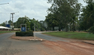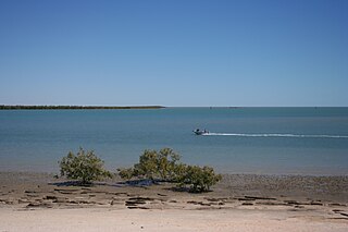
Weipa is a coastal mining town in the local government area of Weipa Town in Queensland. It is one of the largest towns on the Cape York Peninsula. It exists because of the enormous bauxite deposits along the coast. The Port of Weipa is mainly involved in exports of bauxite. There are also shipments of live cattle from the port.

Normanton is an outback town and coastal locality in the Shire of Carpentaria, Queensland, Australia. At the 2021 census, the locality of Normanton had a population of 1,391 people, and the town of Normanton had a population of 1,326 people.

Mornington Island, also known as Kunhanhaa, is an island in the Gulf of Carpentaria in the Shire of Mornington, Queensland, Australia. It is the northernmost and largest of 22 islands that form the Wellesley Islands group. The largest town, Gununa, is in the south-western part of the island.

Far North Queensland (FNQ) is the northernmost part of the Australian state of Queensland. Its largest city is Cairns and it is dominated geographically by Cape York Peninsula, which stretches north to the Torres Strait, and west to the Gulf Country. The waters of Torres Strait include the only international border in the area contiguous with the Australian mainland, between Australia and Papua New Guinea.

Kowanyama is a town and coastal locality in the Aboriginal Shire of Kowanyama, Queensland, Australia.

Pormpuraaw is a coastal town and a locality in the Aboriginal Shire of Pormpuraaw, Queensland, Australia. Pormpuraaw is an Aboriginal community situated on the west coast of Cape York Peninsula approximately halfway between Karumba and Weipa on the Edward River. It is 650 kilometres (400 mi) by road from Cairns. Pormpuraaw currently has a 4-man police station.
Doomadgee is a town and a locality in the Aboriginal Shire of Doomadgee, Queensland, Australia. It is a mostly Indigenous community, situated about 140 kilometres (87 mi) from the Northern Territory border, and 93 kilometres (58 mi) west of Burketown.

Karumba is a town and a coastal locality in the Shire of Carpentaria, Queensland, Australia. In the 2021 census, the locality of Karumba had a population of 487 people.

Burketown is an isolated outback town and coastal locality in the Shire of Burke, Queensland, Australia. In the 2021 census, the locality of Burketown had a population of 204 people.

The Shire of Burke is a local government area in North West Queensland, Australia. The shire lies on the south coast of the Gulf of Carpentaria and abuts the border with the Northern Territory. It covers an area of 39,864 square kilometres (15,391.6 sq mi), and has existed as a local government entity since 1885. The major town and administrative centre of the shire is Burketown.

The Shire of Mornington is a local government area in northwestern Queensland, Australia. The shire covers the Wellesley Islands, which includes Mornington Island; the South Wellesley Islands; Bountiful Islands; and West Wellesley / Forsyth Islands groups in the Gulf of Carpentaria.

The Aboriginal Shire of Doomadgee is a special local government area in North West Queensland, Queensland, Australia. It is managed under a Deed of Grant in Trust under the Local Government Act 2004.

The Gulf Country or North West Queensland is the region of woodland and savanna grassland surrounding the Gulf of Carpentaria in north western Queensland and eastern Northern Territory on the north coast of Australia. The region is also called the Gulf Savannah. The Gulf Country is crossed by the Savannah Way highway.

Duchess is a rural town and locality in the Shire of Cloncurry, Queensland, Australia. In the 2021 census, the locality of Duchess had a population of 53 people.
The Nicholson River is a river in the Northern Territory and the state of Queensland, Australia.

Lawn Hill is an outback locality split between the Shire of Burke and the City of Mount Isa in Queensland, Australia. The locality is on the Queensland border with the Northern Territory. In the 2021 census, Lawn Hill had a population of 63 people.
Nicholson is a coastal locality in the Shire of Burke, Queensland, Australia. It is on the border with the Northern Territory. In the 2021 census, Nicholson had a population of 32 people.

The Aboriginal Shire of Mapoon is a local government area in Far North Queensland, Australia. It is on the western coast of Cape York Peninsula on the Gulf of Carpentaria. In the 2021 census, the Aboriginal Shire of Mapoon had a population of 432 people.

Carpentaria is a coastal locality in the Shire of Carpentaria, Queensland, Australia. In the 2021 census, Carpentaria had a population of 25 people.
The West Wellesley Islands, also referred to as the Forsyth Islands, is an island group and locality in the Gulf of Carpentaria within the Shire of Mornington, Queensland, Australia. The group lies to the south-west of the Wellesley Islands, closer to mainland Australia. The island group comprises four islands: Forsyth Island, Ivis Island, Pains Island and Bayley Island.


