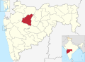
Gangapur, Maharashtra

Last updated

Gangapur
Town
India Maharashtra location map.svg
Red pog.svg
Gangapur
Location in Maharashtra, India
Coordinates: 19°41′57″N75°00′31″E / 19.6991°N 75.0086°E / 19.6991; 75.0086
CountryFlag of India.svg  India
State Maharashtra
District Aurangabad
Population
 (2001)
  Total25,053
Languages
  Official Marathi
Time zone UTC+5:30 (IST)
ISO 3166 code IN-MH
Vehicle registration MH-20
Website maharashtra.gov.in

Gangapur is a town and a municipal council in Aurangabad district in the state of Maharashtra, India.

Contents

Geography

Gangapur is located on west side of Aurangabad-Ahmednagar Highway, 38 km from Aurangabad. Gangapur is Taluka place in historical district Aurangabad. Gangapur is city of holy temples, ancient Lord Narshimha Temple, Vitthal Mandir, Ek Mukhi Datta Temple, Rameshwar Temple, Gudhicha Maroti and Baravcha Ganpati Mukteshwar Temple, Mukunda Devi, Manjari Jagdamba Devi Temple, Jamgaon. Also a Gangapur Sugar Factory Located in Jamgaon.Jamgaon is Situated near back water of Jayakwadi so most of the area is irrigated etc. [1] It has an average elevation of 572 metres (1876 feet) Vitthal Asram Jakmatha & Khandoba Mandir (Katkar Vasti Jakmatha)sankateshwar mandir (Newargav)Shivaji Chouk (Gangapur)), Gangapur famous for Lord Dattatreya.Lord Buddha - there are Four Modern Buddha Viharas in Gangapur City, as follows

LUMBINI BUDDH VIHAR, At- BHARATRATN DR. BABASAHEB AMBEDKAR CHOUK,MAIN ROAD GANGAPUR, TAKSHSHILA BUDDH VIHAR, At- MAHATMA FULE NAGAR, LASUR NAKA, GANGAPUR, JETVAN BUDDH VIHAR, At- DR. BABASAHEB AMBEDKAR NAGAR, MHADA COLONY GANGAPUR, CHA.SAMRAT ASHOKA BUDDH VIHAR At- NAGAR PARISHAD VASAHAT GANGAPUR

Demographics

As of 2012 India census, [2] Gangapur had a population of 41,067. Males constitute 52% of the population and females 48%. Gangapur has an average literacy rate of 71.2%, higher than the national average of 64.1%: male literacy is 74%, and female literacy is 59%. In Gangapur, 15% of the population is under 6 years of age.

Religion in Ganagapur City

Religion in Soegaon Taluka (2011) [3]

   Hinduism (61.42%)
   Islam (30.01%)
   Buddhism (16.5%)
   Jainism (1.02%)
   Christianity (0.37%)
   Sikhism (0.04%)
  Others (0.05%)

Religion in Ganagapur Taluka

Religion in Soegaon Taluka (2011) [4]

   Hinduism (75.61%)
   Islam (15.07%)
   Buddhism (8.16%)
   Jainism (0.57%)
   Christianity (0.23%)
   Sikhism (0.04%)
  Others (0.05%)

Education

There is St Mary's High School Wahegaon run by St Francis Education Society Aurangabad is very famous and well admired Marathi medium high school and more English medium schools.as well as Marathi medium Schools There is one college having Arts, commerce & science streams up to degree level i.e.SHRI MUKTANAND MAHAVIDYALAYA. The college is reaccredited by NAAC with "A+" grade.

Related Research Articles

Paithan ['pəɪ.ʈʰaɳ], historically Pratiṣṭhāna [pɾə'tɪʂʈʰana], is a town with municipal council in Aurangabad district, Maharashtra, Maharashtra, India. Paithan is located 56 kilometres (35 mi) south of present-day Chatrapati Sambhajinagar on the banks of the Godavari River. It was the capital of the Satavahana dynasty, which ruled from the second century BCE to the second century CE. It is one of the few inland towns mentioned in the famous first-century Greek book, the Periplus of the Erythraean Sea.

Mehkar is a tabletop tehsil and a municipal council situated in Buldhana district of the Indian state of Maharashtra. Located at the bank of Painganga River, Mehkar falls in the Vidarbha region of Maharashtra.

Wardha is a city and a municipal council in Wardha district in the Indian state of Maharashtra. The administrative headquarter of Wardha district is situated here. Wardha gets its name from Wardha River which flows on the northern, western and southern boundaries of the district. Founded in 1866, the town is now an important centre for cotton trade. Wardha was an important part of the Gandhian era.

<span class="mw-page-title-main">Aurangabad district, Maharashtra</span> District of Maharashtra in India

Aurangabad district, officially known as Chhatrapati Sambhaji Nagar district, is one of the 36 districts of the state of Maharashtra in western India. It borders the districts of Nashik to the west, Jalgaon to the north, Jalna to the east, and Ahmednagar to the south. The city of Aurangabad houses the district's administrative headquarters. The district has an area of 10,100 km2, of which 37.55% is urban and the rest is rural. Aurangabad District is a major tourism region in Marathwada.

Murtijapur is a Municipal council and one of the taluka of district of Akola of the Amravati division of the Vidarbha region of Maharashtra.

<span class="mw-page-title-main">Osmanabad</span> City in Maharashtra, India

Dharashiv, formerly known as Osmanabad, is a city and a municipal council in Dharashiv district in the Indian state of Maharashtra. The city is the administrative headquarter of Dharashiv district. It is the seventh largest city in Marathwada, and the 39th largest city in Maharashtra by population.

Anjangaon is a city and a municipal council in Amravati district in the state of Maharashtra, India. Anjangaon City got the status of Municipal Council in 1930. It is the first municipal council established in Amravati district and the second biggest council as well. Anjangaon Surji Tehsil was established in 1981. It is technically made up of two main zones, Anjangaon and Surji, on either side of Shahanur River, and is called Anjangaon-Surji in combination. It is called a "Banana Hub of Vidarbha" as it is a large producer of bananas and a hub of medicinal plants - Piper longum and Safed musali.

Chikhli is a city and a municipal council in Buldana district in Vidarbha Region of Maharashtra state, India. It is located on the Pune-Nagpur highway. It is situated at the westernmost border of Vidarbha region of Maharashtra and is 500 km from the state capital, Mumbai. Chikhli is situated on the border of the Marathwada Region and Vidarbha Regions of Maharashtra.

Dehu Road Cantt, is a military cantonment in the city of Pune, India, which was established in October 1958. The Dehu Ordnance Depot and Dehu Ammunition Depot was set up in the 1940s.

<span class="mw-page-title-main">Dharmabad</span> Town in Maharashtra, India

Dharmabad is a town and a municipal council in Nanded district in the state of Maharashtra, India. It is located near the state border with Telangana. Dharmabad has an average elevation of 359 metres (1,178 ft). It is connected by railway. An industrial training institute was established in the town in 1977.

Jintur city and a municipal council in Parbhani district in the Indian state of Maharashtra.

<span class="mw-page-title-main">Lodhikheda</span> City in Madhya Pradesh, India

Lodhikheda is a town and a nagar parishad in Chhindwara district in the Indian state of Madhya Pradesh. It is famous for its oranges. More than 90 per cent of farmers produce oranges. Cotton is grown in large quantities in the local area.

Obra is a town, Tehsil and Assembly constituency of Uttar Pradesh which is recently upgraded from the stature of Nagar Panchayat in Sonebhadra district in the Indian state of Uttar Pradesh. Obra is located 137 km from Varanasi at the Banks of Renu & Sone River with population of 46,574 As per 2011 India Census. State-owned UPRVUNL and UPJVUNL have a coal-fired thermal power plant and a hydro electric power plant here, respectively. The before mentioned industries are the major source of employment either directly or indirectly. Recreational places in Obra include Jawahar Bal Udayan, Ambedkar Stadium, Lord Shiva's temple, Sone river banks, parsoi and kharatiya villages etc. Restructuring of government residential colony is ongoing as new power plants are being constructed.

<span class="mw-page-title-main">Ambajogai</span> Municipal council in Maharashtra, India

Ambajogai is a municipal council, Tehsil and subdivision in Beed district in the state of Maharashtra, India. Ambajogai is known as cultural capital of the Marathwada. The town has tourist destinations like Hattikhana, Monuments of Mukundraj, and Dasopant, temples of Yogeshwari temple, Kholeshwar temple, Barakhambi temple.

<span class="mw-page-title-main">Bhadravati, Maharashtra</span> City in Maharashtra, India

Bhadravati is a city and a municipal council in Chandrapur district in the state of Maharashtra, India. It lies 26 km from Chandrapur city. Bhadravati city has recently bagged the Best City in 'Innovation & Best Practices' award under the population Category - 50K to 1 Lakh from the Government of India under Swach Surverkshan Awards-2021. It has also bagged 8th Rank in being the cleanest city under category population Category - 50K to 1 Lakh under Swach Surverkshan Awards-2021 amongst 132 cities nominated.

Goregaon is a census town in Raigad district in Maharashtra state. It is situated 18 km away from the Raigad fort, the capital of Shivaji's kingdom. For many years, Goregaon has served as a cultural and educational center for surrounding areas in the region. Situated near the Kal River, a tributary of the Savitri River. Goregaon enjoys an abundance of water and natural features. Goregaon (Ghodegaon) is likely the ancient Hippokura (Ghodekula) trade centre mentioned in Ptolemy's writings.

Shiradwad is a village in Belgaum district of Karnataka, situated on the bank of Dudhaganga River.The Village has population of around 3000 (Approx) with Kannada being the mainly spoken language followed by Marathi. Shiradwad is also known as Chand Shiradwad to differentiate it from another village with the same name in Maharashtra. The word Chand is derived from the famous shrine built on the bank of Dudhaganga river named, 'Chand Peer Dargah'. However the official name of the town remains as Shiradwad. The residents of Shiradwad mainly depend on agriculture, but the rise in literacy rate and industrial zones in the nearby area have also contributed to a large extent on the living and economic conditions of its residents. Prominent among people from different communities who reside in shiradwad are Jains, Lingayats, Muslims, Kurubas, Marathas, Scheduled Castes and Scheduled Tribes. Shiradwad was adopted by Mr. Prakash Babanna Hukkeri, the then MP of the territory under Sansad Adarsh Gram Yojana in 2014.

Kadgaon is a town situated Gadhinglaj Taluka of Kolhapur district situated in the southwest corner of the state of Maharashtra, India. Kadgaon is about 4 km from Gadhinglaj, 79 km from Kolhapur. Kadgaon is situated on MH SH 134 and is about 15 km from National Highway 48 (NH48). It is managed by Town Council. It is in the phase of transforming from a small town to a bustling city. It is the second-largest city after Gadhinglaj in Gadhinglaj Taluka also second largest city in Gadhinglaj sub division which Include talukas of Gadhinglaj, Ajra, Bhudargad, Chandgad. As of 2012 it has a population of about 20,851. Kadgaon has amenities that are of the level of Municipal Council in India. Kadgaon has developed as an industrial hub in recent years. It has a strong agricultural sector and is known for its sugarcane, jaggery and red chili production. It is well connected to all of Kolhapur and Maharashtra. It has a very excellent civic amenities. Like in most of the case in the Maharashtra the primary Language spoken is Marathi with 20,851 speaking as their primary Language.

Beed Kh. village is located in Khalapur Tehsil of Raigad district in Maharashtra, India. It is situated 13 km away from sub-district headquarter Khalapur and 66 km away from district headquarter Alibag. Beed Khurd is the gram panchayat of Beed Kh village.

References

  1. gangapur is in bhilwara district Falling Rain Genomics, Inc - Gangapur
  2. "Census of India 2001: Data from the 2001 Census, including cities, villages and towns (Provisional)". Census Commission of India. Archived from the original on 16 June 2004. Retrieved 1 November 2008.
  3. "C-1 Population By Religious Community". Census. Retrieved 10 June 2019.
  4. "C-1 Population By Religious Community". Census. Retrieved 10 June 2019.