Gargas | |
|---|---|
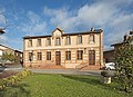
 The town hall in Gargas | |
 Coat of arms | |
Location of Gargas  | |
 Gargas  Gargas | |
| Coordinates: 43°45′28″N1°28′06″E / 43.7578°N 1.4683°E | |
| Country | France |
| Region | Occitania |
| Department | Haute-Garonne |
| Arrondissement | Toulouse |
| Canton | Villemur-sur-Tarn |
| Government | |
| • Mayor (2020–2026) | Jeanine Gibert [1] |
Area 1 | 7.28 km2 (2.81 sq mi) |
| Population (2022) [2] | 758 |
| • Density | 100/km2 (270/sq mi) |
| Time zone | UTC+01:00 (CET) |
| • Summer (DST) | UTC+02:00 (CEST) |
| INSEE/Postal code | 31211 /31620 |
| Elevation | 126–196 m (413–643 ft) (avg. 170 m or 560 ft) |
| 1 French Land Register data, which excludes lakes, ponds, glaciers > 1 km2 (0.386 sq mi or 247 acres) and river estuaries. | |
Gargas is a commune in the Haute-Garonne department in southwestern France.