Triopium or Triopion was a town on the coast of ancient Caria, near ancient Cnidus.
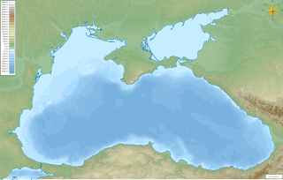
Colussa or Koloussa was a town on the Black Sea coast of ancient Paphlagonia.
Cyptasia or Kyptasia was a town on the Black Sea coast of ancient Paphlagonia. The name appears as Cloptasa in the Tabula Peutingeriana was 7 Roman miles from Sinope on the road to Amisus.
Cromna or Kromna was a town on the Paphlagonian coast, now in modern Turkey. It is mentioned by Homer in the Iliad. It was 60 stadia east of Erythini and 90 west of Cytorus. There are autonomous coins of Cromna.
Neapolis, was a coastal town of ancient Caria, near Myndus, to which it have been the successor settlement. Some scholars place it at Karyanda.
Kildara or Killara (Κιλλαρα) was a town of ancient Caria. It was a polis (city-state) and was in a sympoliteia with Theangela and Thodosa. Kildara is the find-spot of numerous inscriptions in the Carian language and is the name of one specific type of Carian script.
Nausimachion was a coastal town of ancient Bithynia located on the Bosphorus.
Potamonion was a coastal town of ancient Bithynia located on the Bosphorus.
Nausikleia was a coastal town of ancient Bithynia located on the Bosphorus.
Boradion was a coastal town of ancient Bithynia located on the Bosphorus.
Amycus or Amykos was a coastal town of ancient Bithynia located on the Bosphorus.
Argyronion was a coastal town of ancient Bithynia located on the Bosphorus.
Mochadion was a coastal town of ancient Bithynia located on the Bosphorus.
Chelae or Chelai was a coastal town of ancient Bithynia located on the Bosphorus.
Kelesa was a coastal town of ancient Bithynia on the Black Sea inhabited during Roman times. Its name does not occur in ancient authors, but is inferred from epigraphic and other evidence.
Metroon, also called Aulia. was a town on the Black Sea coast of ancient Bithynia.
Aiginetes was a town of ancient Paphlagonia, inhabited during Roman and Byzantine eras.
Carussa or Karoussa, also spelt as Carusa or Karousa (Καροῦσα), also known as Polichnion, was a Greek trading place (emporium) on the Black Sea coast of ancient Paphlagonia, south of Sinope, and 150 stadia from it. It is also mentioned in the Periplus of Pseudo-Scylax as a Greek city; and by Pliny the Elder. It was a member of the Delian League as it appears in tribute lists of ancient Athens.
Zagorus or Zagoros, also Zagorum or Zagoron (Ζάγωρον), and also Zagora (Ζάγωρα) or Zageira (Ζάγειρα) or Zacoria, was a town on the Euxine coast of ancient Paphlagonia on the road between Sinope and the mouth of the Halys River, from the latter of which it was distant about 400 stadia.
Gadilon, also known as Gazelon (Γαζηλών), and possibly Helega, was a town in the north-west of ancient Pontus, in a fertile plain between the Halys River and Amisus. From this town the whole district received the name of Gadilonitis, which is probably the right form, which must, perhaps, be restored in two passages of Strabo, in one of which the common reading is Galaouitis (Γαλαουῖτις), and in the other Gazelotos (Γαζηλωτός). It was the site of a battle between the Umayyads led by Abd al-Aziz ibn al-Walid and Byzantines in 713.


