Related Research Articles
Arsinoe was a city on the coast of ancient Cilicia between Anemurium and Kelenderis; the site is near the modern city of Bozyazı, Mersin Province, Turkey. Strabo mentions Arsinoe as having a port. In the 19th century, William Martin Leake placed it at or near the ruined modern castle, called Softa Kalesi, just west of Bozyazı, below which is a port, such as Strabo describes at Arsinoe, and a peninsula on the east side of the harbor covered with ruins. This modern site is east of Anemurium, and west of, and near to, Kızil Burnu.
Charadrus or Charadros was a town on the coast of ancient Cilicia, between Platanus and Cragus, according to the Stadiasmus. Strabo, who writes it Χαραδροῦς, describes it as a fort with a port below it, and a mountain Andriclus above it. It is described by Francis Beaufort "as an opening through the mountains with a small river." The mountain is mentioned in the Stadiasmus under the name Androcus.
Carallia was a city of the Roman province of Pamphylia Prima and is mentioned in the acts of the Council of Ephesus (431). The same form of the name is given in the acts of the Council of Chalcedon (451).
Idyros was a Greek city in ancient Lycia. Its exact location is uncertain. According to Pseudo-Scylax it was located north of Phaselis.

Babadıl Islands are two small Mediterranean islands in Turkey. They are named after the former name of the village Sipahili in the mainland facing the islands. According to the British captain Francis Beaufort who was tasked to map the Mediterranean coasts of Turkey in 1811–12, the names of the islands were Papadoulae, in the antiquity. Modern scholarship identifies the island group with Akonesiai, and the northern island with ancient Crambusa or Krambousa (Κράμβουσα).
Siderus was a port town of ancient Lycia, referenced in the Periplus of Pseudo-Scylax and the Stadiasmus Maris Magni. The town is also noted by Stephanus of Byzantium under the name Sidarus or Sidarous (Σιδαροῦς). The place may also have borne the name Posidarisus or Posidarisous, mentioned in The Chronicon of Hippolytus as being 30 stadia from Crambousa and the same distance from Moron Hydor.
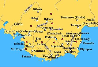
Trysa or Tryssa was a town of ancient Lycia, located between Cyaneae and Myra. It has been archaeologically examined, and among the finds are Lycian tombs, most notably the Heroon of Trysa. Greek inscriptions which were found there show that there was a cult of Zeus Eleutherios and of Helios at Trysa. The town was also inhabited during the Byzantine period and there was a church on the acropolis.
Tyinda was a town of ancient Lycia, between Cyaneae and Phellus. The name is not attested in history, but is derived from epigraphic and other evidence.
Seroiata was a town of ancient Lycia, between Patara and Phellus. The name is not attested in history, but is derived from epigraphic and other evidence.
Typallia was a town of ancient Lycia.
Placoma or Plakoma was a town of ancient Lycia.
Sabandus or Sabandos was a town of ancient Lycia.
Damasei was a town of ancient Lycia.
Kastellon was a town of ancient Lycia.
Arnabanda was a town of ancient Lycia.
Rygmanoi was a town on the coast of ancient Cilicia, east of Anemurium at the mouth of the Orymagdos River.
Mandane was a town on the coast of ancient Cilicia, between Celenderis, and Cape Pisidium or Posidium, from which it was only 7 stadia distant. William Smith conjectured it to be the same place as the Myanda or Mysanda mentioned by Pliny the Elder; and if so, it must also be identical with the town of Myus (Μυούς) mentioned in the Periplus of Pseudo-Scylax between Nagidus and Celenderis. Modern scholarship does not accept the identity.
Pisurgia or Pisourgia was a town on the coast of ancient Cilicia, between Celenderis and Seleucia ad Calycadnum, 45 stadia to the west of Cape Crauni, and to the right of the island of Crambusa.
Mylae or Mylai, also called Mylas (Μύλας) or Myle, was a town of ancient Cilicia, located on a promontory of the same name, between Aphrodisias and Cape Sarpedon.
Pedachtoë or Pedachthoe, also known as Heracleopolis or Herakleioupolis, was a town of ancient Pontus, inhabited during Roman and Byzantine times. It was assigned to the late Roman province of Armenia Prima, in which it became the seat of an archbishop. No longer a residential see, it remains a titular see of the Roman Catholic Church.
References
- 1 2 Richard Talbert, ed. (2000). Barrington Atlas of the Greek and Roman World . Princeton University Press. p. 65, and directory notes accompanying. ISBN 978-0-691-03169-9.
- ↑ Lund University. Digital Atlas of the Roman Empire.
36°31′29″N30°27′15″E / 36.524766°N 30.454074°E
| | This article about a location in ancient Lycia is a stub. You can help Wikipedia by expanding it. |