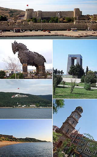
Çanakkale Province is a province of Turkey, located in the northwestern part of the country. It takes its name from the city of Çanakkale. Its area is 9,817 km2, and its population is 559,383 (2022).

Balıkesir Province is a province and metropolitan municipality in northwestern Turkey with coastlines on both the Sea of Marmara and the Aegean. Its area is 14,583 km2, and its population is 1,257,590 (2022). Its adjacent provinces are Çanakkale to the west, İzmir to the southwest, Manisa to the south, Kütahya to the southeast, and Bursa to the east. The provincial capital is Balıkesir. Most of the province lies in the Marmara Region except the southern parts of Bigadiç Edremit, Kepsut, İvrindi, Savaştepe and Sındırgı districts and ones of Ayvalık, Burhaniye, Dursunbey, Gömeç and Havran, that bound the Aegean Region. Kaz Dağı, known also as Mount Ida, is located in this province. Balıkesir province is famous for its olives, thermal spas, and clean beaches, making it an important tourist destination. The province also hosts immense deposits of kaolinite and borax, with some open-pit mines. The Kaz mountains are also threatened with the expansion of gold mining using cyanide which puts the villagers' lives, the agricultural economy, and tourism at risk.

Tekirdağ Province is a province and metropolitan municipality of Turkey. Its area is 6,190 km2, and its population is 1,142,451 (2022). It is located in the East Thrace region of the country, also known as European Turkey, one of only three provinces entirely within continental Europe. Tekirdağ Province is bordered by Istanbul Province to the east, Kırklareli Province to the north, Edirne Province to the west, and the Gallipoli peninsula of Çanakkale Province to the south. Tekirdağ is the capital of the province, and the third largest city in European Turkey after Istanbul and Çorlu.

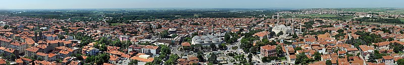
Balıkesir is a city in the Marmara region of Turkey. It is the seat of Balıkesir Province, which is also a metropolitan municipality. As of 2022, the population of Balıkesir Province is 1,257,590, of which 314,958 in the city proper. Between 1341 and 1922, it was the capital of Karasi.
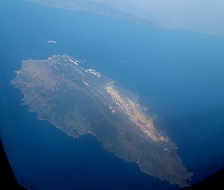
Marmara Island is a Turkish island in the Sea of Marmara. With an area of 126.1 km2 (48.7 sq mi) it is the largest island in the Sea of Marmara and is the second largest island of Turkey after Gökçeada. It is the center of Marmara district in Balıkesir Province. Transportation is possible from Istanbul by ship and ferry, and by motorboat from Tekirdağ and Erdek. Marmara island has a lot of historical artifacts. The town of "Marmara" takes its name from the marble (marmaron) for which the town is famous and which gives the island, the sea and the whole region their name.

Bandırma is a municipality and district of Balıkesir Province, northwestern Turkey. Its area is 755 km2, and its population is 164,965 (2022). Bandırma is located in the south of the Marmara Sea, in the bay with the same name, and is an important port city. It is approximately two hours away from Istanbul, İzmir and Bursa.

Saray is a municipality and district of Tekirdağ Province, Turkey. Its area is 620 km2, and its population is 50,766 (2022). Its elevation is 140 m (460 ft). The district has cold wet winters and hot dry summers. The district governor (kaymakam) is Regaip Ahmet Özyiğit, and the mayor is Abdül Taşyasan (CHP).
The Turkish football system is divided into the following leagues.

East Thrace or Eastern Thrace, also known as Turkish Thrace or European Turkey, is the part of Turkey that is geographically a part of Southeast Europe. It accounts for 3.03% of Turkey's land area and 15% of its population. The largest city is Istanbul, which straddles the Bosporus between Europe and Asia. East Thrace is of historic importance as it is next to a major sea trade corridor and constitutes what remains of the once-vast Ottoman region of Rumelia. It is currently also of specific geostrategic importance because the sea corridor, which includes two narrow straits, provides access to the Mediterranean Sea from the Black Sea for the navies of five countries: Russia, Ukraine, Romania, Bulgaria, and Georgia. The region also serves as a future connector of existing Turkish, Bulgarian, and Greek high-speed rail networks. Due to the guest worker agreement with Turkey and Germany, some Turks in Germany originally come from Eastern Thrace, mostly from the Kırklareli Province.

The geographical regions of Turkey comprise seven regions, which were originally defined at the country's First Geography Congress in 1941. The regions are subdivided into 31 sections, which are further divided into numerous areas, as defined by microclimates and bounded by local geographic formations.
The Aegean region is one of the 7 geographical regions of Turkey. The largest city in the region is İzmir. Other big cities are Manisa, Aydın, Denizli, Muğla, Afyonkarahisar and Kütahya.

The Black Sea region is a geographical region of Turkey. The largest city in the region is Samsun. Other big cities are Zonguldak, Trabzon, Ordu, Tokat, Giresun, Rize, Amasya and Sinop.

The Central Anatolia region is a geographical region of Turkey. The largest city in the region is Ankara, the capital of Turkey. Other big cities are Konya, Kayseri, Eskişehir, Sivas, Aksaray and Kırşehir.
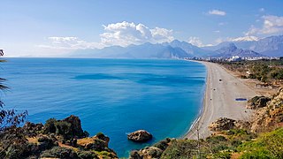
The Mediterranean Region is a geographical region of Turkey. The largest city in the region is Antalya. Other big cities are Adana, Mersin, Isparta, Antakya and Kahramanmaraş.

The 1953 Yenice–Gönen earthquake occurred at 21:06 local time (19:06 UTC on 18 March in the province of Çanakkale and Balıkesir in the Marmara Region at western Turkey. It had a surface-wave magnitude of 7.5 and a maximum felt intensity of IX on the Mercalli intensity scale. It caused widespread damage, killing 1,070 and causing damage that was estimated at US$3,570,000 repair value.
There are 81 provinces in Turkey. Among the 81 provinces, 30 provinces are designated metropolitan municipalities. Metropolitan municipalities are subdivided into districts, where each district includes a corresponding district municipality, which is a second tier municipality.
This is the order of battle of the Turkish Army in June 1941. The formation named 941-A Seferî Kuruluş was as follows:
A vilayet, also known by various other names, was a first-order administrative division of the later Ottoman Empire. It was introduced in the Vilayet Law of 21 January 1867, part of the Tanzimat reform movement initiated by the Ottoman Reform Edict of 1856. The Danube Vilayet had been specially formed in 1864 as an experiment under the leading reformer Midhat Pasha. The Vilayet Law expanded its use, but it was not until 1884 that it was applied to all of the empire's provinces. Writing for the Encyclopaedia Britannica in 1911, Vincent Henry Penalver Caillard claimed that the reform had intended to provide the provinces with greater amounts of local self-government but in fact had the effect of centralizing more power with the sultan and local Muslims at the expense of other communities.
The following are lists of populated places in Turkey by province:
The 1766 Marmara earthquake occurred on 5 August; the second major earthquake to strike the Sea of Marmara region of present-day Turkey that same year. Estimates of the earthquake's moment magnitude (Mw ) range between 7.4 and 7.6. The earthquake was caused by strike-slip movement along a segment of the North Anatolian Fault. There was further damage and casualties in the Sea of Marmara area which had been affected by another major earthquake in May 1766. The worst affected areas were Tekirdağ and Gelibolu.