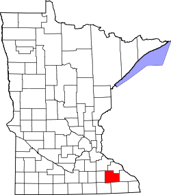
Genoa | |
---|---|
Coordinates: 44°06′36″N92°36′27″W / 44.11000°N 92.60750°W Coordinates: 44°06′36″N92°36′27″W / 44.11000°N 92.60750°W | |
Country | United States |
State | Minnesota |
County | Olmsted |
Township | New Haven Township and Kalmar Township |
Elevation | 1,014 ft (309 m) |
Time zone | UTC-6 (Central (CST)) |
• Summer (DST) | UTC-5 (CDT) |
ZIP code | 55963 and 55920 |
Area code(s) | 507 |
GNIS feature ID | 644070 [1] |
Genoa is an unincorporated community in Olmsted County, Minnesota, United States. The community is located along 75th Street NW (County 14) near Exchange Avenue. Genoa is located within New Haven Township and Kalmar Township. Nearby places include Oronoco, Pine Island, and Byron. The South Branch Middle Fork of the Zumbro River flows nearby.
Genoa was platted in 1865, and named after Genoa, in Italy. [2] A post office was established at Genoa in 1872, and remained in operation until 1905. [3]
Olmsted County is a county in the U.S. state of Minnesota. As of the 2010 census, the population was 144,248, and has an estimated population of 156,277 as of 2018. Its county seat and largest city is Rochester.
Collegeville is an unincorporated community in St. Wendel Township, Stearns County, Minnesota, United States, near St. Joseph. The community is located near the junction of Collegeville Road and Old Collegeville Road. Nearby is Saint John's Abbey, a large Benedictine monastery. Stearns County Road 159 serves as a main route for the community. Interstate 94 is nearby.
Salem Corners is an unincorporated community in Salem Township, Olmsted County, Minnesota, United States, near Byron. The community is located near the junction of Olmsted County Roads 3 and 25.
Viola is an unincorporated community in Viola Township, Olmsted County, Minnesota, United States. It is the site of a yearly Gopher Count festival, which began in 1874.
South Troy is an unincorporated community in Zumbro Township, Wabasha County, Minnesota, United States. It is located on U.S. Highway 63 about 13 miles north of Rochester. Nearby places include Hammond, Zumbro Falls, Mazeppa, Potsdam, and Oronoco. Wabasha County Roads 7 and 11 are nearby.
Douglas is an unincorporated community in Olmsted County, Minnesota, United States. The community is located along 75th Street NW near its junction with County Road 3. Douglas is located within Kalmar Township and New Haven Township. Nearby places include Oronoco, Rochester, and the Douglas State Trail. The community is about two miles from the city of Rochester.
Peary is an unincorporated community in Saint Louis County, Minnesota, United States.
Payne is an unincorporated community in Meadowlands Township, Saint Louis County, Minnesota, United States.
Angora is an unincorporated community in Angora Township, Saint Louis County, Minnesota, United States.
Robinson is an unincorporated community in Morse Township, Saint Louis County, Minnesota, United States.
Simpson is an unincorporated community in Pleasant Grove Township, Olmsted County, Minnesota, United States, near Rochester and Stewartville. The community is located along Olmsted County Road 1 near County Road 16 and 68th Street SE. Whitney Creek flows nearby.
Pleasant Grove is an unincorporated community in Pleasant Grove Township, Olmsted County, Minnesota, United States, near Rochester and Stewartville. The community is located along Olmsted County Road 1 near County Road 140.
Potsdam is an unincorporated community in Farmington Township, Olmsted County, Minnesota, United States, near Elgin and Rochester. The community is located along State Highway 247 near Olmsted County Road 11. The boundary line between Olmsted and Wabasha counties is nearby.
High Forest is an unincorporated community in High Forest Township, Olmsted County, Minnesota, United States, near Rochester and Stewartville. The community is located near the junction of Olmsted County Roads 6 and 8, and Covill Street SW.
Chester is an unincorporated community in Marion Township, Olmsted County, Minnesota, United States. It is located immediately east of Rochester along U.S. Highway 14 near Olmsted County Roads 19 and 119. Chester Woods Park is nearby.
Post Town is an unincorporated community in Kalmar Township, Olmsted County, Minnesota, United States, near Byron. The community is located near the junction of Olmsted County Roads 103 and 105.
Shanty Town is an unincorporated community in Salem Township, Olmsted County, Minnesota, United States, near Byron. The community is located along Olmsted County Road 150 near 35th Street SW.
Ringe is an unincorporated community in Olmsted County, Minnesota, United States, near Rochester. The community is located along 75th Street NE near 40th Avenue NE. Ringe is located within Farmington Township and Haverhill Township.
Rock Dell is an unincorporated community in Rock Dell Township, Olmsted County, Minnesota, United States. The community is located near the junction of Olmsted County Roads 3, 26, and 126. The South Fork of the Zumbro River flows through the community. Nearby places include Byron, Hayfield, Stewartville, and Rochester.
Marion is an unincorporated community in Marion Township, Olmsted County, Minnesota, United States.
This article about a location in Olmsted County, Minnesota is a stub. You can help Wikipedia by expanding it. |