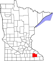
Salem Township, Olmsted County, Minnesota

Last updated
Salem Township, Minnesota
USA Minnesota location map.svg
Red pog.svg
Salem Township, Minnesota
Location within the state of Minnesota
Usa edcp location map.svg
Red pog.svg
Salem Township, Minnesota
Salem Township, Minnesota (the United States)
Coordinates: 43°58′39″N92°36′47″W / 43.97750°N 92.61306°W / 43.97750; -92.61306 Coordinates: 43°58′39″N92°36′47″W / 43.97750°N 92.61306°W / 43.97750; -92.61306
Country United States
State Minnesota
County Olmsted
Area
  Total35.7 sq mi (92.5 km2)
  Land35.7 sq mi (92.5 km2)
  Water0.0 sq mi (0.0 km2)
Elevation
1,070 ft (326 m)
Population
 (2000)
  Total1,061
  Density29.7/sq mi (11.5/km2)
Time zone UTC-6 (Central (CST))
  Summer (DST) UTC-5 (CDT)
FIPS code 27-58234 [1]
GNIS feature ID0665538 [2]
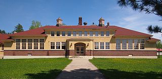
Salem Town Hall. SalemTownshipHallOlmstedCountyMinnesota2006-07-04.JPG
Salem Town Hall.

Salem Township is a township in Olmsted County, Minnesota. The population was 1,061 at the 2000 census. The township hall is located at the junction of County Road 25 (Salem Road) and County Road 3 at the unincorporated community of Salem Corners.

Contents

Salem Township was organized in 1858, and named after Salem, Illinois. [3]

Geography

According to the United States Census Bureau, the township has a total area of 35.7 square miles (92.5 km2), all land.

Demographics

As of the census [1] of 2000, there were 1,061 people, 399 households, and 308 families residing in the township. The population density was 29.7 inhabitants per square mile (11.5/km2). There were 409 housing units at an average density of 11.4/sq mi (4.4/km2). The racial makeup of the township was 98.87% White, 0.28% Asian, 0.19% from other races, and 0.66% from two or more races. Hispanic or Latino of any race were 0.19% of the population.

There were 399 households, out of which 31.8% had children under the age of 18 living with them, 68.7% were married couples living together, 4.3% had a female householder with no husband present, and 22.6% were non-families. 16.3% of all households were made up of individuals, and 5.0% had someone living alone who was 65 years of age or older. The average household size was 2.66 and the average family size was 2.99.

In the township the population was spread out, with 25.8% under the age of 18, 7.9% from 18 to 24, 26.2% from 25 to 44, 29.5% from 45 to 64, and 10.6% who were 65 years of age or older. The median age was 40 years. For every 100 females, there were 103.6 males. For every 100 females age 18 and over, there were 102.3 males.

The median income for a household in the township was $54,107, and the median income for a family was $61,875. Males had a median income of $37,917 versus $29,135 for females. The per capita income for the township was $28,340. About 2.3% of families and 2.7% of the population were below the poverty line, including 2.0% of those under age 18 and 4.5% of those age 65 or over.

Related Research Articles

Shamrock Township is a township in Aitkin County, Minnesota, United States. The population was 1,272 as of the 2010 census.

Rapidan Township is a township in Blue Earth County, Minnesota, United States. The population was 1,101 as of the 2010 census.

Boy River Township is a township in Cass County, Minnesota, United States. The population was 100 as of the 2000 census. This township took its name from the Boy River.

Pine River Township is a township in Cass County, Minnesota, United States. The population was 1,061 as of the 2000 census. This township took its name from the Pine River.

Rogers Township is a township in Cass County, Minnesota, United States. The population was 43 as of the 2000 census. Rogers Township was named for William A. Rogers, an early settler.

Torrey Township is a township in Cass County, Minnesota, United States. The population was 122 as of the 2000 census.

Barber Township is a township in Faribault County, Minnesota, United States. The population was 278 at the 2000 census.

Hay Creek Township is a township in Goodhue County, Minnesota, United States. The population was 862 at the 2000 census. The unincorporated community of Hay Creek is located within the township.

Henrietta Township is a township in Hubbard County, Minnesota, United States. The population was 1,582 at the 2000 census.

Kandiyohi Township is a township in Kandiyohi County, Minnesota, United States. The population was 600 at the 2000 census.

Racine Township is a township in Mower County, Minnesota, United States. The population was 445 at the time of the 2000 census. The largest town in the township is Racine with a population of 442 as of the 2010 census.. All other area in the township is unincorporated.

Trondhjem Township is a township in Otter Tail County, Minnesota, United States. The population was 171 at the 2000 census.

Tumuli Township is a township in Otter Tail County, Minnesota, United States. The population was 434 at the 2000 census.

Western Township is a township in Otter Tail County, Minnesota, United States. The population was 142 at the 2000 census.

Dell Grove Township is a township in Pine County, Minnesota, United States. The population was 699 at the 2000 census.
<span class="mw-page-title-main">Alango Township, St. Louis County, Minnesota</span> Township in Minnesota, United States

Alango Township is a township in Saint Louis County, Minnesota, United States. The population was 258 at the 2010 census. Saint Louis County Roads 22 and 25 are two of the main routes in the township. Heino Road and Samuelson Road also pass through the township. Cook is nearby.

Alborn Township is a township in Saint Louis County, Minnesota, United States. At the 2010 census, the population was 460.

Midway Township is a township in Saint Louis County, Minnesota, United States. The population was 1,399 at the 2010 census.

Toivola Township is a township in Saint Louis County, Minnesota, United States. At the 2010 census, the population was 170. Toivola is a name Finnish in origin.

Tikander Lake is an unorganized territory in Saint Louis County, Minnesota, United States. The population was 783 at the 2000 census.

References

  1. 1 2 "U.S. Census website". United States Census Bureau . Retrieved 2008-01-31.
  2. "US Board on Geographic Names". United States Geological Survey. 2007-10-25. Retrieved 2008-01-31.
  3. Upham, Warren (1920). Minnesota Geographic Names: Their Origin and Historic Significance. Minnesota Historical Society. p.  388.