Gentry's Mill, Texas

Last updated

Gentry's Mill, Texas
USA Texas location map.svg
Red pog.svg
Gentry's Mill
Usa edcp location map.svg
Red pog.svg
Gentry's Mill
Coordinates: 31°37′42″N98°13′32″W / 31.62833°N 98.22556°W / 31.62833; -98.22556
Country United States
State Texas
County Hamilton
Elevation
[1]
1,132 ft (345 m)
Time zone UTC-6 (Central (CST))
  Summer (DST) UTC-5 (CDT)
Area code 254
GNIS feature ID1378348 [1]

Gentry's Mill is an unincorporated community in Hamilton County, in the U.S. state of Texas. [1] According to the Handbook of Texas,[ citation needed ] the community had a population of 17 in 2000.

Contents

History

Gentry's Mill was named for Frederick Browder Gentry. He settled in this area in 1875 on Waring Creek and owned a wheat and corn mill. S.C. Terry then built a gin. A post office was established at Gentry's Mill in 1876 and remained in operation until 1895. Its population was 75 in 1884. The 1983 county highway map showed a church, cemetery, and community center in the community. Its population was 17 in 2000. [2]

Geography

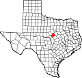
Gentry's Mill is located 8 mi (13 km) northwest of Hamilton in north-central Hamilton County. [2]

Education

Gentry's Mill had a school until 1950. [2] Today the community is served by the Hamilton Independent School District.

Related Research Articles

<span class="mw-page-title-main">Mills County, Texas</span> County in Texas, United States

Mills County is a county located in Central Texas, United States. It was created on March 15, 1887, from parts of four existing counties—Brown, Comanche, Hamilton, and Lampasas—and named after John T. Mills. The 2020 census reported a population of 4,456. The county seat is Goldthwaite. A long-time resident of the county quipped that residing here is the closest a person could get to living in Mayberry.

<span class="mw-page-title-main">Kimble County, Texas</span> County in Texas, United States

Kimble County is a county located on the Edwards Plateau in the U.S. state of Texas. As of the 2020 census, its population was 4,286. Its county seat is Junction. The county was created in 1858 and organized in 1876. It is named for George C. Kimble, who died at the Battle of the Alamo.

<span class="mw-page-title-main">Hamilton County, Texas</span> County in Texas, United States

Hamilton County is a county located on the Edwards Plateau in the U.S. state of Texas. As of the 2020 census, its population was 8,222. The county seat is Hamilton. The county was created in 1858. It is named for James Hamilton Jr., a former governor of South Carolina who gave financial aid to the Republic of Texas.

<span class="mw-page-title-main">White County, Illinois</span> County in Illinois, United States

White County is a county located in the U.S. state of Illinois. According to the 2020 census, it had a population of 13,877. Its county seat is Carmi. It is located in the southern portion of Illinois known locally as "Little Egypt".

<span class="mw-page-title-main">Crosby, Texas</span> Census-designated place in Texas, United States

Crosby is a census-designated place in Harris County, Texas, United States. The population was 3,417 at the 2020 census.

<span class="mw-page-title-main">Carrollton, Texas</span> City in Texas, United States

Carrollton is a city in Dallas, Denton, and Collin counties in the U.S. state of Texas. As of the 2020 census, its population was 133,434, making it the 27th-most populous city in Texas.

<span class="mw-page-title-main">Evant, Texas</span> Town in Texas, United States

Evant is a town in Coryell and Hamilton counties in central Texas, United States. The population was 426 at the 2010 census. The Coryell County portion of Evant is part of the Killeen–Temple–Fort Hood Metropolitan Statistical Area.

Anderson Mill is a neighborhood of Austin and a former census-designated place (CDP) in Travis and Williamson counties in the U.S. state of Texas. The population was 7,199 at the 2010 census.

Martin's Mill is an unincorporated community in south-central Van Zandt County, Texas, United States. According to the Handbook of Texas, the community had a population of 125 in 2000.

<span class="mw-page-title-main">Star, Texas</span> Unincorporated community in Texas, United States

Star is an unincorporated community in Mills County in Central Texas, United States. According to the Handbook of Texas, the community had an estimated population of 85 in 2000.

Dalby Springs is a small unincorporated town in Bowie County, Texas, United States. According to the Handbook of Texas, the community had a population of 141 in 2000. It is located within the Texarkana metropolitan area.

Medina is an unincorporated community in Bandera County, Texas, United States. It is part of the San Antonio Metropolitan Statistical Area. Medina is famous for its apples. The community's population was estimated to be 515 in 2000.

Jonesboro is an unincorporated community in Coryell and Hamilton counties in Central Texas, United States. The Coryell County portion of the community is part of the Killeen–Temple–Fort Hood Metropolitan Statistical Area.

Shelby is an unincorporated community in Austin County, Texas, United States. According to the Handbook of Texas, the community had a population of 175 in 2000. It is located within the Texas German belt region, a region stretching from Sealy in the east to Fredericksburg in the west, settled by German emigrants. To this day, Austin County has a large German Texan population and many people still speak German.

Pottsville is an unincorporated community located in western Hamilton County in Central Texas, United States.

Alexander is an unincorporated community located in southern Erath County in Central Texas, United States. Alexander is located in the southern part of the county, along Texas State Highway 6 and Fm-914. The town was originally called: "Harper's Mill" when the Post Office was approved for operation around the 1870s. The name was changed in the 1880s, when the Texas Central line, part of the historic Katy Railroad, was built from east to west through the townsite on its way from the Waco area to Stamford, with a branch to Cross Plains from the line at De Leon. In 1907, the Stephenville North and South Texas Railway, part of the Cotton Belt Route, was constructed from north to south and intersected with the Katy's line in Alexander. This made the town an important community for business in the area. The Cotton Belt Route ran from Stephenville through to nearby Carlton. On October 17, 1934, the Cotton Belt Route was abandoned from Stephenville to Hamilton. The Katy Railroad remained through Alexander until its abandonment in the late 1960s. The Alexander post office closed in 1970 and the population remained at a steady 40 from the 1970s through 2000.

Holly is an unincorporated community in Houston County, Texas, United States. According to the Handbook of Texas, the community had a population of 112 in 2000.

Rhea Mills is an unincorporated farming community in Collin County, Texas, United States. According to the Handbook of Texas, the community had a population of 47 in 2000. It is located within the Dallas-Fort Worth Metroplex.

Pancake is an unincorporated community in Coryell County, in the U.S. state of Texas. According to the Handbook of Texas, the community had a population of 11 in 2000. It is located within the Killeen-Temple-Fort Hood metropolitan area.

Colfax is an unincorporated populated place in Van Zandt County, Texas, United States. It is located within the Dallas/Fort Worth Metroplex and had a population of 35 in 2000.

References

  1. 1 2 3 U.S. Geological Survey Geographic Names Information System: Gentry's Mill, Texas
  2. 1 2 3 Hunt, William R. "Gentry's Mill, TX". tshaonline.org. Retrieved December 21, 2022.