It has been requested that the title of this article be changedto Geography of eSwatini. Please see the relevant discussion on the discussion page. Do not move the page until the discussion has reached consensus for the change and is closed.
Southern Africa is the southernmost region of the African continent, variably defined by geography or geopolitics, and including several countries. The term southern Africa or Southern Africa, generally includes Angola, Botswana, Eswatini (Swaziland), Lesotho, Malawi, Mozambique, Namibia, South Africa, Zambia, and Zimbabwe, though Angola may be included in Central Africa and Malawi, Mozambique, Zambia and Zimbabwe in East Africa. From a political perspective the region is said to be unipolar with South Africa as a first regional power.
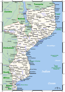
Mozambique, officially the Republic of Mozambique, is a country located in Southeast Africa bordered by the Indian Ocean to the east, Tanzania to the north, Malawi and Zambia to the northwest, Zimbabwe to the west, and Eswatini (Swaziland) and South Africa to the southwest. The sovereign state is separated from the Comoros, Mayotte and Madagascar by the Mozambique Channel to the east. The capital of Mozambique is Maputo while Matola is the largest city, being a suburb of Maputo.
South Africa, officially the Republic of South Africa (RSA), is the southernmost country in Africa. It is bounded to the south by 2,798 kilometres (1,739 mi) of coastline of Southern Africa stretching along the South Atlantic and Indian Oceans; to the north by the neighbouring countries of Namibia, Botswana, and Zimbabwe; and to the east and northeast by Mozambique and Eswatini (Swaziland); and it surrounds the enclaved country of Lesotho. South Africa is the largest country in Southern Africa and the 25th-largest country in the world by land area and, with over 57 million people, is the world's 24th-most populous nation. It is the southernmost country on the mainland of the Old World or the Eastern Hemisphere. About 80 percent of South Africans are of Sub-Saharan African ancestry, divided among a variety of ethnic groups speaking different African languages, nine of which have official status. The remaining population consists of Africa's largest communities of European (White), Asian (Indian), and multiracial (Coloured) ancestry.
The climate of Swaziland varies from tropical to near temperate. The seasons are the reverse of those in the Northern Hemisphere with December being mid-summer and June mid-winter. Generally speaking, rain falls mostly during the summer months, often in the form of thunderstorms. Winter is the dry season. Annual rainfall is highest on the Highveld in the West, between 1,000 and 2,000mm (39.4 and 78.7in) depending on the year. The further East, the less rain, with the Lowveld recording 500 to 900mm (19.7 to 35.4in) per annum. Variations in temperature are also related to the altitude of the different regions. The Highveld temperature is temperate and, seldom, uncomfortably hot while the Lowveld may record temperatures around 40°C (104°F) in summer.
The Celsius scale, also known as the centigrade scale, is a temperature scale used by the International System of Units (SI). As an SI derived unit, it is used by all countries except the United States, the Bahamas, Belize, the Cayman Islands and Liberia. It is named after the Swedish astronomer Anders Celsius (1701–1744), who developed a similar temperature scale. The degree Celsius (°C) can refer to a specific temperature on the Celsius scale or a unit to indicate a difference between two temperatures or an uncertainty. Before being renamed to honor Anders Celsius in 1948, the unit was called centigrade, from the Latin centum, which means 100, and gradus, which means steps.
The Fahrenheit scale is a temperature scale based on one proposed in 1724 by Dutch–German–Polish physicist Daniel Gabriel Fahrenheit (1686–1736). It uses the degree Fahrenheit as the unit. Several accounts of how he originally defined his scale exist. The lower defining point, 0 °F, was established as the freezing temperature of a solution of brine made from equal parts of ice, water and salt. Further limits were established as the melting point of ice (32 °F) and his best estimate of the average human body temperature. The scale is now usually defined by two fixed points: the temperature at which water freezes into ice is defined as 32 °F, and the boiling point of water is defined to be 212 °F, a 180 °F separation, as defined at sea level and standard atmospheric pressure.
The average temperatures at Mbabane, according to seasons:
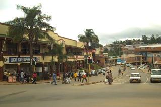
Mbabane is the capital and largest city in Eswatini. With an estimated population of 94,874 (2010), it is located on the Mbabane River and its tributary the Polinjane River in the Mdzimba Mountains. It is located in the Hhohho Region, of which it is also the capital. The average elevation of the city is 1243 meters. It lies on the MR3 road.
Spring
September – October
18°C (64.4°F)
Summer
November – March
20°C (68°F)
Autumn
April – May
17°C (62.6°F)
Winter
June – August
13°C (55.4°F)
Physical geography
Topographic map of Swaziland
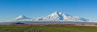
The terrain largely consists of mountains and hills, with some moderately sloping plains. The lowest point is the Great Usutu River, at 21 metres, and the highest is Emlembe, at 1,862 m.
A mountain is a large landform that rises above the surrounding land in a limited area, usually in the form of a peak. A mountain is generally steeper than a hill. Mountains are formed through tectonic forces or volcanism. These forces can locally raise the surface of the earth. Mountains erode slowly through the action of rivers, weather conditions, and glaciers. A few mountains are isolated summits, but most occur in huge mountain ranges.
A hill is a landform that extends above the surrounding terrain. It often has a distinct summit, although in areas with scarp/dip topography a hill may refer to a particular section of flat terrain without a massive summit.
In geography, a plain is a flat, sweeping landmass that generally does not change much in elevation. Plains occur as lowlands along the bottoms of valleys or on the doorsteps of mountains, as coastal plains, and as plateaus or uplands.
As a landlocked country, Swaziland has neither coastline nor maritime claims. In terms of land boundaries, Swaziland borders Mozambique for 105 kilometres, and South Africa for 430, giving a total land boundary length of 535km.
Asbestos is a set of six naturally occurring silicate minerals, which all have in common, their asbestiform habit: i.e., long, thin fibrous crystals, with each visible fiber composed of millions of microscopic "fibrils" that can be released by abrasion and other processes. The minerals are chrysotile, amosite, crocidolite, tremolite, anthophyllite, and actinolite.
Coal is a combustible black or brownish-black sedimentary rock, formed as rock strata called coal seams. Coal is mostly carbon with variable amounts of other elements; chiefly hydrogen, sulfur, oxygen, and nitrogen. Coal is formed if dead plant matter decays into peat and over millions of years the heat and pressure of deep burial converts the peat into coal. Vast deposits of coal originates in former wetlands—called coal forests—that covered much of the Earth's tropical land areas during the late Carboniferous (Pennsylvanian) and Permian times.
Clay is a finely-grained natural rock or soil material that combines one or more clay minerals with possible traces of quartz (SiO2), metal oxides (Al2O3, MgO etc.) and organic matter. Geologic clay deposits are mostly composed of phyllosilicate minerals containing variable amounts of water trapped in the mineral structure. Clays are plastic due to particle size and geometry as well as water content, and become hard, brittle and non–plastic upon drying or firing. Depending on the soil's content in which it is found, clay can appear in various colours from white to dull grey or brown to deep orange-red.
670km² of the country's land is irrigated. The following table describes land use in Swaziland.
This page is based on this Wikipedia article Text is available under the CC BY-SA 4.0 license; additional terms may apply. Images, videos and audio are available under their respective licenses.
Related Research Articles
Burundi is located in central Africa, to the east of the Democratic Republic of the Congo, at the co-ordinates 3°30′S30°0′E.
Eritrea is located in the Horn of Africa and is bordered on the northeast and east by the Red Sea, on the west and northwest by Sudan, on the south by Ethiopia, and on the southeast by Djibouti. The country has a high central plateau that varies from 1,800 to 3,000 meters (5,906–9,843 ft) above sea level. A coastal plain, western lowlands, and some 350 islands comprise the remainder of Eritrea's land mass. Eritrea has no year-round rivers.
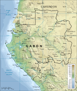
Gabon is a country in West Africa, lying along the Atlantic Ocean, just south of the Bight of Biafra.
Guinea is a country on the coast of West Africa and is bordered by Guinea-Bissau, Senegal, Mali, Ivory Coast, Liberia, and Sierra Leone.
Morocco spans from the Mediterranean Sea and Atlantic Ocean on the north and the west respectively, into large mountainous areas in the interior body, to the Sahara desert in the far south. Morocco is a Northern African country, located in the extreme north west of Africa on the doors of continental Europe. The strait of Gibraltar separates Spain off Morocco with a 13 kilometres (8.1 mi) span of water. Morocco borders the North Atlantic Ocean to the west, and the west Mediterranean Sea to the north.
Mozambique is located on the east coast of southern Africa. Mozambique has a tropical climate with two seasons, a wet season from October to March and a dry season from April to September.
Nigeria is a country in West Africa. Nigeria shares land borders with the Republic of Benin in the west, Chad and Cameroon in the east, and Niger in the north. Its coast lies on the Gulf of Guinea in the south and it borders Lake Chad to the northeast. Noted geographical features in Nigeria include the Adamawa highlands, Mambilla Plateau, Jos Plateau, Obudu Plateau, the Niger River, River Benue and Niger Delta.
Sierra Leone is located on the west coast of Africa, between the 7th and 10th parallels north of the equator. Sierra Leone is bordered by Guinea to the north and northeast, Liberia to the south and southeast, and the Atlantic Ocean to the west.
Eswatini, officially the Kingdom of Eswatini and also known as Swaziland, is a landlocked country in Southern Africa. It is bordered by Mozambique to its northeast and South Africa to its north, west and south. At no more than 200 kilometres (120 mi) north to south and 130 kilometres (81 mi) east to west, Eswatini is one of the smallest countries in Africa; despite this, its climate and topography are diverse, ranging from a cool and mountainous highveld to a hot and dry lowveld.
Tanzania comprises many lakes, national parks, and Africa's highest point, Mount Kilimanjaro.
Zimbabwe is a landlocked country in southern Africa lying wholly within the tropics. It straddles an extensive high inland plateau that drops northwards to the Zambezi valley where the border with Zambia is and similarly drops southwards to the Limpopo valley and the border with South Africa.
The country has borders with Botswana 813 km, Mozambique 1,231 km, South Africa 225 km, Zambia 797 km and almost meets Namibia at its westernmost point.
Zambia is a landlocked country located in Southern Africa, to the east of Angola. It has a total area of 752 618 square kilometres, of which 9 220 km² are water.
Malawi is a landlocked country in southeast Africa. It is wholly within the tropics; from about 9°30S at its northernmost point to about 17°S at the southernmost tip. The country occupies a thin strip of land between Zambia and Mozambique protruding southwards into Mozambique along the valley of the Shire River. In the north and north east it also shares a border with Tanzania. Malawi is connected by rail to the Mozambican ports of Nacala and Beira. It lies between latitudes 9° and 18°S, and longitudes 32° and 36°E.
Rwanda is located in central Africa, to the east of the Democratic Republic of the Congo, at the co-ordinates 2°00′S30°0′E.
South Africa occupies the southern tip of Africa, its coastline stretching more than 2,850 kilometres from the desert border with Namibia on the Atlantic (western) coast southwards around the tip of Africa and then northeast to the border with Mozambique on the Indian Ocean. The low-lying coastal zone is narrow for much of that distance, soon giving way to a mountainous escarpment that separates the coast from the high inland plateau. In some places, notably the province of KwaZulu-Natal in the east, a greater distance separates the coast from the escarpment. Although most of the country is classified as semi-arid, it has considerable variation in climate as well as topography.
The Gambia is a very small and narrow country with the border based on the Gambia River. The country is less than 48 km wide at its greatest width. The country's present boundaries were defined in 1889 after an agreement between the United Kingdom and France. It is often claimed by Gambians that the distance of the borders from the Gambia River corresponds to the area that British naval cannon of the time could reach from the river's channel. However, there is no historical evidence to support the story, and the border was actually delineated using careful surveying methods by the Franco-British boundary commission. Apart from its coastline, where the Gambia borders the Atlantic Ocean, it is an enclave of Senegal and is by far the smallest country on mainland Africa.
Veld, also spelled veldt, is a type of wide open rural landscape in Southern Africa. Particularly, it is a flat area covered in grass or low scrub, especially in the countries of South Africa, Lesotho, Swaziland, Zimbabwe and Botswana. A certain sub-tropical woodland ecoregion of Southern Africa has been officially defined as the Bushveld by the World Wide Fund for Nature. Trees are found only in a few places—frost, fire and grazing animals allow grass to grow but prevent the growth of trees.
Mpumalanga is a province of South Africa. The name means "east", or literally "the place where the sun rises" in the Swazi, Xhosa, Ndebele and Zulu languages. Mpumalanga lies in eastern South Africa, bordering Swaziland and Mozambique. It constitutes 6.5% of South Africa's land area. It shares borders with the South African provinces of Limpopo to the north, Gauteng to the west, the Free State to the southwest, and KwaZulu-Natal to the south. The capital is Mbombela (Nelspruit).
The Highveld is the portion of the South African inland plateau which has an altitude above roughly 1500 m, but below 2100 m, thus excluding the Lesotho mountain regions to the south-east of the Highveld. It is home to some of the country's most important commercial farming areas, as well as its largest concentration of metropolitan centres, especially the Gauteng conurbation, which accommodates one-third of South Africa's population.
Inkomati WMA, or Inkomati Water Management Area , in South Africa is situated in the north-eastern part of South Africa in the Mpumalanga Province, with a small area in the Limpopo Province. It borders on Mozambique in the east and on Swaziland in the south-east. The water management area extends over several parallel river catchments which all drain in a general easterly direction, and flow together at the border with Mozambique or within Mozambique, to form the Incomati River which discharges into the Indian Ocean immediately north of Maputo. A special situation is presented by the Komati River, the most southern tributary of the Incomati River, which rises in South Africa and flows into Swaziland, then re-enters South Africa where it is joined by the Crocodile River at the border with Mozambique, before flowing into Mozambique as the Incomati River. The Sabie River is the other main river in the water management area and flows into Corumuna Dam in Mozambique just downstream of the border with South Africa, and upstream of its confluence with the Inkomati River.