Placer County, officially the County of Placer, is a county located in the U.S. state of California. As of the 2020 census, the population was 404,739. The county seat is Auburn.

Plumas County is a county located in the Sierra Nevada of the U.S. state of California. As of the 2020 census, the population was 19,790. The county seat is Quincy, and the only incorporated city is Portola. The largest community in the county is East Quincy. The county was named for the Spanish Río de las Plumas, which flows through it. The county itself is also the namesake of a native moth species, Hadena plumasata.

Sierra County is a county located in the U.S. state of California. As of the 2020 census, the population was 3,236, making it California's second-least populous county. The county seat is Downieville; the sole incorporated city is Loyalton. The county is in the Sierra Nevada, northeast of Sacramento on the border with Nevada.

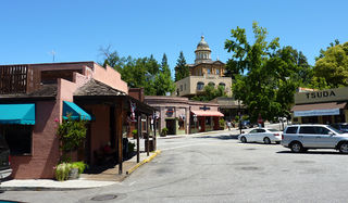
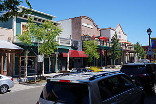
Auburn is a city in and the county seat of Placer County, California, United States. Its population was 13,776 during the 2020 census. Auburn is known for its California Gold Rush history and is registered as a California Historical Landmark.

La Porte is a census-designated place (CDP) in Plumas County, California, United States. The population was 65 at the 2020 census. The town was known as Rabbit Creek until 1857.

Folsom is a city in Sacramento County, California, United States. The population was 80,454 at the 2020 census.

Downieville is a census-designated place in and the county seat of Sierra County, California, United States. Downieville is on the North Fork of the Yuba River, at an elevation of 2,966 feet (904 m). The 2020 United States census reported Downieville's population was 290.

The Folsom Lake State Recreation Area surrounds Folsom Lake in the foothills of the Sierra Nevada. The majority of it is owned by the U.S. Bureau of Reclamation and is managed by the California Department of Parks and Recreation. It is located near the city of Folsom, California, about 25 miles (40 km) east of Sacramento.

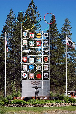
Olympic Valley is an unincorporated community located in Placer County, California northwest of Tahoe City along California State Highway 89 on the banks of the Truckee River near Lake Tahoe. It is home to Palisades Tahoe, the site of the 1960 Winter Olympics. Olympic Valley is the smallest resort area to host the Olympic Winter Games.

Dutch Flat is a small unincorporated community and census-designated place (CDP) in Placer County, California, United States, about 30 miles (48 km) northeast of Auburn along Interstate 80. It was founded by German immigrants in 1851 and was once one of the richest gold mining locations in California. Dutch Flat is now registered as a California Historical Landmark.

Camp Richardson is an unincorporated resort community at Lake Tahoe, in El Dorado County, California. It lies at an elevation of 6250 feet in the Sierra Nevada. A vacation community, Camp Richardson has a marina, cabins, hotel rooms, and a bar and grill. The camp was established by Captain Alonzo Richardson in 1921.
Clarksville is an unincorporated community in El Dorado County, California. It is located 14 miles (23 km) west-southwest of Placerville, at an elevation of 676 feet.
Gold Hill is an unincorporated community in El Dorado County, California. It is located 2.5 miles (4.0 km) south of Coloma, at an elevation of 1621 feet.
Smithflat is an unincorporated community in El Dorado County, California, United States. It lies 4 km (2.5 mi) east of Placerville and 7.2 km (4.5 mi) west of Camino at an elevation of 2224 feet.
Snow Point was a historic mining town in Nevada County, California on the San Juan Ridge about 2 miles east of Moores Flat and about 6 miles west of Graniteville. It was located at an elevation of 4321 ft just off present day German Bar Road about midway between that road's intersections with present day Moore's Flat Road and Hagerty Road.
Cal-Ida is an unincorporated community in Sierra County, California, United States. Cal-Ida is 7 miles (11 km) west of Goodyears Bar. A former sawmill camp, Cal-Ida was down to four residents by 1971; a few buildings remain at the site today.
Blue Canyon is an unincorporated community in Placer County, California. Blue Canyon is located 4 miles (6.4 km) southwest of Emigrant Gap. It lies at an elevation of 4695 feet.

Virginiatown is a former settlement in Placer County, California. Virginiatown is located on Auburn Ravine, 7.5 miles (12.1 km) west of Auburn.

Schroeder Mountain is a mountain in the California's Sierra Nevada, on the Tahoe National Forest. It is located 0.8 miles (1 km) east of California State Route 49 in Sierra County. Its elevation is 6,942 feet (2,116 m).

Frederick Alonzo Bee (傅列秘) was an early opponent of Anti-Chinese sentiment in the United States. He was a California Gold Rush pioneer, miner, merchant, manager of the Pony Express, builder of the telegraph over the Sierras, developer of Sausalito, California, lobbyist for the San Francisco Chamber of Commerce, official at the Chinese Consulate, and vineyardist near Martinez, California. Bee Street in Sausalito was named after him. Bee was appointed as Consul by the Chinese government after he effectively represented the interests of the Chinese community in front of a Congressional committee and settled disputes in Chinatown. Bee acted in an official capacity to represent the interests of Chinese immigrants, and appeared in federal court cases; his efforts to preserve harmony were recognized by the Emperor of China. October, 2015 Sierra Heritage magazine featured Frederick Bee in a 4-page article written by Lj Bottjer. Sherri Bergmann wrote an article for the January 22, 2018, Mountain Democrat.


