Gilserberg

Last updated
Gilserberg
Wappen Gilserberg.png
Location of Gilserberg within Schwalm-Eder-Kreis district
Gilserberg in HR.svgSchwarzenbornNeukirchenBorkenWabernFelsberg
Germany adm location map.svg
Red pog.svg
Gilserberg
Hesse location map.svg
Red pog.svg
Gilserberg
Coordinates: 50°57′N09°04′E / 50.950°N 9.067°E / 50.950; 9.067 Coordinates: 50°57′N09°04′E / 50.950°N 9.067°E / 50.950; 9.067
Country Germany
State Hesse
Admin. region Kassel
District Schwalm-Eder-Kreis
Subdivisions10 Ortsteile
Government
   Mayor (201824) Rainer Barth [1]
Area
  Total61.58 km2 (23.78 sq mi)
Elevation
341 m (1,119 ft)
Population
 (2020-12-31) [2]
  Total2,903
  Density47/km2 (120/sq mi)
Time zone UTC+01:00 (CET)
  Summer (DST) UTC+02:00 (CEST)
Postal codes
34630
Dialling codes 06696
Vehicle registration HR
Website www.gilserberg.de

Gilserberg is a community in the Schwalm-Eder district in Hesse, Germany.

Contents

Geography

Location

Gilserberg lies at the foot of the Kellerwald, a low mountain range, nestled in the Kurhessen Highland on Federal Highway (Bundesstraße) B 3, 60 km from Kassel and 30 km from Marburg.

Constituent communities

Together with the main centre, which also bears the same name as the whole municipality, the ten centres of Appenhain, Heimbach, Itzenhain, Lischeid, Moischeid, Sachsenhausen, Schönau, Schönstein, Sebbeterode and Winterscheid also belong to the community of Gilserberg.

History

Gilserberg had its first documentary mention in 1262. [3]

Religion

Jewish community

There was a Jewish community in Gilserberg from the 18th century through to sometime after 1933. The Jewish population peaked about 1900 at 70 or more persons. The first synagogue was supposedly built about the beginning of the 19th century. A newer one was festively consecrated on 12 January 1898. However, it was destroyed on Kristallnacht (9 November 1938). At least four of the community's Jewish residents were murdered in Nazi death camps. All that is left nowadays in Gilserberg of the former Jewish community is a small Jewish graveyard.

Amalgamations

As part of Hesse's municipal reforms, the formerly independent communities of Gilserberg, Heimbach, Lischeid, Moischeid, Sachsenhausen, Schönau, Schönstein, Sebbeterode and Winterscheid voluntarily combined to form the community of Gilserberg on 1 January 1972. On 1 April of the same year, the communities of Appenhain and Itzenhain also joined, making the community complete.

Town partnership

Related Research Articles

Worms, Germany Place in Rhineland-Palatinate, Germany

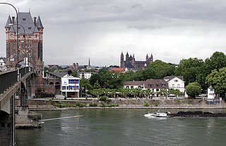
Worms is a city in Rhineland-Palatinate, Germany, situated on the Upper Rhine about 60 km (40 mi) south-southwest of Frankfurt am Main. It had about 82,000 inhabitants as of 2015.

Eschwege Town in Hesse, Germany

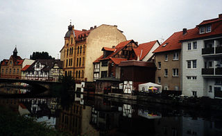
Eschwege, the district seat of the Werra-Meißner-Kreis, is a town in northeastern Hesse, Germany. In 1971, the town hosted the eleventh Hessentag state festival.

Heppenheim Town in Hesse, Germany

Heppenheim (Bergstraße) is the seat of Bergstraße district in Hesse, Germany, lying on the Bergstraße on the edge of the Odenwald. It is the birthplace of 4-time Formula One World Champion Sebastian Vettel.

Waldeck, Hesse Town in Hesse, Germany

Waldeck is a small town in Waldeck-Frankenberg district in northwestern Hesse, Germany.

Sušice Town in Plzeň, Czech Republic

Sušice is a town in Klatovy District in the Plzeň Region of the Czech Republic. It has about 11,000 inhabitants. It lies on the Otava River, some 60 km (37 mi) to the south of the regional capital of Plzeň. The town centre is well preserved and is protected by law as an urban monument zone.

Aach, Rhineland-Palatinate Municipality in Rhineland-Palatinate, Germany

Aach is a municipality in the German state of Rhineland-Palatinate. It is part of Trier-Land, a Verbandsgemeinde.

Neustadt, Hesse Town in Hesse, Germany

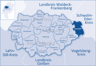
Neustadt is a town in the Marburg-Biedenkopf district in Hesse, Germany. For the town of the same name in Canada see Neustadt, Ontario.

Guxhagen Municipality in Hesse, Germany

Guxhagen is a community in Schwalm-Eder district in northern Hesse, Germany.

Rotenburg an der Fulda Town in Hesse, Germany

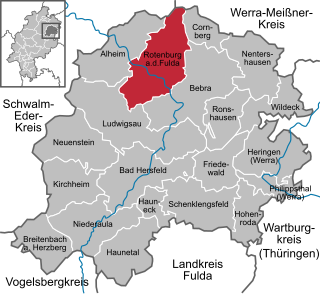
Rotenburg an der Fulda is a town in Hersfeld-Rotenburg district in northeastern Hesse, Germany lying, as the name says, on the river Fulda.

Bad König Town in Hesse, Germany

Bad König is a town and resort (Kurort) in the central Odenwald in the Odenwaldkreis (district) in Hesse, Germany, 29 km southeast of Darmstadt.

Gemünden (Wohra) Town in Hesse, Germany

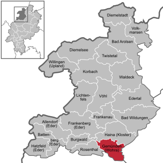
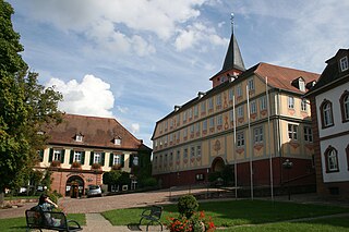
Gemünden is a town in Waldeck-Frankenberg district in Hesse, Germany.

Neckarsteinach Town in Hesse, Germany

The four-castle town of Neckarsteinach lies on the Neckar in the Bergstraße district in the southernmost part of Hesse, Germany, 15 km east of Heidelberg.

Haina Municipality in Hesse, Germany

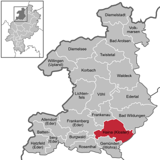
Haina (Kloster) is a community in Waldeck-Frankenberg in northwest Hesse, Germany.

Beselich Municipality in Hesse, Germany

Beselich is a community in Limburg-Weilburg district in Hesse, Germany.

Kleinheubach Municipality in Bavaria, Germany

Kleinheubach is a market community in the Miltenberg district in the Regierungsbezirk of Lower Franconia (Unterfranken) in Bavaria, Germany and the seat of the like-named Verwaltungsgemeinschaft. It has a population of around 3,600.

Schenklengsfeld Municipality in Hesse, Germany

Schenklengsfeld is a community in Hersfeld-Rotenburg district in eastern Hessen, Germany lying roughly 30 km northeast of Fulda and 60 km southeast of Kassel.

Becherbach bei Kirn Municipality in Rhineland-Palatinate, Germany

Becherbach bei Kirn is an Ortsgemeinde – a municipality belonging to a Verbandsgemeinde, a kind of collective municipality – in the Bad Kreuznach district in Rhineland-Palatinate, Germany. It belongs to the Verbandsgemeinde Kirner Land, whose seat is in the town of Kirn. Becherbach bei Kirn should not be confused with Becherbach. Becherbach bei Kirn has borne the tag “bei Kirn” since 1 July 1969, at which time both municipalities found themselves in the same district as a result of administrative reform.

Guldental Municipality in Rhineland-Palatinate, Germany

Guldental is an Ortsgemeinde – a municipality belonging to a Verbandsgemeinde, a kind of collective municipality – in the Bad Kreuznach district in Rhineland-Palatinate, Germany. It belongs to the Verbandsgemeinde Langenlonsheim-Stromberg, whose seat is in Langenlonsheim. With a population of some 2,900 inhabitants, Guldental is the biggest rural winegrowing community on the Nahe.

Rümmelsheim Municipality in Rhineland-Palatinate, Germany

Rümmelsheim is an Ortsgemeinde – a municipality belonging to a Verbandsgemeinde, a kind of collective municipality – in the Bad Kreuznach district in Rhineland-Palatinate, Germany. It belongs to the Verbandsgemeinde Langenlonsheim-Stromberg, whose seat is in Langenlonsheim. Rümmelsheim is a winegrowing village.

Hohenroda Municipality in Hesse, Germany

Hohenroda is a municipality in Hersfeld-Rotenburg district in eastern Hesse, Germany lying right on the boundary with Thuringia.

References

  1. Direkt gewählte (Ober-) Bürgermeister/-innen der hessischen Städte und Gemeinden, accessed 5 July 2021.
  2. "Bevölkerung in Hessen am 31.12.2020 nach Gemeinden". Hessisches Statistisches Landesamt (in German). June 2021.
  3. "Ortsteile". www.gilserberg.de (in German). Retrieved 2 March 2022.