Frielendorf | |
|---|---|
 Coat of arms | |
Location of Frielendorf within Schwalm-Eder-Kreis district 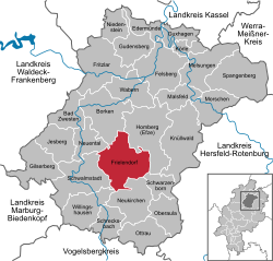 | |
 Location of Frielendorf | |
 Frielendorf  Frielendorf | |
| Coordinates: 50°59′N09°20′E / 50.983°N 9.333°E | |
| Country | Germany |
| State | Hesse |
| Admin. region | Kassel |
| District | Schwalm-Eder-Kreis |
| Government | |
| • Mayor (2021–27) | Jens Nöll [1] (SPD) |
| Area | |
• Total | 85.83 km2 (33.14 sq mi) |
| Highest elevation | 260 m (850 ft) |
| Lowest elevation | 230 m (750 ft) |
| Population (2023-12-31) [2] | |
• Total | 7,266 |
| • Density | 84.66/km2 (219.3/sq mi) |
| Time zone | UTC+01:00 (CET) |
| • Summer (DST) | UTC+02:00 (CEST) |
| Postal codes | 34621 |
| Dialling codes | 05684 |
| Vehicle registration | HR,MEG,FZ |
| Website | www.frielendorf.de |
Frielendorf is a municipality in the Schwalm-Eder district, Hesse, Germany.
