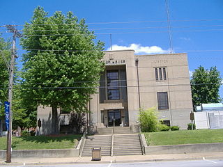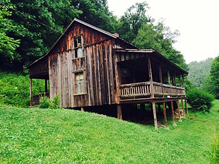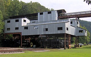
Pike County is a county in the U.S. state of Kentucky. As of the 2020 Census, the population was 58,669. Its county seat is Pikeville. The county was founded in 1821. With regard to the sale of alcohol, it is classified as a moist county–– a county in which alcohol sales are prohibited, but containing a "wet" city. There are three cities in the county, Pikeville, Elkhorn City, and Coal Run Village, where package alcohol sales are legal.

Perry County is a county in the U.S. state of Kentucky. As of the 2020 census, the population was 28,473. Its county seat is Hazard. The county was founded in 1820. Both the county and county seat are named for Commodore Oliver Hazard Perry, a naval hero in the War of 1812.

Ohio County is a county located in the U.S. state of Kentucky. As of the 2020 census, the population was 23,772. Its county seat is Hartford, and its largest city is Beaver Dam. The county is named after the Ohio River, which originally formed its northern boundary. It is a moist county, which means that the sale of alcohol is only legal within certain city limits.

Muhlenberg County is a county in the U.S. Commonwealth of Kentucky. As of the 2020 census, the population was 30,928. Its county seat is Greenville and its largest city is Central City.

McCreary County is a county located in the U.S. state of Kentucky. As of the 2020 census, the population was 16,888. Its county seat is Whitley City. The county is named for James B. McCreary, a Confederate war soldier and two-time Governor of Kentucky. During his second term as governor, McCreary County was created by the Legislature and was named in his honor.

Hopkins County is a county located in the western part of the U.S. state of Kentucky. As of the 2020 census, the population was 45,423. Its county seat is Madisonville. Hopkins County was created December 9, 1806 from Henderson County. It was named for General Samuel Hopkins, an officer in both the American Revolutionary War and War of 1812, and later a Kentucky legislator and U.S. Congressman.

Harlan County is a county located in southeastern Kentucky. As of the 2020 census, the population was 26,831. Its county seat is Harlan. It is classified as a moist county—a county in which alcohol sales are prohibited, but containing a "wet" city, in this case Cumberland, where package alcohol sales are allowed. In the city of Harlan, restaurants seating 100+ may serve alcoholic beverages.

Breathitt County is a county in the eastern Appalachian portion of the U.S. state of Kentucky. As of the 2020 census, the population was 13,718. Its county seat is Jackson. The county was formed in 1839 and was named for John Breathitt, who was Governor of Kentucky from 1832 to 1834. Breathitt County was a prohibition or dry county, until a public vote in July 2016 that allowed alcohol sales.

Bituminous coal, or black coal, is a type of coal containing a tar-like substance called bitumen or asphalt. Its coloration can be black or sometimes dark brown; often there are well-defined bands of bright and dull material within the seams. It is typically hard but friable. Its quality is ranked higher than lignite and sub-bituminous coal, but lesser than anthracite. It is the most abundant rank of coal, with deposits found around the world, often in rocks of Carboniferous age. Bituminous coal is formed from sub-bituminous coal that is buried deeply enough to be heated to 85 °C (185 °F) or higher.

The West Kentucky Coal Field comprises an area in the west-central and northwestern part of the state, bounded by the Dripping Springs Escarpment and the Pennyroyal Plateau and the Ohio River, but is part of the Illinois Basin that extends into Indiana and Illinois. It is characterized by Pennsylvanian age sandstones, shales and coal. Nearly all of the counties in the area are part of the television market known as the Kentucky–Illinois–Indiana tri-state area.

Black Mountain is the highest mountain peak in the Commonwealth of Kentucky, United States, with a summit elevation of 4,145 feet (1,263 m) above mean sea level and a top-to-bottom height of over 2,500 feet (760 m). The summit is located at approximately 36°54′51″N82°53′38″W in Harlan County, Kentucky near the Virginia border, just above the towns of Lynch, Kentucky and Appalachia, Virginia. It is alternatively known as Katahrin's Mountain, and is about 500 feet (150 m) taller than any other mountain in Kentucky.
Highsplint is a former coal town with an extinct post office in Harlan County, Kentucky, United States. It was named for the High Splint and Seagraves Coal Companies which operated a mine in the town at that time. Highsplint's first post office was established on February 7, 1918, with John D. Casey as postmaster, remaining in operation until 1974.

Butcher Hollow is a coal-mining community located in Johnson County, Kentucky, United States.
Stone is an unincorporated community and coal town in Pike County, Kentucky, United States. It was established in 1912. Stone was a mining community named for Galen Stone, head of the Pond Creek Coal Company which was based in Stone. In 1922 the Pond Creek Coal Company was sold to Fordson Coal Company, which was a subsidiary of Ford Motor Company. In 1936 Fordson sold the mine at Stone to Eastern Coal Company.

Blue Heron, also known as Mine 18, is a former coal mining community or coal town on the banks of the Big South Fork of the Cumberland River in McCreary County, Kentucky, United States, that has been recreated and is maintained as an interpretive history area in the Big South Fork National River and Recreation Area.
Barthell is a former coal town in McCreary County, Kentucky, United States. It was established in 1902 and was the first of 18 mining camps to be built by the Stearns Coal and Lumber Company. It now serves as an open-air history museum, which is open from April through Thanksgiving.
Hellier is an unincorporated community and coal town in Pike County, Kentucky, United States.
Closplint is an unincorporated community in Harlan County, Kentucky, United States. The settlement was named Cloversplint after the mining company that built the mine to exploit the coal and the settlement as a coal town in 1926. The arrangement of the company houses is considered to have shown the influence of reform thinking about such towns. The company operated here between 1928 and 1946. When the United States Postal Service established a post office, it shortened the name to Closplint.
Fourseam is an unincorporated community located in Perry County, Kentucky, United States.
Harveyton is an unincorporated community located in Perry County, Kentucky, United States.


