Highland is a hamlet in Ulster County, New York, United States. The population was 6,385 at the 2020 census. It is part of the New York City Combined Statistical area.

Madison Township is a township in Armstrong County, Pennsylvania, United States. The population was 826 at the 2020 census, an increase over the figure of 820 tabulated in 2010.

Cresson Township is a township in Cambria County, Pennsylvania, United States. The population was 2,820 at the 2020 census. The township surrounds the boroughs of Cresson and Sankertown but is separate from them. It is part of the Johnstown, Pennsylvania Metropolitan Statistical Area.
Bismarck is a rural unincorporated community and census-designated place (CDP) in Hot Spring County, Arkansas. It was first listed as a CDP in the 2020 census with a population of 2,332. It is located between Hot Springs and Caddo Valley, centered around the intersection of State Hwy 7 and State Hwy 84 in Hot Spring County, Arkansas, United States.
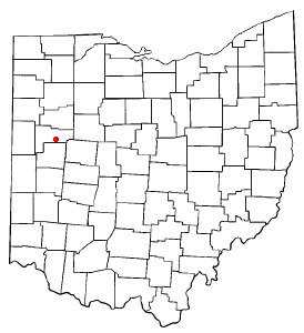
Fryburg is an unincorporated community located in central Pusheta Township, Auglaize County, Ohio, United States.

Irwin is an unincorporated community in southwestern Union Township, Union County, Ohio, United States. It is located at 40°07′21″N83°29′22″W, at the intersection of Ohio State Route 4 and 161. Irwin has a post office which serves the surrounding area, including the community of Rosedale.
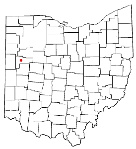
Kossuth is an unincorporated community located in eastern Salem Township, Auglaize County, Ohio, United States.

St. Mary of the Annunciation Catholic Church is a Catholic church in Charleston, South Carolina, and was the first Catholic parish established in the Carolinas and Georgia. The current building at 93 Hasell Street and is the third structure to house the congregation on this site.

Lineboro is an unincorporated community located in northeastern Carroll County, Maryland, United States. The community was named for its location near the Mason–Dixon line.

Fairfield Township is one of thirteen townships in Tippecanoe County, Indiana. As of the 2010 census, its population was 51,113 and it contained 24,527 housing units.

Wayne Township is one of fifteen townships in Wayne County, Indiana, United States. As of the 2010 census, its population was 41,217 and it contained 19,510 housing units.
Zieglerville is an unincorporated community in Lower Frederick Township in Montgomery County, Pennsylvania, United States. Its ZIP Code is 19492 and it is located on the west side of the Perkiomen Creek where PA Route 29 and PA Route 73 split at a roundabout, just north of Schwenksville.
Oakley is an unincorporated community in St. Mary's County, Maryland, United States. The River View was listed on the National Register of Historic Places in 1976.

Andrewville is an unincorporated community in Kent County, Delaware, United States. Its elevation is 52 ft (16 m) and is located at 38°51′41″N75°38′06″W. It is located west of Farmington on Andrewville Road.

St. Patrick's Church is an historic Roman Catholic church in Glynwood, an unincorporated community in Moulton Township, Auglaize County, Ohio, United States. Located north of U.S. Route 33 between St. Marys and Wapakoneta, the church was built in 1883 in the Gothic Revival style. It is one of many large Catholic churches in a region of rural western Ohio known as the "Land of the Cross-Tipped Churches," which was settled by primarily Catholic immigrants during the nineteenth century.

Montra is an unincorporated community in Jackson Township, Shelby County, Ohio, United States. Established in the middle of the nineteenth century, the small community is prominent because of a landmark church, Emanuel Lutheran Church of Montra.

St. Patrick is an unincorporated community in northwestern Turtle Creek Township, Shelby County, Ohio, United States. It lies at the intersection of Hoying and Wright-Puthoff Roads, northwest of the city of Sidney, the county seat of Shelby County. Its elevation is 971 feet (296 m) and it is located at 40°22′15″N84°17′15″W.
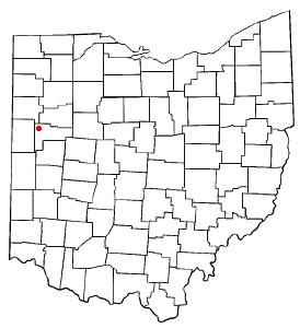
Egypt is an unincorporated community in western Jackson Township, Auglaize County, Ohio, United States. Located at 40°23′8″N84°25′59″W, the community sits at an elevation of 971 feet (296 m), approximately 2 miles (3.2 km) west of the village of Minster.

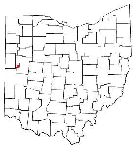
Cassella is an unincorporated community in Marion Township, Mercer County, Ohio, United States. Located at 40°24′22″N84°33′8″W, it lies at an elevation of 955 feet (291 m). Situated at the intersection of State Route 119 and Cassella-Montezuma Road in western Marion Township, it lies in the headwaters of Beaver Creek to the south of the city of Celina, the county seat of Mercer County. Other nearby communities include Maria Stein, 3 miles (4.8 km) to the east, Carthagena, 2 miles (3.2 km) to the north, and St. Henry, 4 miles (6.4 km) to the west.
McCartyville is an unincorporated community in Shelby County, Ohio, United States. Located at the junction of State Routes 29 and 119, it lies in southern Van Buren Township, 3 miles (4.8 km) south of central Kettlersville and approximately 8 miles (13 km) northwest of the city of Sidney, the county seat of Shelby County. Its elevation is 974 feet (297 m), and it is located at 40°23′41″N84°15′21″W.