Kossuth, Ohio

Last updated

Location of Kossuth, Ohio OHMap-doton-Salem.PNG
Location of Kossuth, Ohio

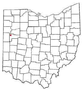
Kossuth is an unincorporated community located in eastern Salem Township, Auglaize County, Ohio, United States. [1]

It is located along State Routes 66 and 197 between Saint Marys and Spencerville. The community is served by the Spencerville Local School District and the Spencerville (45887) post office.

Kossuth is named in honor of Lajos Kossuth, a Hungarian revolutionary hero who led the democratic, anti-Habsburg Hungarian Revolution of 1848. [2]

Kossuth was platted and organized along the Miami and Erie Canal as Deep Cut in 1845, adopting its current name in 1859. [3] [4] Incorporated in 1897, the village surrendered its charter several years later in 1910. [5]

Related Research Articles

<span class="mw-page-title-main">Paulding County, Ohio</span> County in Ohio, United States

Paulding County is a county located in the U.S. state of Ohio. As of the 2020 census, the population was about 18,806. Its county seat is Paulding. The county was created in 1820 and later organized in 1839. It is named for John Paulding, one of the captors of Major John André in the American Revolutionary War.

<span class="mw-page-title-main">Auglaize County, Ohio</span> County in Ohio, United States

Auglaize County is a county in Northwestern Ohio, United States of America. As of the 2020 census, the population was 46,442. Its county seat and largest city is Wapakoneta.

<span class="mw-page-title-main">Allen County, Ohio</span> County in Ohio, United States

Allen County is a county located in the northwestern part of the U.S. state of Ohio. Its county seat and largest city is Lima. The county was created in 1820 and organized in 1831. The county is named in honor of Colonel John Allen, who was killed leading his men at the Battle of Frenchtown during the War of 1812.

<span class="mw-page-title-main">New Knoxville, Ohio</span> Village in Ohio, United States

New Knoxville is a village in Auglaize County, Ohio, United States. It was established in 1836. The population was 946 at the 2020 census. It is included in the Wapakoneta, Ohio Micropolitan Statistical Area.

<span class="mw-page-title-main">Miami and Erie Canal</span> 19th-century manmade water route between Cincinnati and Toledo, Ohio, U.S.

The Miami and Erie Canal was a 274-mile (441 km) canal that ran from Cincinnati to Toledo, Ohio, creating a water route between the Ohio River and Lake Erie. Construction on the canal began in 1825 and was completed in 1845 at a cost to the state government of $8 million. At its peak, it included 19 aqueducts, three guard locks, 103 canal locks, multiple feeder canals, and a few man-made water reservoirs. The canal climbed 395 feet (120 m) above Lake Erie and 513 feet (156 m) above the Ohio River to reach a topographical peak called the Loramie Summit, which extended 19 miles (31 km) between New Bremen, Ohio to lock 1-S in Lockington, north of Piqua, Ohio. Boats up to 80 feet long were towed along the canal by mules, horses, or oxen walking on a prepared towpath along the bank, at a rate of four to five miles per hour.

<span class="mw-page-title-main">Logan Township, Auglaize County, Ohio</span> Township in Ohio, United States

Logan Township is one of the fourteen townships of Auglaize County, Ohio, United States. The 2020 census found 1,158 people in the township.

<span class="mw-page-title-main">Salem Township, Auglaize County, Ohio</span> Township in Ohio, United States

Salem Township is one of the fourteen townships of Auglaize County, Ohio, United States. The 2020 census found 507 people in the township.

<span class="mw-page-title-main">Saint Marys Township, Auglaize County, Ohio</span> Township in Ohio, United States

Saint Marys Township is one of the fourteen townships of Auglaize County, Ohio, United States. The 2020 census found 11,065 people in the township.

<span class="mw-page-title-main">Fryburg, Ohio</span> Unincorporated community in Ohio, U.S.

Fryburg is an unincorporated community located in central Pusheta Township, Auglaize County, Ohio, United States.

<span class="mw-page-title-main">Moulton, Ohio</span> Unincorporated community in Ohio, U.S.

Moulton is an unincorporated community located in southern Moulton Township, Auglaize County, Ohio, United States.

<span class="mw-page-title-main">Glynwood, Ohio</span> Unincorporated community in Ohio, U.S.

Glynwood is an unincorporated community located in southwestern Moulton Township, in Auglaize County, Ohio, United States.

<span class="mw-page-title-main">Swanders, Ohio</span> Unincorporated community in Ohio, U.S.

Swanders is a rural unincorporated community located on Fort Loramie-Swanders Road in Franklin Township, Shelby County, Ohio, United States. It lies midway between the village of Anna and the city of Sidney.

<span class="mw-page-title-main">Miami and Erie Canal Deep Cut</span> United States historic place

The Miami and Erie Canal Deep Cut is a well-preserved long section of the Miami and Erie Canal near Spencerville in western Ohio. The 6,600-foot (2,000 m) segment represents one of the major construction efforts of the canal; in order to avoid using locks to go over a ridge, the canal was dug deeply into it, far more than the 5-foot (1.5 m) depth of the canal itself. Workers dug the canal bed up to 52 feet (16 m) into the blue clay ridge that separated the St. Marys and Auglaize River watersheds. It is a United States National Historic Landmark. The cut is owned by the state and managed jointly by Johnny Appleseed MetroParks and the Heritage Trails Park District as Deep Cut Historical Park, with multi-use trails and a picnic area.

<span class="mw-page-title-main">Geyer, Ohio</span> Unincorporated community in Ohio, U.S.

Geyer is an unincorporated community in southwestern Clay Township, Auglaize County, Ohio, United States.

<span class="mw-page-title-main">Peoria, Ohio</span> Unincorporated community in Ohio, United States

Peoria is an unincorporated community in Liberty Township, Union County, Ohio, United States. It is located at 40°18′50″N83°26′45″W, along Raymond Road, about 1.75 miles south of Raymond and 6.5 miles northwest of Marysville.

<span class="mw-page-title-main">Montra, Ohio</span> Unincorporated community in Ohio, U.S.

Montra is an unincorporated community in Jackson Township, Shelby County, Ohio, United States. Established in the middle of the nineteenth century, the small community is prominent because of a landmark church, Emanuel Lutheran Church of Montra.

<span class="mw-page-title-main">Egypt, Ohio</span> Unincorporated community in Ohio, U.S.

Egypt is an unincorporated community in western Jackson Township, Auglaize County, Ohio, United States. Located at 40°23′8″N84°25′59″W, the community sits at an elevation of 971 feet (296 m), approximately 2 miles (3.2 km) west of the village of Minster.

Gutman is an unincorporated community in Auglaize County, in the U.S. state of Ohio.

Slater is an unincorporated community in Clay Township, Auglaize County, Ohio, United States. It is located southeast of Wapakoneta and just south of Saint Johns, on Geyer Road between Clay Road and Gutman Road, at 40°31′40″N84°04′24″W.

Seneca Township is a minor civil division in Kossuth County, Iowa, United States.

References

  1. U.S. Geological Survey Geographic Names Information System: Kossuth, Ohio
  2. Gannett, Henry (1905). The Origin of Certain Place Names in the United States. Government Printing Office. pp.  177.
  3. "Kossuth Deep Cut Original Plat" (PDF). Auglaize County, Ohio. Retrieved September 25, 2021.
  4. "Kossuth Original Plat" (PDF). Auglaize County, Ohio. Retrieved September 25, 2021.
  5. "Kossuth Incorporation" (PDF). Auglaize County, Ohio. Retrieved September 25, 2021.

40°39′34″N84°20′53″W / 40.65944°N 84.34806°W / 40.65944; -84.34806