Waynesfield, Ohio

Last updated

Waynesfield, Ohio
Waynesfield downtown.jpg
Downtown Waynesfield
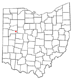
OHMap-doton-Waynesfield.png
Location of Waynesfield, Ohio
Map of Auglaize County Ohio Highlighting Waynesfield Village.png
Location of Waynesfield in Auglaize County
Coordinates: 40°36′09″N83°58′26″W / 40.60250°N 83.97389°W / 40.60250; -83.97389
Country United States
State Ohio
County Auglaize
Township Wayne
Government
   Mayor Rodney Luma[ citation needed ]
Area
[1]
  Total0.66 sq mi (1.72 km2)
  Land0.66 sq mi (1.72 km2)
  Water0.00 sq mi (0.00 km2)
Elevation
[2]
1,066 ft (325 m)
Population
 (2020)
  Total749
  Density1,129.71/sq mi (435.88/km2)
Time zone UTC-5 (Eastern (EST))
  Summer (DST) UTC-4 (EDT)
ZIP code
45896
Area code 419
FIPS code 39-82390
GNIS feature ID2400116 [2]
Website http://www.waynesfieldohio.com/

Waynesfield is a village in Auglaize County, Ohio, United States. The population was 749 at the 2020 census. It is included in the Wapakoneta, Ohio Micropolitan Statistical Area.

Contents

History

Waynesfield was founded on July 1, 1848. [3]

Geography

According to the United States Census Bureau, the village has a total area of 0.74 square miles (1.92 km2), all land. [4]

Demographics

Historical population
CensusPop.Note
1880 306
1890 48056.9%
1900 54212.9%
1910 5420.0%
1920 5847.7%
1930 561−3.9%
1940 5925.5%
1950 73323.8%
1960 7654.4%
1970 704−8.0%
1980 82617.3%
1990 8310.6%
2000 803−3.4%
2010 8475.5%
2020 749−11.6%
U.S. Decennial Census [5]

2010 census

As of the census [6] of 2010, there were 847 people, 309 households, and 218 families living in the village. The population density was 1,144.6 inhabitants per square mile (441.9/km2). There were 350 housing units at an average density of 473.0 per square mile (182.6/km2). The racial makeup of the village was 97.8% White, 0.6% African American, 0.2% Native American, 0.1% Asian, 0.7% from other races, and 0.6% from two or more races. Hispanic or Latino of any race were 2.1% of the population.

There were 309 households, of which 42.1% had children under the age of 18 living with them, 50.8% were married couples living together, 12.3% had a female householder with no husband present, 7.4% had a male householder with no wife present, and 29.4% were non-families. 25.6% of all households were made up of individuals, and 8.4% had someone living alone who was 65 years of age or older. The average household size was 2.74 and the average family size was 3.29.

The median age in the village was 33.5 years. 31.4% of residents were under the age of 18; 8.4% were between the ages of 18 and 24; 26.3% were from 25 to 44; 23.1% were from 45 to 64; and 10.7% were 65 years of age or older. The gender makeup of the village was 47.9% male and 52.1% female.

2000 census

As of the census [7] of 2000, there were 803 people, 307 households, and 213 families living in the village. The population density was 1,137.4 inhabitants per square mile (439.2/km2). There were 323 housing units at an average density of 457.5 per square mile (176.6/km2). The racial makeup of the village was 97.38% White, 0.12% African American, 0.62% Native American, and 1.87% from two or more races. Hispanic or Latino of any race were 1.37% of the population.

There were 307 households, out of which 34.5% had children under the age of 18 living with them, 55.7% were married couples living together, 9.4% had a female householder with no husband present, and 30.6% were non-families. 26.4% of all households were made up of individuals, and 11.4% had someone living alone who was 65 years of age or older. The average household size was 2.62 and the average family size was 3.17.

In the village, the population was spread out, with 30.4% under the age of 18, 8.2% from 18 to 24, 29.1% from 25 to 44, 19.7% from 45 to 64, and 12.6% who were 65 years of age or older. The median age was 32 years. For every 100 females there were 93.0 males. For every 100 females age 18 and over, there were 91.4 males.

The median income for a household in the village was $29,712, and the median income for a family was $40,000. Males had a median income of $32,250 versus $19,453 for females. The per capita income for the village was $13,944. About 6.3% of families and 10.6% of the population were below the poverty line, including 12.5% of those under age 18 and 5.5% of those age 65 or over.

Education

Waynesfield-Goshen Local Schools District operates in one PK-12 building which consists of a high school, middle school and a elementary school. The school's athletic programs' mascot is the Tigers and competes in the NWCC (Northwest Central Conference).

Waynesfield has a public library, a branch of the Auglaize County Public Library. [8]

Sports and leisure

Prairie View Golf Club built in 1991 is a Public 18 Hole Golf Course with well groomed fairways and greens. The course rating is a 70.0 and a slope rating of 113.[ citation needed ]

Waynesfield Raceway Park (built in 1993) is a 40 acre motor sports facility which includes a 1/3 mile high-banked dirt oval race track. The facility also includes a 1/5 mile dirt oval race track for kart/quarter midget racing. It is located a mile south of town.[ citation needed ]

Related Research Articles

<span class="mw-page-title-main">Auglaize County, Ohio</span> County in Ohio, United States

Auglaize County is a county in Northwestern Ohio, United States of America. As of the 2020 census, the population was 46,442. Its county seat and largest city is Wapakoneta.

<span class="mw-page-title-main">Stockbridge, Michigan</span> Village in Michigan, United States

Stockbridge is a village in Ingham County in the U.S. state of Michigan. It is located within Stockbridge Township about 36 miles (58 km) southeast from downtown Lansing. The population was 1,218 at the 2010 census.

<span class="mw-page-title-main">Cedar Hill Lakes, Missouri</span> Village in Missouri, United States

Cedar Hill Lakes is a village in Jefferson County, Missouri, United States. The population was 203 at the 2020 census.

<span class="mw-page-title-main">Evergreen, Missouri</span> Village in Missouri, United States

Evergreen is a village in Laclede County, Missouri, United States. The population was 28 at the 2010 census. It was named Twin Bridges at the 2000 census.

<span class="mw-page-title-main">Fort Shawnee, Ohio</span> CDP in Ohio, United States

Fort Shawnee is census-designated place (CDP) in Allen County, Ohio, United States. The population was 6,263 at the 2020 census. It is included in the Lima, Ohio Metropolitan Statistical Area. Fort Shawnee is adjacent to the city of Lima and the village of Cridersville in Auglaize County. In 2012, village residents voted to disincorporate the village. Fort Shawnee is located at 40°40′54″N84°8′21″W. According to the United States Census Bureau, the village had a total area of 7.25 square miles (18.78 km2), of which 7.21 square miles (18.67 km2) is land and 0.04 square miles (0.10 km2) is water.

<span class="mw-page-title-main">Buckland, Ohio</span> Village in Ohio, United States

Buckland is a village in Auglaize County, Ohio, United States. The population was 233 at the 2020 census. It is included in the Wapakoneta, Ohio Micropolitan Statistical Area. The village is served by the Wapakoneta City School District.

<span class="mw-page-title-main">Cridersville, Ohio</span> Village in Ohio, United States

Cridersville is a village in Auglaize County, Ohio, United States. The population was 1,791 at the 2020 census. It is included in the Wapakoneta, Ohio Micropolitan Statistical Area.

<span class="mw-page-title-main">Minster, Ohio</span> Village in Ohio, United States

Minster is a village in Auglaize and Shelby counties, in the U.S. state of Ohio. The population was 3,046 at the 2020 census. It is included in the Wapakoneta, Ohio Micropolitan Statistical Area. It is adjacent to the village of New Bremen to the north.

<span class="mw-page-title-main">New Bremen, Ohio</span> Village in Ohio, United States

New Bremen is a village in Auglaize County, Ohio, United States. The population was 3,034 at the 2020 census. It is included in the Wapakoneta, Ohio Micropolitan Statistical Area. The village is adjacent to Minster to the south.

<span class="mw-page-title-main">New Knoxville, Ohio</span> Village in Ohio, United States

New Knoxville is a village in Auglaize County, Ohio, United States. It was established in 1836. The population was 946 at the 2020 census. It is included in the Wapakoneta, Ohio Micropolitan Statistical Area.

<span class="mw-page-title-main">Uniopolis, Ohio</span> Unincorporated community and Census-designated place in Ohio, United States

Uniopolis is an unincorporated community and former village in Auglaize County, Ohio, United States. The population was 188 at the 2020 census. It is included in the Wapakoneta, Ohio Micropolitan Statistical Area.

<span class="mw-page-title-main">Cuyahoga Heights, Ohio</span> Village in Ohio, United States

Cuyahoga Heights is a village in Cuyahoga County, Ohio, United States. The population was 573 at the 2020 census. A suburb of Cleveland, it is a part of the Cleveland metropolitan area.

<span class="mw-page-title-main">Yorkshire, Ohio</span> Village in Ohio, United States

Yorkshire is a village in Darke County, Ohio, United States. The population was 95 at the 2020 census.

<span class="mw-page-title-main">Woodlawn, Ohio</span> Village in Ohio, United States

Woodlawn is a village in Hamilton County, Ohio, United States. The population was 3,916 at the 2020 census.

<span class="mw-page-title-main">Botkins, Ohio</span> Village in Ohio, United States

Botkins is a village in Shelby County, Ohio, United States. The population was 1,155 at the 2020 census.

<span class="mw-page-title-main">Clearview, West Virginia</span> Village in West Virginia, United States

Clearview is a village in Ohio County, West Virginia, United States. It is part of the Wheeling, West Virginia Metropolitan Statistical Area. The population was 565 at the 2010 census.

<span class="mw-page-title-main">Bellevue, Wisconsin</span> Village in Wisconsin, United States

Bellevue is a village in Brown County, Wisconsin. It was a town until incorporating as a village on February 14, 2003. The population was 15,935 at the time of the 2020 census. Bellevue is part of the Green Bay metropolitan area. Bellevue sits around 4.34 miles (6.99 km) east from central Green Bay.

<span class="mw-page-title-main">Avoca, Wisconsin</span> Village in Wisconsin, United States

Avoca is a village in Iowa County, Wisconsin, United States. The population was 637 at the 2010 census. It is part of the Madison Metropolitan Statistical Area. It is named after Avoca in Ireland.

<span class="mw-page-title-main">Wilson, Ohio</span> Village in Ohio, United States

Wilson is a village in Belmont and Monroe counties in the U.S. state of Ohio. The population was 129 at the 2020 census. It is part of the Wheeling metropolitan area.

<span class="mw-page-title-main">Black Earth, Wisconsin</span> Village in Wisconsin, United States

Black Earth is a village in Dane County, Wisconsin, United States. The population was 1,338 at the 2010 census. The village is located within the Town of Black Earth. It is part of the Madison Metropolitan Statistical Area.

References

  1. "ArcGIS REST Services Directory". United States Census Bureau. Retrieved September 20, 2022.
  2. 1 2 U.S. Geological Survey Geographic Names Information System: Waynesfield, Ohio
  3. Auglaize County, Ohio Atlas and History, Piqua: Magee Brother Publishing, 1917. Accessed 2007-12-30. 123.
  4. "US Gazetteer files 2010". United States Census Bureau . Retrieved January 6, 2013.
  5. "Census of Population and Housing". Census.gov. Retrieved June 4, 2015.
  6. "U.S. Census website". United States Census Bureau . Retrieved January 6, 2013.
  7. "U.S. Census website". United States Census Bureau . Retrieved January 31, 2008.
  8. "Hours & Locations". Auglaize County Libraries. Retrieved February 25, 2018.