Saint Johns, Ohio

Last updated

Saint Johns, Ohio
Old house in Saint Johns, Ohio.jpg
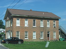
An old house in Saint Johns
OHMap-doton-Saint Johns.PNG
Location of Saint Johns, Ohio
Coordinates: 40°33′21″N84°04′47″W / 40.55583°N 84.07972°W / 40.55583; -84.07972
Country Flag of the United States (23px).png  United States
State Flag of Ohio.svg Ohio
County Auglaize
Townships Clay, Union
Area
[1]
  Total
0.39 sq mi (1.01 km2)
  Land0.38 sq mi (0.99 km2)
  Water0.007 sq mi (0.018 km2)
Elevation
[2]
1,004 ft (306 m)
Population
 (2020)
  Total
304
  Density800/sq mi (310/km2)
Time zone UTC-5 (Eastern (EST))
  Summer (DST) UTC-4 (EDT)
ZIP codes
45884
45895 (Wapakoneta)
Area code(s) 419 & 567
FIPS code 3969596
GNIS feature ID2628970 [2]

Saint Johns is a census-designated place located along the border between the Union and Clay townships of Auglaize County, Ohio, United States. [2] As of the 2020 census it had a population of 304.

Contents

It is located between Indian Lake and Wapakoneta at the intersection of U.S. Route 33 and State Route 65. Served by the Wapakoneta City School District, the zip code for Saint Johns is 45884.

History

Saint Johns was founded in 1835, and named for John Rogers, proprietor. [3] A post office called Saint Johns has been in operation since 1838. [4] In the center of Saint Johns, on the corner of Center Street and Walnut Street, is a memorial recognizing this place to be known as Black Hoof's last home. [5]

Geography

Saint Johns has a total area of 0.391 square miles (1.01 km2), of which 0.384 square miles (0.99 km2) is land and 0.007 square miles (0.018 km2) is water. [6]

References

  1. "ArcGIS REST Services Directory". United States Census Bureau. Retrieved September 20, 2022.
  2. 1 2 3 U.S. Geological Survey Geographic Names Information System: Saint Johns, Ohio
  3. Sutton, Robert (1880). History of Auglaize County, Ohio : with the Indian history of Wapakoneta, and the first settlement of the county. p. 172.
  4. "Auglaize County". Jim Forte Postal History. Retrieved December 22, 2015.
  5. "Shelby County Historical Society - Indians - Chief Blackhoof".
  6. "2020 U.S. Gazetteer Files". United States Census Bureau. Retrieved December 7, 2025.