
Alberschwende is a municipality and a village in the district of Bregenz in the Austrian state of Vorarlberg.
Lanzenkirchen is a market town in the district of Wiener Neustadt-Land in the Austrian state of Lower Austria.
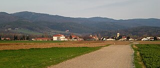
Oberndorf is a municipality in Kitzbühel district in the Austrian state of Tyrol. It is located in the Leukental valley, on the Kitzbühler Ache stream, halfway between St. Johann in Tirol and Kitzbühel.

Regau is a municipality in the Austrian state of Upper Austria near Vöcklabruck, which is the capital of the district.
Sankt Paul im Lavanttal is a municipality of the Wolfsberg district in the Austrian state of Carinthia.

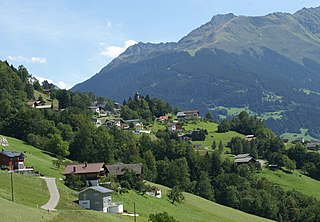
Absam is a municipality in the Innsbruck-Land District, Tyrol (Austria) situated at an altitude of 632 m, which had an area of 51.92 km2 and 6,776 inhabitants as January 2015.
Bartholomäberg is a municipality and a village in the district of Bludenz in the Austrian state of Vorarlberg.

Baumkirchen is a community in the district of Innsbruck Land. It lies in the Inn Valley north of the Inn River on a batter of the Gnadenwald terrace. The village can be reached via the Inn Valley Motorway.

Fritzens is a municipality in the district Innsbruck country in Tyrol (Austria). It lies 16 km east of Innsbruck on the left side of the Inn River. The Iron Age Fritzens-Sanzeno culture is named for archaeological finds from the village.

St. Martin bei Lofer is a municipality in the district of Zell am See, in the state of Salzburg in Austria.
Sankt Jakob in Haus is a municipality in the Kitzbühel district in the Austrian state of Tyrol located 13.60 km northeast of Kitzbühel as well as 2.50 km above Fieberbrunn. It is the smallest community in the district. The village was mentioned in documents for the first time in 1308 but settlement already began in the 10th century. The main source of income is tourism.

Sankt Peter am Kammersberg is a small village in Austria in the state of Styria with 2,076 inhabitants. It was first mentioned in documents in the year 1007.

Sankt Leonhard im Pitztal is a municipality in the Imst district, located 20 kilometres (12 mi) south of Imst on the upper course of the Pitze River in western Austria. The village covers a large area and has a length of around 25 kilometres (16 mi). It is one of the biggest communities of Tyrol by area.
Altach is a municipality in the district of Feldkirch, in the westernmost Austrian state of Vorarlberg.

St. Martin am Tennengebirge is a municipality in the St. Johann im Pongau district in the Austrian state of Salzburg.
St. Georgen am Fillmannsbach is a municipality in the district of Braunau in the Austrian state of Upper Austria.

St. Pantaleon is a municipality in the Braunau district in Upper Austria, Austria. A monument was erected by the riverlet Moosach in memory of the slave workers engaged there in 1940/41 at the Weyer concentration camp.
St. Pankraz is a municipality in the district of Kirchdorf in the Austrian state of Upper Austria.

St. Marienkirchen am Hausruck is a municipality in the district of Ried in the Austrian state of Upper Austria.

St. Lorenz is a municipality in the district of Vöcklabruck in the Austrian state of Upper Austria.


