The Bezirk Innsbruck-Land is an administrative district (Bezirk) in Tyrol, Austria. It encloses the Statutarstadt Innsbruck, and borders Bavaria (Germany) in the north, the district Schwaz in the east, South Tyrol in Italy to the south, and the district of Imst in the west.

Brenner is a comune and a village in South Tyrol in northern Italy, located about 60 km (37 mi) north of Bolzano on the border with Tyrol, Austria.

Pfitsch is a comune (municipality) South Tyrol in northern Italy, located about 45 kilometres (28 mi) north of the city of Bolzano at the border with Austria. It is named after the valley of Pfitschtal or Pfitscher Tal.

Absam is a municipality in the Innsbruck-Land District, Tyrol (Austria) situated at an altitude of 632 m, which had an area of 51.92 km2 and 6,776 inhabitants as January 2015.

Aldrans is a municipality in the Innsbruck-Land District, Tyrol (Austria) at an altitude of 760 m (2,490 ft), which had an area of 8.89 km2 (3.43 sq mi) and 2,496 inhabitants as January 2015.

Ampass is a municipality in the Innsbruck-Land District, Tyrol (Austria) situated at an altitude of 651 m, has an area of 7.9 km2 and 1793 inhabitants as January 2015.

Inzing is a town in the Austrian Federal State of Tyrol.

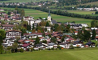
Going am Wilden Kaiser is a municipality in the district of Kitzbühel in the Austrian region of Sölllandl. It is located 8.5 km northwest of Kitzbühel and 5 km west of Sankt Johann in Tirol. The village has 1849 inhabitants and is divided into 5 sub-districts. Its main source of income is tourism. It is connected to the large Ski Welt skiing area by the Astbergbahn chairlift, which takes skiers rapidly from Going in the valley up to the large expanse of ski terrain on the mountainsides.
Kirchdorf in Tirol is a municipality in the Kitzbühel district in the Austrian state of Tyrol located 12.2 km (7.6 mi) north of Kitzbühel as well as 3 km (1.9 mi) north of Sankt Johann in Tirol at the Kitzbühler Ache. By area, Kirchdorf is the second largest municipality in the district. The village obtained its name from an old church which was built in the 8th century. The main sources of income are agriculture and tourism.

Tux is a municipality in the Schwaz district in the Austrian state of Tyrol.

Prutz is a municipality in the Landeck district in the Austrian state of Tyrol. Located at the mouth of the Kauner valley on the upper Inn, it is 10 km south of the city of Landeck and 36 km north of Reschen Pass, that forms the border to Italy. The border to Switzerland is located 23 km away towards the south-west.

Gries am Brenner, often referred to as simply Gries, is a municipality in the Wipptal in the southern district of Innsbruck-Land. The village consists of several hamlets.

Gries im Sellrain is a municipality in the Sellrain Valley in the western district of Innsbruck-Land. The village lies in the valley and the Melach River flows through it.
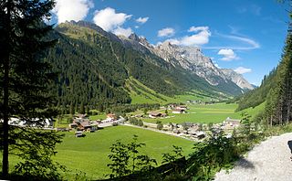
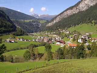
Gschnitz is a municipality with 415 inhabitants in the south of North Tyrol.
Kematen in Tirol is a municipality in the district Innsbruck-Land located about 12 km west of Innsbruck. The Melach river flows into the Inn river in Kematen. Kematen was first mentioned as "Caminata" around 600.

Matrei am Brenner is a small municipality in the southern part of the District Innsbruck-Land and is located approximately 17 km south of Innsbruck. Matrei has always been an important station for commerce. On 1 January 2022 the municipalities of Pfons and Mühlbachl were merged into Matrei. The village has 3,500 inhabitants, at 992 m. above sea level and the Sill river flows through it.
Vals is a municipality in the southern Innsbruck-Land District in the Austrian state of Tyrol.

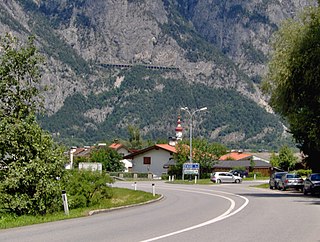
Steinach am Brenner is a market town in the district of Innsbruck-Land in the Austrian state of Tyrol located south of Innsbruck in the Wipptal at the Sill River.

Sellrain is a municipality in the district of Innsbruck-Land in the Austrian state of Tyrol located 14.40 km (8.95 mi) southwest of Innsbruck in the Sellrain Valley. The River Melach and its tributary the Fotscherbach flow through it. Most inhabitants are farmers and also have another job in the neighboring Innsbruck. There are two Catholic churches in the village St. Quirin and St. Anna. They are both over 300 years old.

Schmirn is a municipality in the District Innsbruck-Land in the Austrian state of Tyrol.


