Scarborough or Scarboro may refer to:

The North York Moors is an upland area in north-eastern Yorkshire, England. It contains one of the largest expanses of heather moorland in the United Kingdom. The area was designated as a National Park in 1952, through the National Parks and Access to the Countryside Act 1949. Covering an area of 554 sq mi (1,430 km2), the National Park has a population of 23,380. It is administered by the North York Moors National Park Authority, which is based in Helmsley.

Whitby is a seaside town, port and civil parish in North Yorkshire, England. It is on the Yorkshire Coast at the mouth of the River Esk and has a maritime, mineral and tourist economy.

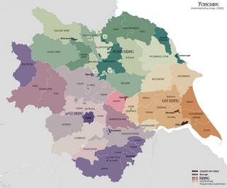
The North Riding of Yorkshire was a subdivision of Yorkshire, England, alongside York, the East Riding and West Riding. The riding's highest point was at Mickle Fell at 2,585 ft (788 m).

Scarborough is a seaside town in the district and county of North Yorkshire, England. With a population of 61,749, Scarborough is the largest town on the Yorkshire Coast and the fourth-largest settlement in the county.

Filey is a seaside town and civil parish in North Yorkshire, England. It is located between Scarborough and Bridlington on Filey Bay. Although it was a fishing village, it has a large beach and became a popular tourist resort. According to the 2011 UK census, Filey parish had a population of 6,981, in comparison to the 2001 UK census population figure of 6,819, and a population of 6,870 in 1991.

Lythe is a small village and large civil parish, in North Yorkshire, England, situated near Whitby within the North York Moors National Park. The name of the village derives from Old Norse and means hill or slope.

Scarborough, formerly Scarborough Central, is a Grade II listed railway station serving the seaside town of Scarborough, North Yorkshire. It lies 42 miles (68 km) east of York and is one of the eastern termini on the North TransPennine route; it is managed by TransPennine Express. and is also served by Northern Trains. The station is also at the northern end of the Yorkshire Coast line and is reputed to have the longest station seat in the world at 456-foot (139 m).

Boulby is a hamlet in the Loftus parish, located within the North York Moors National Park. It is in the borough of Redcar and Cleveland, North Yorkshire, England. The hamlet is located off the A174, near Easington and 1-mile (1.6 km) west of Staithes.

Goldsborough is a village and civil parish in North Yorkshire, England. It is situated near the River Nidd and one mile (1.6 km) east of Knaresborough. Goldsborough is recognised by the well-known stately home Goldsborough Hall and its other features including: Goldsborough Primary School, the Bay Horse Inn and the Goldsborough Cricket Grounds.

Whitby West Cliff railway station was a railway station on the Whitby Redcar and Middlesbrough Union Railway. It was opened on 3 December 1883, to serve the West Cliff area of the town of Whitby, North Yorkshire, England. It was one of two stations serving Whitby; the other was Whitby Town railway station, which served the lines to Malton and Battersby.

The Yorkshire Coast runs from the Tees estuary to the Humber estuary, on the east coast of England. The cliffs at Boulby are the highest on the east coast of England, rising to 660 feet (200 m) above the sea level.

Goldsborough railway station served the village of Goldsborough, North Yorkshire, England from 1850 to 1965 on the Harrogate line. The station was over 13 miles (21 km) west of York railway station, and nearly 3 miles (4.8 km) east of Knaresborough.

The Church of St Oswald, Lythe, is the parish church for the village of Lythe, 4 miles (6.4 km) west, north west of Whitby in North Yorkshire, England. The church is at the top of Lythe Bank and is just east of the village on the A174 road.

Kettleness, is a hamlet in the Scarborough District of North Yorkshire, England. The settlement only consists of half-a-dozen houses, but up until the early 19th century, it was a much larger village. However, most of that village, which was on the headland, slipped into the sea as a result of instability caused by quarrying for the alum industry. Kettleness became a smaller settlement, with houses rebuilt slightly further inland.

Bent Rigg Radar Station,, was a radar site located at Bent Rigg, 0.6 miles (1 km) south of Ravenscar, North Yorkshire, England. Several radar stations had been located in the Ravenscar area from 1938, but a more permanent site was built at Bent Rigg in 1941, which was crewed by technicians and other staff from the Royal Air Force. Bent Rigg, and the wider location around Ravenscar, was deemed "attractive" for the siting of long-range finding equipment. It was originally part of the Coastal Defence/Chain Home Low (CD/CHL) system, designed to detect shipping. Later, it was upgraded with more powerful equipment as part of the Chain Home Extra Low (CHEL). The last recorded use of the station was in September 1944, and it is believed that the site closed soon afterwards.

Prospect Hill Junction was a railway junction in Whitby, North Yorkshire, England. The junction had access to the line into Whitby Town railway station, Whitby West Cliff railway station, and also to the Scarborough line, which went south across Larpool Viaduct. It first saw traffic in December 1883, but did not open as a junction until 1885. It was closed to passenger and freight traffic in March 1965, though the lines were not lifted until 1973.
Pickering Lythe was one of twelve wapentakes within the historical county of the North Riding of Yorkshire, England. It was recognised within the Domesday Book as Dic, an area covering the Vale of Pickering, and swathes of land east towards the North Yorkshire coast.

Falsgrave is an area of Scarborough in North Yorkshire, England. The settlement pre-dates the Domesday Book survey and was the manor which Scarborough belonged to. Gradually the settlements importance inverted, the area now a south west continuation of shops from the town centre street of Westborough. Parts of the area were designated as a conservation area in 1985. It is also where the A170 and A171 roads meet.

