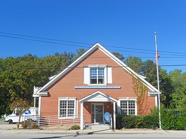
Grasonville, Maryland

Last updated
Grasonville, Maryland
CDP
GrasonvilleMorning.jpg
Morning in Grasonville
Queen Anne's County Maryland Incorporated and Unincorporated areas Grasonville Highlighted.svg
Coordinates: 38°57′46″N76°12′12″W / 38.96278°N 76.20333°W / 38.96278; -76.20333 Coordinates: 38°57′46″N76°12′12″W / 38.96278°N 76.20333°W / 38.96278; -76.20333
CountryUnited States
State Maryland
County Queen Anne's
Area
[1]
  Total6.29 sq mi (16.29 km2)
  Land5.53 sq mi (14.32 km2)
  Water0.76 sq mi (1.97 km2)
Elevation
16 ft (5 m)
Population
 (2020)
  Total3,474
  Density628.32/sq mi (242.60/km2)
Time zone UTC−5 (Eastern (EST))
  Summer (DST) UTC−4 (EDT)
ZIP code
21638
Area code 410
FIPS code 24-34550
GNIS feature ID0597482

Grasonville is a census-designated place (CDP) in Queen Anne's County, Maryland, United States. The population was 2,193 at the 2000 census.

Contents

Geography

Grasonville is located at 38°57′46″N76°12′12″W / 38.96278°N 76.20333°W / 38.96278; -76.20333 (38.962875, 76.203305). [2]

According to the United States Census Bureau, the CDP has a total area of 5.2 square miles (13 km2), of which 4.7 square miles (12 km2) is land and 0.6 square miles (1.6 km2) (10.56%) is water.

Demographics

Historical population
CensusPop.
2020 3,474
U.S. Decennial Census [3]

As of the 2010 census, [4] there were 3,425 people, 1,248 households, and 871 families residing in the CDP. The population density was 619.9 people per square mile. The racial makeup of the CDP was 72.06% White, 20.06% African American, 0.64% Native American, 1.49% Asian, 2.92% from other races, and 2.83% from two or more races. Hispanic or Latino of any race were 5.52% of the population.

There were 1,248 total occupied households. 659 (52.8%) of Grasonville households were married couples living together, 144 (11.5%) had a female householder with no husband present, and 377 (30.2%) were non-families. 286 households were made up of individuals, and 116 had someone living alone who was 65 years of age or older. The average household size was 2.73 and the average family size was 3.21.

In the CDP, the population was spread out, with 28.5% under the age of 18, 8.3% from 18 to 24, 27.8% from 25 to 44, 26.2% from 45 to 64, and 12.6% who were 65 years of age or older. The median age was 37.7 years. For every 100 females, there were 99.1 males.

According to the American Community Survey, the median income for a household in the CDP was $82,467, and the median income for a family was $105,078. [5] The per capita income for the CDP was $33,560. [6] About 8.5% of families [7] and 13.5% of the population were below the poverty line, including 21.5% of those under age 18 and 9.5% of those age 65 or over. [8]

Related Research Articles

<span class="mw-page-title-main">Lake of the Woods, Illinois</span> Census-designated place in Illinois, United States

Lake of the Woods is a census-designated place (CDP) in Champaign County, Illinois, United States. The population was 2403 at the 2020 census. Lake of the Woods is in Mahomet Township and mostly surrounded by the northeast part of the village of Mahomet.

<span class="mw-page-title-main">Brooklyn Park, Maryland</span> Census-designated place in Maryland, United States

Brooklyn Park is a census-designated place (CDP) in Anne Arundel County, Maryland, United States. The population was 14,373 at the 2010 census.

<span class="mw-page-title-main">Ferndale, Maryland</span> Census-designated place in Maryland, United States

Ferndale is a census-designated place (CDP) in Anne Arundel County, Maryland, United States. At the 2010 census, the population was 16,746.

<span class="mw-page-title-main">Mayo, Maryland</span> Census-designated place in Maryland, United States

Mayo is a census-designated place (CDP) in Anne Arundel County, Maryland, United States. The population was 8,298 at the 2010 census. The Mayo CDP of 2010 includes all of the area that used to be counted as the Selby-on-the-Bay CDP. The beach in Mayo used to be a popular weekend resort.

<span class="mw-page-title-main">Parole, Maryland</span> Census-designated place in Maryland, United States

Parole, a suburb of Annapolis, is a census-designated place (CDP) in Anne Arundel County, Maryland, United States. The population was 15,922 at the 2010 census. It is where several major roads intersect at the western edge of the state capital, Annapolis, and contains the Annapolis Mall, and a number of other large shopping centers, and the Anne Arundel Medical Center. It is generally considered to be part of Annapolis rather than a separate town. The neighborhood was named because it was a parole camp, where Union and Confederate prisoners of war were brought for mutual exchange and eventual return to their respective homes.

<span class="mw-page-title-main">Riva, Maryland</span> Census-designated place in Maryland, United States

Riva is a census-designated place (CDP) in Anne Arundel County, Maryland, United States. The population was 4,076 at the 2010 census. The area is scenic, especially where the two-lane Riva Road crosses the South River on a bridge. The area is growing with large new homes as the suburbs of Annapolis grow outward. Riva is bordered by Annapolis to the north, Edgewater to the east, and Davidsonville to the west.

<span class="mw-page-title-main">Shady Side, Maryland</span> Census-designated place in Maryland, United States

Shady Side is a census-designated place (CDP) in Anne Arundel County, Maryland, United States. The population was 5,803 at the 2010 census.

<span class="mw-page-title-main">Lochearn, Maryland</span> Census-designated place in Maryland, United States

Lochearn is an unincorporated community and census-designated place in Baltimore County, Maryland, United States, located immediately to the west of the City of Baltimore. Per the 2020 census, the population was 25,511.

<span class="mw-page-title-main">Rossville, Maryland</span> Census-designated place in Maryland, United States

Rossville is an unincorporated community and census-designated place in Baltimore County, Maryland, United States. The population was 15,147 at the 2010 census.

<span class="mw-page-title-main">Dunkirk, Maryland</span> Census-designated place in Maryland, United States

Dunkirk is a census-designated place (CDP) in Calvert County, Maryland, United States. The population was 2,521 at the 2010 census.

<span class="mw-page-title-main">St. Leonard, Maryland</span> Census-designated place in Maryland

St. Leonard is a census-designated place (CDP) in Calvert County, Maryland, United States. The population was 742 at the 2010 census. Residents of the Calvert Beach and Long Beach communities also use the St. Leonard ZIP code designation. St. Leonard has a large antique dealer complex.

<span class="mw-page-title-main">Potomac Heights, Maryland</span> Census-designated place in Maryland, United States

Potomac Heights is a census-designated place (CDP) in Charles County, Maryland, United States. The population was 1,117 at the 2010 census. It has a volunteer fire department and numerous older rambler homes built for workers at the nearby U.S. Navy munitions plant in Indian Head.

<span class="mw-page-title-main">Algonquin, Maryland</span> Census-designated place in Maryland, United States

Algonquin is a census-designated place (CDP) in Dorchester County, Maryland, United States. The population was 1,241 at the 2010 census. The community was named for the Algonquin people, one of the Native American tribes in the East.

<span class="mw-page-title-main">Jarrettsville, Maryland</span> Census-designated place in Maryland, United States

Jarrettsville is an unincorporated community and census-designated place (CDP) in Harford County, Maryland, United States. The population was 2,888 at the 2020 census.

<span class="mw-page-title-main">Stevensville, Maryland</span> CDP in Maryland, United States

Stevensville is a census-designated place (CDP) in Queen Anne's County, Maryland, United States, and is the county's most populous place among both CDPs and municipalities. The community is the eastern terminus of the Chesapeake Bay Bridge. The Stevensville Historic District is one of two registered historic districts in the county, the other being the Centreville Historic District.

<span class="mw-page-title-main">Charlotte Hall, Maryland</span> CDP in Maryland, United States

Charlotte Hall is a census-designated place (CDP) in Charles and St. Mary's counties, Maryland, United States. The population was 1,420 at the 2010 census. The Maryland Veterans Home for disabled veterans, including a U.S. Veterans Affairs clinic, is located on the site of the former Charlotte Hall Military Academy. The Academy site was declared the Charlotte Hall Historic District, and listed on the National Register of Historic Places in 1975. Since 1940, a sizable Amish farming community has existed nearby, along with a farmers' market and large flea market complex on Maryland Route 5, which is also the site of numerous strip-mall businesses continuing into the adjacent community of Mechanicsville.

<span class="mw-page-title-main">St. Stephens, North Carolina</span> Census-designated place in North Carolina, United States

St. Stephens is a census-designated place (CDP) in Catawba County, North Carolina, United States. The population was 8,759 at the 2010 census, down from 9,439 in 2000. It is part of the Hickory–Lenoir–Morganton Metropolitan Statistical Area.

<span class="mw-page-title-main">Dentsville, South Carolina</span> Census-designated place in South Carolina, United States

Dentsville is a census-designated place (CDP) in Richland County, South Carolina, United States. The population was 14,062 at the 2010 census. It is part of the Columbia, South Carolina, Metropolitan Statistical Area.

Middle Valley is a census-designated place (CDP) in Hamilton County, Tennessee, United States. The population was 11,695 at the 2020 census. It is part of the Chattanooga, TN–GA Metropolitan Statistical Area.

Langleyville is an unincorporated census-designated place in Christian County, Illinois, United States. As of the 2020 census, it had a population of 391.

References

  1. "2020 U.S. Gazetteer Files". United States Census Bureau. Retrieved April 26, 2022.
  2. "US Gazetteer files: 2010, 2000, and 1990". United States Census Bureau. 2011-02-12. Retrieved 2011-04-23.
  3. "Census of Population and Housing". Census.gov. Retrieved June 4, 2016.
  4. "U.S. Census: Maryland 2010: Summary Population and Housing Characteristics: 2010 Census of Population and Housing" (PDF).{{cite web}}: CS1 maint: url-status (link)
  5. "Explore Census Data". data.census.gov. Retrieved 2020-04-21.
  6. "Explore Census Data". data.census.gov. Retrieved 2020-04-21.
  7. "Explore Census Data". data.census.gov. Retrieved 2020-04-21.
  8. "Explore Census Data". data.census.gov. Retrieved 2020-04-21.