Queenstown, Maryland

Last updated

Queenstown, Maryland
QACourthouse QueenstownMD.jpg
Courthouse of Queen Anne's County built in 1708
Flag of Queenstown, Maryland.svg
Seal of Queenstown, Maryland.png
Queen Anne's County Maryland Incorporated and Unincorporated areas Queenstown Highlighted.svg
Coordinates: 38°59′21″N76°9′24″W / 38.98917°N 76.15667°W / 38.98917; -76.15667
Country United States
State Maryland
County Queen Anne's
Incorporated 1892 [1]
Area
[2]
  Total2.01 sq mi (5.20 km2)
  Land2.01 sq mi (5.20 km2)
  Water0.00 sq mi (0.00 km2)
Elevation
20 ft (6 m)
Population
 (2020)
  Total705
  Density350.92/sq mi (135.50/km2)
Time zone UTC-5 (Eastern (EST))
  Summer (DST) UTC-4 (EDT)
ZIP code
21658
Area code 410
FIPS code 24-64600
GNIS feature ID0597939
Website www.queenstown-md.com

Queenstown is a town in Queen Anne's County, Maryland, United States. The population was 664 at the 2010 census.

Contents

Geography

Estuary of the Chesapeake Bay near Queenstown, c. 1897 Estuary of Chesapeake Bay Plate VII WBClark 1897.jpg
Estuary of the Chesapeake Bay near Queenstown, c. 1897

Queenstown is located at 38°59′21″N76°9′24″W / 38.98917°N 76.15667°W / 38.98917; -76.15667 (38.989086, -76.156645). [3]

According to the United States Census Bureau, the town has a total area of 1.45 square miles (3.76 km2), all land. [4]

History

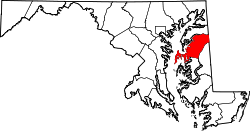
Queenstown was the original seat of Queen Anne's County, before the location changed to Centreville, Maryland. Its location was important during the 18th century, because it is near a creek that, during that time, could be navigated by tradesmen. A hub for shipping and receiving, Queenstown was attacked by English troops in the War of 1812 on August 13, 1813. [5]

Bloomingdale, Bowlingly, and St. Peter's Church are listed on the National Register of Historic Places. [6]

US 301 southbound in Queenstown 2022-06-29 09 14 00 View south along U.S. Route 301 (Blue Star Memorial Highway) just south of Maryland State Route 456 (Del Rhodes Avenue) in Queenstown, Queen Anne's County, Maryland.jpg
US 301 southbound in Queenstown

Transportation

The primary present-day method of transportation to and from Queenstown is by road. The town is located adjacent to the junction of U.S. Route 301 and U.S. Route 50, which link the town to metropolitan Philadelphia, Washington, D.C., and Ocean City. State highways also serving the town include Maryland Route 18, Maryland Route 456 and Maryland Route 656.

Demographics

Historical population
CensusPop.Note
1900 374
1910 279−25.4%
1920 270−3.2%
1930 2886.7%
1940 275−4.5%
1950 31614.9%
1960 39525.0%
1970 387−2.0%
1980 49126.9%
1990 453−7.7%
2000 61736.2%
2010 6647.6%
2020 7056.2%
U.S. Decennial Census [7]

2010 census

As of the census [8] of 2010, there were 664 people, 271 households, and 185 families living in the town. The population density was 457.9 inhabitants per square mile (176.8/km2). There were 294 housing units at an average density of 202.8 per square mile (78.3/km2). The racial makeup of the town was 92.9% White, 3.2% African American, 0.2% Native American, 0.9% Asian, 0.5% Pacific Islander, 0.9% from other races, and 1.5% from two or more races. Hispanic or Latino of any race were 3.8% of the population.

There were 271 households, of which 32.8% had children under the age of 18 living with them, 50.9% were married couples living together, 14.0% had a female householder with no husband present, 3.3% had a male householder with no wife present, and 31.7% were non-families. 26.6% of all households were made up of individuals, and 10.4% had someone living alone who was 65 years of age or older. The average household size was 2.45 and the average family size was 2.92.

The median age in the town was 40.2 years. 25% of residents were under the age of 18; 4.9% were between the ages of 18 and 24; 27.9% were from 25 to 44; 27% were from 45 to 64; and 15.2% were 65 years of age or older. The gender makeup of the town was 48.5% male and 51.5% female.

2000 census

As of the census [9] of 2000, there were 617 people, 255 households, and 184 families living in the town. The population density was 1,501.8 inhabitants per square mile (579.8/km2). There were 279 housing units at an average density of 679.1 per square mile (262.2/km2). The racial makeup of the town was 95.30% White, 3.73% African American, 0.16% Native American, 0.16% Asian, and 0.65% from two or more races. Hispanic or Latino of any race were 1.30% of the population.

Outlet shopping center in Queenstown, Maryland Queenstown Outlet Shopping Center.jpg
Outlet shopping center in Queenstown, Maryland

There were 255 households, out of which 27.1% had children under the age of 18 living with them, 57.6% were married couples living together, 11.0% had a female householder with no husband present, and 27.8% were non-families. 22.0% of all households were made up of individuals, and 6.3% had someone living alone who was 65 years of age or older. The average household size was 2.42 and the average family size was 2.83.

In the town, the population was spread out, with 20.6% under the age of 18, 8.6% from 18 to 24, 28.7% from 25 to 44, 28.4% from 45 to 64, and 13.8% who were 65 years of age or older. The median age was 41 years. For every 100 females, there were 102.3 males. For every 100 females age 18 and over, there were 99.2 males.

The median income for a household in the town was $48,500, and the median income for a family was $49,500. Males had a median income of $37,321 versus $30,893 for females. The per capita income for the town was $24,185. About 3.9% of families and 3.7% of the population were below the poverty line, including 2.8% of those under age 18 and 13.4% of those age 65 or over.

Points of interest

Queenstown Premium Outlets is an outlet mall located on Routes 50 and 301 that hosts over 65 stores.

Related Research Articles

<span class="mw-page-title-main">Ferndale, Maryland</span> Census-designated place in Maryland, United States

Ferndale is a census-designated place (CDP) in Anne Arundel County, Maryland, United States. At the 2010 census, the population was 16,746.

<span class="mw-page-title-main">North Beach, Maryland</span> Town in Maryland

North Beach is a town in Calvert County, Maryland, United States. The population was 1,978 at the 2010 U.S. Census.

<span class="mw-page-title-main">St. Leonard, Maryland</span> Census-designated place in Maryland

St. Leonard is a census-designated place (CDP) in Calvert County, Maryland, United States. The population was 742 at the 2010 census. Residents of the Calvert Beach and Long Beach communities also use the St. Leonard ZIP code designation. St. Leonard has a large antique dealer complex.

<span class="mw-page-title-main">Rising Sun, Maryland</span> Town in Maryland, United States

Rising Sun is a town in Cecil County, Maryland, United States. The population was 2,781 at the 2010 census.

<span class="mw-page-title-main">Myersville, Maryland</span> Town in the United States

Myersville is a town in Frederick County, Maryland, United States. The population was 1,626 at the 2010 United States Census.

<span class="mw-page-title-main">Rosemont, Maryland</span> Village in Maryland

Rosemont is a village in Frederick County, Maryland, United States. The population was 272 at the 2020 census. Maryland state routes 79 and 871 pass through Rosemont.

<span class="mw-page-title-main">Kitzmiller, Maryland</span> Town in Maryland, United States

Kitzmiller is a town in Garrett County, Maryland, United States. The population was 321 at the 2010 census.

<span class="mw-page-title-main">Mountain Lake Park, Maryland</span> Town in Maryland

Mountain Lake Park is a town in Garrett County, Maryland, United States. The population was 2,147 as of the 2020 census.

<span class="mw-page-title-main">Bel Air North, Maryland</span> Census-designated place in Maryland, United States

Bel Air North is a census-designated place (CDP) in Harford County, Maryland, United States. It is situated immediately north of the incorporated town of Bel Air. As of the 2010 census, the CDP population was 30,568, up from 25,798 in 2000.

<span class="mw-page-title-main">Cloverly, Maryland</span> Census-designated place in Maryland, United States

Cloverly is an unincorporated town and census-designated place in Montgomery County, Maryland, United States. Its population was 15,285 as of the 2020 census.

<span class="mw-page-title-main">Barclay, Maryland</span> Town in Maryland, United States

Barclay is a town in Queen Anne's County, Maryland, United States. The population was 120 at the 2010 census.

<span class="mw-page-title-main">Centreville, Maryland</span> Incorporated town in Queen Annes County, Maryland, United States

Centreville is an incorporated town in Queen Anne's County, Maryland, United States on the Delmarva Peninsula. Incorporated in 1794, it is the county seat of Queen Anne's County. The population was 4,285 at the 2010 census. The ZIP code is 21617 and the area codes are 410 and 443. The primary local telephone exchange is 758. It hosts the Queen Anne's County Fair each summer and was home to three franchises during the existence of the Eastern Shore Baseball League—the Colts, Red Sox, and Orioles.

<span class="mw-page-title-main">Church Hill, Maryland</span> Town in Maryland, United States

Church Hill is a town in Queen Anne's County, Maryland, United States. The population was 745 at the 2010 census.

<span class="mw-page-title-main">Leonardtown, Maryland</span> Town in Maryland, United States

Leonardtown is a town in and the county seat of St. Mary's County, Maryland, United States. The population was 4,563 at the 2020 census. Leonardtown is perhaps most famous for the national oyster-shucking championship that is held annually at the St. Mary's County fairgrounds.

<span class="mw-page-title-main">Trappe, Maryland</span> Town in Maryland, United States

Trappe is a town in Talbot County, Maryland, United States. The population was 1,077 at the 2010 census. It is the site of one of the largest mixed-use developments on the U.S. East Coast called Trappe East or "Lakeside" with controversy arising over its wastewater treatment.

<span class="mw-page-title-main">Southampton Township, Somerset County, Pennsylvania</span> Township in Pennsylvania, United States

Southampton Township is a township in Somerset County, Pennsylvania, United States. The population was 604 at the 2020 census. It is part of the Johnstown, Pennsylvania, Metropolitan Statistical Area.

<span class="mw-page-title-main">Cairo, West Virginia</span> Town in West Virginia, United States

Cairo is a town in Ritchie County, West Virginia, United States, along West Virginia Route 31, the North Fork of the Hughes River, and the North Bend Rail Trail. The population was 174 at the 2020 census.

<span class="mw-page-title-main">Hampstead, Maryland</span> Town in Maryland, United States

Hampstead is a town in Carroll County in the U.S. state of Maryland. The population was 6,323 at the 2010 census.

<span class="mw-page-title-main">Chevy Chase (town), Maryland</span> Town in Montgomery County, Maryland, US

Chevy Chase is an incorporated town in Montgomery County, Maryland, United States. The population was 2,904 at the 2020 census.

<span class="mw-page-title-main">Chevy Chase (CDP), Maryland</span> Census-designated place in Maryland, United States

Chevy Chase is a census-designated place (CDP) in Montgomery County, Maryland, United States. The population was 10,176 at the 2020 census.

References

  1. "Queenstown". Maryland Manual. Retrieved June 27, 2017.
  2. "2020 U.S. Gazetteer Files". United States Census Bureau. Retrieved April 26, 2022.
  3. "US Gazetteer files: 2010, 2000, and 1990". United States Census Bureau. February 12, 2011. Retrieved April 23, 2011.
  4. "US Gazetteer files 2010". United States Census Bureau. Archived from the original on January 12, 2012. Retrieved January 25, 2013.
  5. "Maryland's Eastern Shore". National Park Service, U.S. Department of the Interior. Retrieved November 17, 2021.
  6. "National Register Information System". National Register of Historic Places . National Park Service. July 9, 2010.
  7. "Census of Population and Housing". Census.gov. Retrieved June 4, 2015.
  8. "U.S. Census website". United States Census Bureau . Retrieved January 25, 2013.
  9. "U.S. Census website". United States Census Bureau . Retrieved January 31, 2008.