Grassflat, Pennsylvania | |
|---|---|
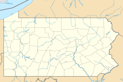  Grassflat Location in Pennsylvania  Grassflat Grassflat (the United States) | |
| Coordinates: 41°0′9″N78°6′52″W / 41.00250°N 78.11444°W | |
| Country | United States |
| State | Pennsylvania |
| County | Clearfield |
| Township | Cooper |
| Area | |
• Total | 1.13 sq mi (2.93 km2) |
| • Land | 1.13 sq mi (2.93 km2) |
| • Water | 0.00 sq mi (0.00 km2) |
| Elevation | 1,470 ft (450 m) |
| Population | |
• Total | 479 |
| • Density | 423.52/sq mi (163.50/km2) |
| Time zone | UTC-5 (Eastern (EST)) |
| • Summer (DST) | UTC-4 (EDT) |
| ZIP code | 16839 |
| FIPS code | 42-30528 |
| GNIS feature ID | 1175985 |
Grassflat is a census-designated place [3] located in Cooper Township, Clearfield County, in the state of Pennsylvania. As of the 2020 census, the population was 479. [4]
Pennsylvania Route 53 passes just west of the community, leading 3 miles (5 km) southwest to Interstate 80, Exit 133 at Kylertown and 12 miles (19 km) east to Snow Shoe.

