Grampian, Pennsylvania

Last updated
Grampian, Pennsylvania
Grampian Post Offce.jpg
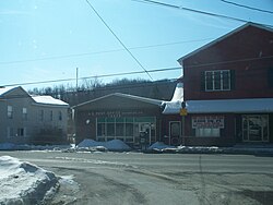
The post office in Grampian
Clearfield County Pennsylvania Incorporated and Unincorporated areas Grampian Highlighted.svg
Location of Grampian in Clearfield County, Pennsylvania.
Map of Pennsylvania highlighting Clearfield County.svg
Map showing Clearfield County in Pennsylvania
USA Pennsylvania location map.svg
Red pog.svg
Grampian
Pennsylvania
Coordinates: 40°57′55″N78°36′41″W / 40.96528°N 78.61139°W / 40.96528; -78.61139 Coordinates: 40°57′55″N78°36′41″W / 40.96528°N 78.61139°W / 40.96528; -78.61139
Country United States
State Pennsylvania
County Clearfield
Settled1805
Incorporated1885
Government
  TypeBorough Council
Area
[1]
  Total0.28 sq mi (0.73 km2)
  Land0.28 sq mi (0.73 km2)
  Water0.00 sq mi (0.00 km2)
Elevation
1,580 ft (480 m)
Population
 (2020) [2]
  Total361
  Density1,280.14/sq mi (494.82/km2)
Time zone UTC-5 (Eastern (EST))
  Summer (DST) UTC-4 (EDT)
ZIP code
16838
Area code 814
FIPS code 42-30280

Grampian is a borough in Clearfield County, Pennsylvania, United States. The population was 361 as of the 2020 census. [3]

Contents

The community was named after the Grampian Mountains, in Scotland, the ancestral home of an early settler. [4]

Geography

Grampian is located in western Clearfield County at 40°57′55″N78°36′41″W / 40.96528°N 78.61139°W / 40.96528; -78.61139 (40.965240, -78.611294). [5] U.S. Route 219 passes through the borough, leading northwest 15 miles (24 km) to DuBois and southwest 11 miles (18 km) to Mahaffey. Pennsylvania Route 879 leads east 5 miles (8 km) to Curwensville and 12 miles (19 km) to Clearfield, the county seat.

According to the United States Census Bureau, the borough has a total area of 0.28 square miles (0.73 km2), all land. [6]

Water supply

The town of Grampian is the remnants of a booming coal industry. The town had reached such sustainable population that a municipal water supply was incorporated. The water supply is piped from Curwensville and then dispersed into several water tanks for community use. The water authority board handles budgets, grants and hiring of licensed technicians. Grampian/Penn Township Water Authority employs one full-time licensed technician to run day-to-day operations.

Demographics

Historical population
CensusPop.
1890 219
1900 600174.0%
1910 66611.0%
1920 6771.7%
1930 533−21.3%
1940 63218.6%
1950 589−6.8%
1960 529−10.2%
1970 73739.3%
1980 424−42.5%
1990 415−2.1%
2000 4416.3%
2010 356−19.3%
2020 3611.4%
Sources: [7] [8] [9] [2]

As of the census [8] of 2000, there were 441 people, 166 households, and 119 families residing in the borough. The population density was 1,486.0 people per square mile (567.6/km2). There were 177 housing units at an average density of 596.4 per square mile (227.8/km2). The racial makeup of the borough was 99.77% White, 0.23% from other races. Hispanic or Latino of any race were 0.68% of the population.

There were 166 households, out of which 42.2% had children under the age of 18 living with them, 56.6% were married couples living together, 10.8% had a female householder with no husband present, and 28.3% were non-families. 24.7% of all households were made up of individuals, and 10.8% had someone living alone who was 65 years of age or older. The average household size was 2.66 and the average family size was 3.14.

In the borough the population was spread out, with 31.3% under the age of 18, 7.5% from 18 to 24, 29.5% from 25 to 44, 17.5% from 45 to 64, and 14.3% who were 65 years of age or older. The median age was 31 years. For every 100 females there were 94.3 males. For every 100 females age 18 and over, there were 88.2 males.

The median income for a household in the borough was $29,271, and the median income for a family was $34,219. Males had a median income of $26,528 versus $20,179 for females. The per capita income for the borough was $12,127. About 6.2% of families and 8.4% of the population were below the poverty line, including 14.8% of those under age 18 and none of those age 65 or over.

Notable person

See also

Related Research Articles

<span class="mw-page-title-main">Brady Township, Clearfield County, Pennsylvania</span> Township in Pennsylvania, United States

Brady Township is a township in Clearfield County, Pennsylvania, United States. The population was 1,942 at the 2020 census.

<span class="mw-page-title-main">Brisbin, Pennsylvania</span> Borough in Pennsylvania, United States

Brisbin is a borough in Clearfield County, Pennsylvania, United States. The population was 422 at the 2020 census.

<span class="mw-page-title-main">Burnside, Pennsylvania</span> Borough in Pennsylvania, United States

Burnside is a borough in Clearfield County, Pennsylvania, United States. The population was 188 at the 2020 census.

<span class="mw-page-title-main">Chester Hill, Pennsylvania</span> Borough in Pennsylvania, United States

Chester Hill is a borough in Clearfield County, Pennsylvania, United States. The population was 821 at the 2020 census.

<span class="mw-page-title-main">Coalport, Pennsylvania</span> Borough in Pennsylvania, United States

Coalport is a borough in Clearfield County, Pennsylvania, United States. The population was 425 at the 2020 census.

<span class="mw-page-title-main">Curwensville, Pennsylvania</span> Borough in Pennsylvania, United States

Curwensville is a borough in Clearfield County, Pennsylvania, United States, 45 miles (72 km) north of Altoona on the West Branch Susquehanna River. Coal mining, tanning, and the manufacture of fire bricks were the industries at the turn of the 20th century. In 1900, 1,937 people lived in the borough, and in 1910, 2,549 lived there. As of the 2020 U.S. census, the borough had a population of 2,567. The population of the borough at its highest was 3,422 in 1940.

<span class="mw-page-title-main">Ferguson Township, Clearfield County, Pennsylvania</span> Township in Pennsylvania, United States

Ferguson Township is a township in Clearfield County, Pennsylvania, United States. The population was 545 at the 2020 census.

<span class="mw-page-title-main">Glen Hope, Pennsylvania</span> Borough in Pennsylvania, United States

Glen Hope is a borough in Clearfield County, Pennsylvania, United States. The population was 127 at the 2020 census.

<span class="mw-page-title-main">Greenwood Township, Clearfield County, Pennsylvania</span> Township in Pennsylvania, United States

Greenwood Township is a township in Clearfield County, Pennsylvania, United States. The township has a population of 362 people, according to the 2020 United States census. Between Mahaffey and Grampian on U.S. Route 219, Greenwood Township contains the villages of Curry Run and Bells Landing. The West Branch of the Susquehanna River passes through it, along with several abandoned and presently used railroad grades.

<span class="mw-page-title-main">Irvona, Pennsylvania</span> Borough in Pennsylvania, United States

Irvona is a borough in Clearfield County, Pennsylvania, United States. The population was 549 at the 2020 census.

<span class="mw-page-title-main">Lawrence Township, Clearfield County, Pennsylvania</span> Township in Pennsylvania, United States

Lawrence Township is a township in Clearfield County, Pennsylvania, United States. The population was 7,503 at the 2020 census. Lawrence Township borders the townships of Boggs, Bradford, Goshen, Huston, Knox, Pike and Pine in Clearfield County, as well as Benezette and Jay Townships in Elk County to the north. Lawrence Township borders the borough of Clearfield as well.

<span class="mw-page-title-main">Lumber City, Pennsylvania</span> Former Borough in Pennsylvania, United States

Lumber City is a former borough in Clearfield County, Pennsylvania, United States. The population was 76 at the 2010 census.

<span class="mw-page-title-main">Mahaffey, Pennsylvania</span> Borough in Pennsylvania, United States

Mahaffey is a borough in Clearfield County, Pennsylvania, United States. The population was 329 at the 2020 census.

<span class="mw-page-title-main">Newburg, Clearfield County, Pennsylvania</span> Borough in Pennsylvania, United States

Newburg is a borough in Clearfield County, Pennsylvania, United States. The population was 82 at the 2020 census.

<span class="mw-page-title-main">Osceola Mills, Pennsylvania</span> Borough in Pennsylvania, United States

Osceola Mills is a borough in Clearfield County, Pennsylvania, United States. The population was 1,045 at the 2020 census.

<span class="mw-page-title-main">Penn Township, Clearfield County, Pennsylvania</span> Township in Pennsylvania, United States

Penn Township is a township in Clearfield County, Pennsylvania, United States. The population was 1,203 at the 2020 census.

<span class="mw-page-title-main">Pike Township, Clearfield County, Pennsylvania</span> Township in Pennsylvania, United States

Pike Township is a township in Clearfield County, Pennsylvania, United States. The population was 2,308 at the 2020 census.

<span class="mw-page-title-main">Ramey, Pennsylvania</span> Borough in Pennsylvania, United States

Ramey is a borough in Clearfield County, Pennsylvania, United States. The population was 436 at the 2020 census.

<span class="mw-page-title-main">Wallaceton, Pennsylvania</span> Borough in Pennsylvania, United States

Wallaceton is a borough in Clearfield County, Pennsylvania, United States. The population was 297 at the 2020 census.

<span class="mw-page-title-main">Falls Creek, Pennsylvania</span> Borough in Pennsylvania, United States

Falls Creek is a borough located in Jefferson and Clearfield counties in Pennsylvania, United States. The population was 1,036 at the 2020 census. Of this, 994 were in Jefferson County, and 42 were in Clearfield County.

References

  1. "ArcGIS REST Services Directory". United States Census Bureau. Retrieved October 12, 2022.
  2. 1 2 "Census Population API". United States Census Bureau. Retrieved Oct 12, 2022.
  3. Bureau, US Census. "City and Town Population Totals: 2020—2021". Census.gov. US Census Bureau. Retrieved August 7, 2022.
  4. Espenshade, A. Howry (1925). Pennsylvania place names. State College, PA: The Pennsylvania State College. p. 245.
  5. "US Gazetteer files: 2010, 2000, and 1990". United States Census Bureau. 2011-02-12. Retrieved 2011-04-23.
  6. "Geographic Identifiers: 2010 Census Summary File 1 (G001): Grampian borough, Pennsylvania". U.S. Census Bureau, American Factfinder. Archived from the original on May 1, 2015. Retrieved May 1, 2015.
  7. "Census of Population and Housing". U.S. Census Bureau. Retrieved 11 December 2013.
  8. 1 2 "U.S. Census website". United States Census Bureau . Retrieved 2008-01-31.
  9. "Incorporated Places and Minor Civil Divisions Datasets: Subcounty Resident Population Estimates: April 1, 2010 to July 1, 2012". Population Estimates. U.S. Census Bureau. Archived from the original on 11 June 2013. Retrieved 11 December 2013.