The Mackenzie River is a river in the Canadian boreal forest. It forms, along with the Slave, Peace, and Finlay, the longest river system in Canada, and includes the second largest drainage basin of any North American river after the Mississippi.
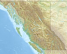
Fort Nelson is a community in northeast British Columbia, Canada, within the Northern Rockies Regional Municipality (NRRM). It held town status prior to 6 February 2009, when it amalgamated with the former Northern Rockies Regional District to form the NRRM, becoming its administrative centre. The NRRM is the first regional municipality in the province.

The Peace River Country is an aspen parkland region centring on the Peace River in Canada. It extends from northwestern Alberta to the Rocky Mountains in northeastern British Columbia, where a certain portion of the region is also referred to as the Peace River Block.
Helmet Airport is located 200 km (120 mi) north-east of Fort Nelson, in the Greater Sierra, British Columbia, Canada.

Petroleum production in Canada is a major industry which is important to the economy of North America. Canada has the third largest oil reserves in the world and is the world's fourth largest oil producer and fourth largest oil exporter. In 2019 it produced an average of 750,000 cubic metres per day (4.7 Mbbl/d) of crude oil and equivalent. Of that amount, 64% was upgraded from unconventional oil sands, and the remainder light crude oil, heavy crude oil and natural-gas condensate. Most of Canadian petroleum production is exported, approximately 600,000 cubic metres per day (3.8 Mbbl/d) in 2019, with 98% of the exports going to the United States. Canada is by far the largest single source of oil imports to the United States, providing 43% of US crude oil imports in 2015.
The Canadian petroleum industry arose in parallel with that of the United States. Because of Canada's unique geography, geology, resources and patterns of settlement, however, it developed in different ways. The evolution of the petroleum sector has been a key factor in the history of Canada, and helps illustrate how the country became quite distinct from her neighbour to the south.

Northern Alberta is a geographic region located in the Canadian province of Alberta.
The BC Oil and Gas Commission is a Crown Corporation of the province of British Columbia, Canada, established in 1998. Its mandate is to regulate oil and gas activities and pipelines in British Columbia. Their mandate does not extend to regulating consumer gas prices at the pump.
Canada's early petroleum discoveries took place near population centres or along lines of penetration into the frontier.
Natural gas has been used almost as long as crude oil in Canada, but its commercial development was not as rapid. This is because of special properties of this energy commodity: it is a gas, and it frequently contains impurities. The technical challenges involved to first process and then pipe it to market are therefore considerable. Furthermore, the costs of pipeline building make the whole enterprise capital intensive, requiring both money and engineering expertise, and large enough markets to make the business profitable.
The Montney Formation is a stratigraphical unit of Lower Triassic age in the Western Canadian Sedimentary Basin in British Columbia and Alberta.

The Cardium Formation is a stratigraphic unit of Late Cretaceous age in the Western Canada Sedimentary Basin. It takes the name from the fossilized heart-shaped cockle shells in the family Cardiidae present. It was first described along the Bow River banks by James Hector in 1895. It is present throughout western Alberta and in northeastern British Columbia, and it is a major source of petroleum and natural gas.
The Muskwa Formation is a stratigraphical unit of Frasnian age in the Western Canadian Sedimentary Basin.

The Redknife Formation is a stratigraphical unit of Devonian age in the Western Canadian Sedimentary Basin.
The Doig Formation is a geologic formation of middle Triassic age in the Western Canadian Sedimentary Basin. It takes the name from Doig River, a tributary of the Beatton River, and was first described in the Texaco N.F.A. Buick Creek No. 7 well by J.H. Armitage in 1962..

The Horn River Formation is a stratigraphic unit of Devonian age in the Western Canadian Sedimentary Basin.
The Woodbend Group is a stratigraphical unit of Frasnian age in the Western Canadian Sedimentary Basin.
The Duvernay Formation is a stratigraphical unit of Frasnian age in the Western Canadian Sedimentary Basin.

The inclusion of unconventional shale gas with conventional gas reserves has caused a sharp increase in estimated recoverable natural gas in Canada. Until the 1990s success of hydraulic fracturing in the Barnett Shales of north Texas, shale gas was classed as "unconventional reserves" and was considered too expensive to recover. There are a number of prospective shale gas deposits in various stages of exploration and exploitation across the country, from British Columbia to Nova Scotia.

Fracking in Canada was first used in Alberta in 1953 to extract hydrocarbons from the giant Pembina oil field, the biggest conventional oil field in Alberta, which would have produced very little oil without fracturing. Since then, over 170,000 oil and gas wells have been fractured in Western Canada. Fracking is a process that stimulates natural gas or oil in wellbores to flow more easily by subjecting hydrocarbon reservoirs to pressure through the injection of fluids or gas at depth causing the rock to fracture or to widen existing cracks.