Gregory, Queensland

Last updated

Map all coordinates using: OpenStreetMap  
Download coordinates as: KML
Gregory
Queensland
Gregory Downs - panoramio (2).jpg
Wills Developmental Road in Gregory, 2013
Australia Queensland location map.svg
Red pog.svg
Gregory
Coordinates 18°39′08″S139°15′17″E / 18.6522°S 139.2547°E / -18.6522; 139.2547 (Gregory (town centre)) Coordinates: 18°39′08″S139°15′17″E / 18.6522°S 139.2547°E / -18.6522; 139.2547 (Gregory (town centre))
Population72 (2016 census) [1]
 • Density0.00683/km2 (0.01770/sq mi)
Postcode(s) 4830
Area10,538.4 km2 (4,068.9 sq mi)
Time zone AEST (UTC+10:00)
Location
LGA(s) Shire of Burke
State electorate(s) Traeger
Federal division(s) Kennedy
Localities around Gregory:
Nicholson Burketown Carpentaria
Lawn Hill Gregory Stokes
Lawn Hill Gunpowder Gidya

Gregory (formerly Gregory Downs) is an outback town and locality in the Shire of Burke, Queensland, Australia. [2] [3] In the 2016 census, the locality of Gregory had a population of 72 people. [1]

Contents

Geography

The town is situated on the banks of the perennial Gregory River. The Gregory River was named by explorer William Landsborough on 19 November 1861, after explorer Augustus Charles Gregory, the first Surveyor General of Queensland. [4]

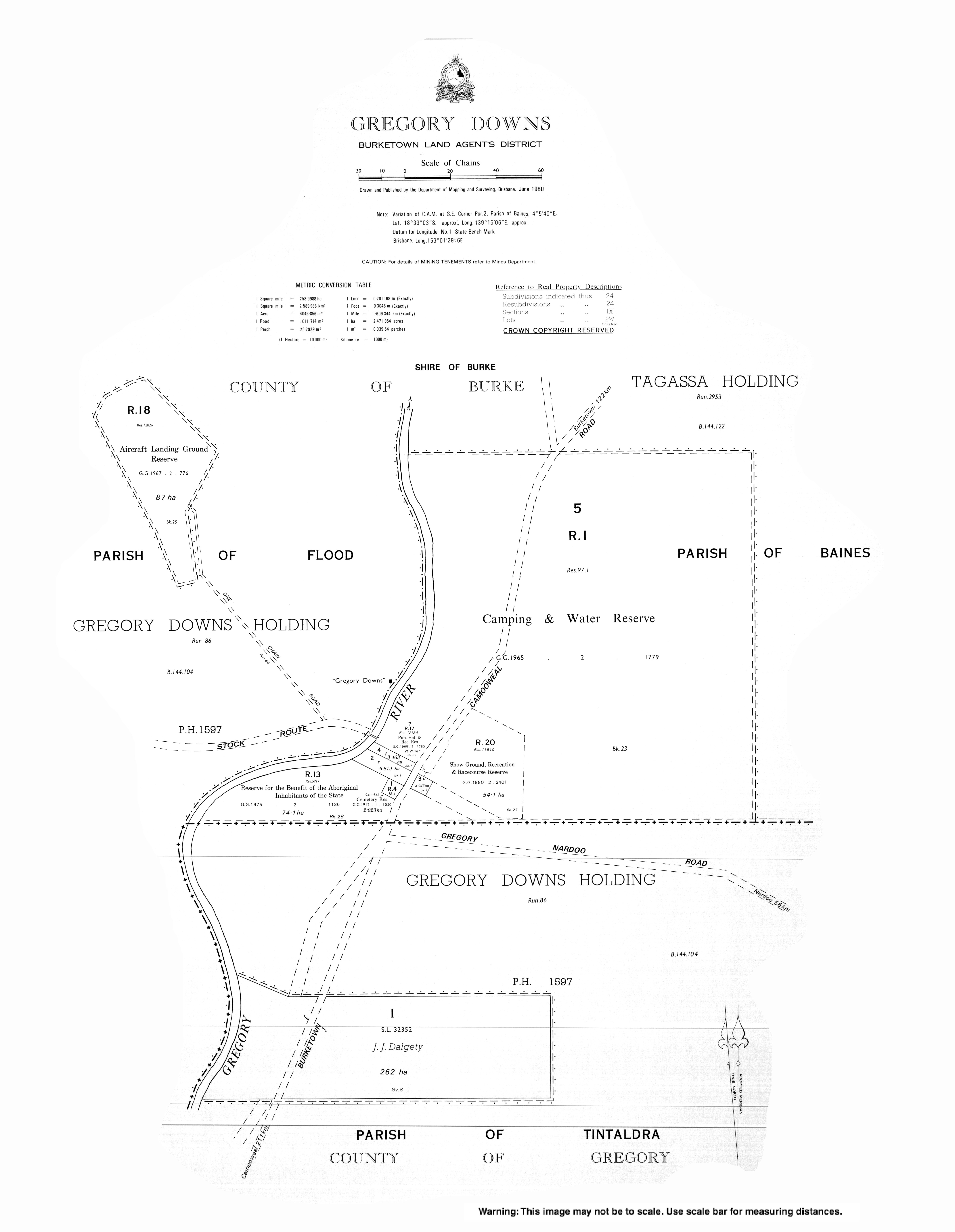
Gregory Downs is a pastoral station which breeds cattle on 266,425 hectares (658,350 acres) of native grazing land. It carries approximately 30,000 Brahman cattle, a breed suitable for the Gulf Country. It has an 85-kilometre (53 mi) frontage to the Gregory River. [5] It was one of the first pastoral stations established in the Gulf Country. [6]

History

Gregory Post Office opened on 2 May 1878 and closed in 1894. [7]

The Gregory Downs pastoral station was established in 1876 by the Watson brothers (Harry F. Watson, Sidney Grandison Watson and Robert McGregor Watson) who travelled overland with approximately 900 cattle. They liked the clear running water in the Gregory River and settled at a crossing point of the river with their cattle on the western bank and their homestead on the eastern bank. In the late 1800s they built the Gregory Downs Hotel and Store near the homestead ( 18°38′59″N139°15′12″E / 18.6497°N 139.2533°E / 18.6497; 139.2533 (Gregory Downs Hotel) ), but eventually decided that they found the travellers too much of a nuisance and so they relocated their homestead onto the western bank of the river ( 18°38′30″S139°15′06″E / 18.6417°S 139.2517°E / -18.6417; 139.2517 (Gregory Downs homestead) ). [8] There was a coach service from the hotel to Burketown. The hotel also served as a post for the mounted police. [6]

The town had a population of 40 people in 2008. [9]

In 2013, the town was renamed from Gregory Downs to Gregory. [10]

In the 2016 census, the locality of Gregory had a population of 72 people. [1]

Education

There are no schools in Gregory. The nearest government primary school is Burketown State School in neighbouring Burketown to the north; however, Gregory is so large that the school would only be accessible to those living in the northern parts of Gregory. There are no secondary schools in Gregory, nor nearby. Other options for schooling are distance education and boarding schools. [11]

Amenities

The Gregory branch of the Queensland Country Women's Association meets at various locations in the district. [12]

Attractions

Willis Lookout is a tourist attraction ( 18°59′00″S139°15′00″E / 18.9833°S 139.2500°E / -18.9833; 139.2500 (Willis Lookout) ). [13] [14]

Brodies Lookout is a tourist attraction ( 18°55′00″S139°34′00″E / 18.9167°S 139.5667°E / -18.9167; 139.5667 (Brodies Lookout) ). [13]

See also

Related Research Articles

Birdsville Town in Queensland, Australia

Birdsville is a rural town and locality in the Shire of Diamantina, Queensland, Australia. In the 2016 census the locality of Birdsville had a population of 140 people. It is a popular tourist destination with many people using it as a starting point across the Simpson Desert.

Thargomindah Town in Queensland, Australia

Thargomindah is a rural town and locality in the Shire of Bulloo, Queensland, Australia. The town of Thargomindah is the administrative centre for the Shire of Bulloo. In the 2016 census, Thargomindah had a population of 270 people. It was founded on Wongkumara and Kalali territory.

Normanton, Queensland Town in Queensland, Australia

Normanton is an outback town and coastal locality in the Shire of Carpentaria, Queensland, Australia. In the 2016 census the locality of Normanton had a population of 1,257 people, of whom 750 (60%) identified as Aboriginal and/or Torres Strait Islander people, while the town of Normanton had a population of 1,210 people, of whom 743 (62%) identified as Aboriginal and/or Torres Strait Islander people.

Richmond, Queensland Town in Queensland, Australia

Richmond is a rural town and locality in the Shire of Richmond, Queensland, Australia. In the 2016 census, the locality of Richmond had a population of 648 people.

Doomadgee is a town and a locality in the Aboriginal Shire of Doomadgee, Queensland, Australia. It is a mostly Indigenous community, situated about 140 kilometres (87 mi) from the Northern Territory border, and 93 kilometres (58 mi) west of Burketown.

Burketown Town in Queensland, Australia

Burketown is an isolated outback town and coastal locality in the Shire of Burke, Queensland, Australia. In the 2016 census, the locality of Burketown had a population of 238 people.

Shire of Burke Local government area in Queensland, Australia

The Shire of Burke is a local government area in North West Queensland, Australia. The shire lies on the south coast of the Gulf of Carpentaria and abuts the border with the Northern Territory. It covers an area of 39,864 square kilometres (15,391.6 sq mi), and has existed as a local government entity since 1885. The major town and administrative centre of the shire is Burketown.

Gulf Country Region in Queensland, Australia

The Gulf Country is the region of woodland and savanna grassland surrounding the Gulf of Carpentaria in north western Queensland and eastern Northern Territory on the north coast of Australia. The region is also called the Gulf Savannah. It contains large reserves of zinc, lead and silver. The Gulf Country is crossed by the Savannah Way highway.

For the former Cattle station in the Kimberley region of Western Australia, see Marion Downs Sanctuary

Pandie Pandie Station, most commonly known as Pandie Pandie, also often spelled as Pandi Pandi or Pandy Pandy, is a pastoral lease that operates as a cattle station in north east South Australia. It lies on the eastern edge of Karanguru territory.

Durham, Queensland Suburb of Bulloo Shire, Queensland, Australia

Durham is a rural locality in the Shire of Bulloo, Queensland, Australia. In the 2016 census Durham had a population of 36 people.

Lawn Hill, Queensland Suburb of Shire of Burke, Queensland, Australia

Lawn Hill is an outback locality split between the Shire of Burke and the City of Mount Isa in Queensland, Australia. The locality is on the Queensland border with the Northern Territory. In the 2016 census Lawn Hill had a population of 19 people.

Burketown Post Office Historic post office building in Burketown, Queensland, Australia

Burketown Post Office is a heritage-listed former post office at Musgrave Street, Burketown, Shire of Burke, Queensland, Australia. It was designed by George Connolly and built in 1887. It is also known as Burketown Tourist Information Centre. It was added to the Queensland Heritage Register on 1 January 1993.

Abingdon Downs is a rural locality in the Shire of Etheridge, Queensland, Australia. In the 2016 census, Abingdon Downs had a population of 0 people.

Augustus Downs Station is a pastoral lease that operates as a cattle station in the Gulf Country of outback Queensland.

Amaroo, Queensland Suburb of Shire of Boulia, Queensland, Australia

Amaroo is an outback locality split between the Shire of Boulia and the Shire of Diamantina, both in Central Western Queensland, Australia. In the 2016 census, Amaroo had a population of 22 people.

Lyndhurst is a locality in the Shire of Etheridge, Queensland, Australia. In the 2016 census, Lyndhurst had a population of 8 people.

Gangalidda is a coastal locality in the Aboriginal Shire of Doomadgee, Queensland, Australia, on the Gulf of Carpentaria. In the 2016 census, Gangalidda had a population of 0 people. Bayley Point is a small blunt point on the coast within the locality, directly opposite Bayley Island, rising to about 500 metres (1,600 ft).

Mantuan Downs is a rural locality in the Central Highlands Region, Queensland, Australia. In the 2016 census Mantuan Downs had a population of 31 people.

Taldora, Queensland Suburb of Shire of Mckinlay, Queensland, Australia

Taldora is an outback locality in the Shire of Mckinlay, Queensland, Australia. In the 2016 census Taldora had a population of 37 people.

References

  1. 1 2 3 Australian Bureau of Statistics (27 June 2017). "Gregory (SSC)". 2016 Census QuickStats. Retrieved 20 October 2018. OOjs UI icon edit-ltr-progressive.svg
  2. "Gregory – town in Shire of Burke (entry 48265)". Queensland Place Names. Queensland Government . Retrieved 13 August 2022.
  3. "Gregory – locality in Shire of Burke (entry 42541)". Queensland Place Names. Queensland Government . Retrieved 13 August 2022.
  4. "Gregory River – river in the Burke Shire (entry 14847)". Queensland Place Names. Queensland Government . Retrieved 13 September 2015.
  5. "Gregory Downs". Paraway Pastoral Co. Retrieved 29 November 2019.{{cite web}}: CS1 maint: url-status (link)
  6. 1 2 "Gregory Downs". Queensland Holidays. Tourism Queensland. Retrieved 30 August 2010.
  7. Premier Postal History. "Post Office List". Premier Postal Auctions. Retrieved 10 May 2014.
  8. "Gregory Hotel, Burke Shire". Burke Shire Council . Retrieved 29 November 2019.{{cite web}}: CS1 maint: url-status (link)
  9. Reg Burton. "Gregory Downs: powerless". North Queensland Register. Fairfax Media. Archived from the original on 6 July 2011. Retrieved 30 August 2010.
  10. "Gregory (entry 48265)". Queensland Place Names. Queensland Government . Retrieved 13 September 2015.
  11. "Queensland Globe". State of Queensland . Retrieved 25 August 2022.
  12. "Branch locations". Queensland Country Women's Association . Archived from the original on 26 December 2018. Retrieved 26 December 2018.
  13. 1 2 "Tourist points - Queensland". Queensland Open Data. Queensland Government. 18 November 2020. Archived from the original on 24 November 2020. Retrieved 24 November 2020.
  14. "Welcome to The Gulf Savannah" (PDF) (Map). Queensland Government. 2009. Retrieved 25 August 2022.