Gunpowder, Queensland

Last updated

Map all coordinates using: OpenStreetMap  
Download coordinates as: KML
Gunpowder
Queensland
Aerial view of Mount Oxide main mine area in March 2011.jpg
Aerial view of Mount Oxide main mine area, 2011
Australia Queensland location map.svg
Red pog.svg
Gunpowder
Coordinates 19°43′03″S139°22′43″E / 19.7176°S 139.3786°E / -19.7176; 139.3786 (Gunpowder (town centre)) Coordinates: 19°43′03″S139°22′43″E / 19.7176°S 139.3786°E / -19.7176; 139.3786 (Gunpowder (town centre))
Population43 (2016 census) [1]
 • Density0.00552/km2 (0.01429/sq mi)
Postcode(s) 4825
Area7,793.2 km2 (3,009.0 sq mi)
Time zone AEST (UTC+10:00)
Location
LGA(s) City of Mount Isa
State electorate(s) Traeger
Federal division(s) Kennedy
Localities around Gunpowder:
Lawn Hill Gregory Gidya
Camooweal Gunpowder Three Rivers
Barkly Mount Isa (locality) Mount Isa (locality)

Gunpowder is an outback town and locality in the City of Mount Isa, Queensland, Australia. [2] [3] In the 2016 census, Gunpowder had a population of 43 people. [1]

Contents

Geography

Waggabundi is a former Aboriginal township ( 19°28′54″S139°23′04″E / 19.4818°S 139.3845°E / -19.4818; 139.3845 (Waggabundi) ) in the vicinity of the Mount Oxide Mine. [4] [5]

Waggaboonyah Range ( 20°04′51″S139°18′59″E / 20.0808°S 139.3163°E / -20.0808; 139.3163 (Waggaboonyah Range) ) is a north-south range in the south of the locality. [6]

Gunpowder has the following mountains:

Gunpowder has the following mountain passes:

Waggaboonyah Dam is a dam ( 19°40′59″S139°22′52″E / 19.6830°S 139.3811°E / -19.6830; 139.3811 (Waggaboonyah Dam) ) across Greenstone Creek which creates Waggaboonyah Lake ( 19°42′00″S139°23′00″E / 19.7°S 139.3833°E / -19.7; 139.3833 (Waggaboonyah Lake) ). Downstream of the dam the creek enters Gunpowder Creek. [11] [12] The dam is approximately 2 kilometres (1.2 mi) north of the town of Gunpowder. [13]

There are mines in the locality but the predominant land use is grazing on native vegetation. [13]

History

Ernest Henry Ernest Henry (Explorer).tif
Ernest Henry

Mount Oxide was discovered by Ernest Henry in 1882. Owing to the remote location, little mining took place until the 1920s. [5]

Mount Oxide Mine is located 140 km north of Mount Isa and 40 km north-east of Mount Gordon Mine (formerly known as Gunpowder). [5]

The main mining periods were 1927 to 1943 and 1955 to 1960, when the higher grade ore was worked by underground methods with access via an adit; and 1967 to 1971, when the lower-grade envelope and remnants of high-grade ore were bulk mined in an open-cut. [5]

Underground mining produced 79,000 tonnes of ore (15.9% Cu) for a yield of 12,500 tonnes of copper, and some 355,000 tonnes of ore averaging 2.5% Cu were treated at the Gunpowder concentration plant in 1970–71. Leaching and precipitation operations in the 1962 to 1965 and 1978 to 1982 periods yielded an additional 1,369 tonnes of copper. [5]

Between World War I and World War II an Aboriginal townsite existed on the site named Waggabundi (after the Waggabonga Aboriginal tribe). The abandoned townsite is about 1 km south of the existing open pit. [5]

Mount Oxide Mine is now classed as an abandoned mine site as there is no current mining lease or environmental authority in place. [5]

Waggaboonyah Dam was built in 1969 for water storage.

Gunpowder State School opened on 27 January 1970. It closed on 24 September 1982 but reopened on 24 January 1991. It closed permanently on 31 December 1999. [14] [15]

Legal issues were raised in the mid 1990s over the extent and responsibility for rehabilitation liability for the mine site. The operators of the site who caused the mining disturbances no longer exist as corporate entities. [5] In the 2016 census, Gunpowder had a population of 43 people. [1]

In the 2016 census, the locality of Gunpowder had a population of 43 people. [1]

Economy

There are a number of homesteads in the locality: [16]

Mine remediation

The legacy of a century of mining activity has resulted in residual stockpiles, leach heaps and overburden dumps remaining on the site. Watercourses turn blue-green for several kilometres downstream of the mine pit (downstream of the confluence of the tributaries around the mine area) after moderate to heavy wet seasons. Downstream impacts have been observed to vary depending on the intensity of wet seasons and the time of visit, with impacts ranging from minimal to extensive downstream discolouration. [5]

A government interdepartmental working group has been formed to manage the impact of mine flooding in north-west Queensland. Immediate costs incurred to investigate and address issues have been borne by individual agencies. [5]

The short-term objectives of the Mount Oxide abandoned mine site are to: [5]

The long-term objective is to remediate the site to allow for an agreed future use of the land. [5]

Education

There are no schools in the locality. The nearest primary schools are Camooweal State School in neighbouring Camooweal to the west and Barkly Highway State School in Soldiers Hill in Mount Isa to the south-east. The nearest secondary school is Spinifex State College in Mount Isa. However, given the size of the locality of Gunpowder, for many parts of the locality the distances to the schools would be too far and distance education or boarding school would be necessary. Spinifex State College provides boarding facilities. [13]

Related Research Articles

Mount Isa City in Queensland, Australia

Mount Isa is a city in the Gulf Country region of Queensland, Australia. It came into existence because of the vast mineral deposits found in the area. Mount Isa Mines (MIM) is one of the most productive single mines in world history, based on combined production of lead, silver, copper and zinc.

Mount Morgan, Queensland City in Queensland, Australia

Mount Morgan is a rural town and locality in the Rockhampton Region, Queensland, Australia. In the 2016 census the locality of Mount Morgan had a population of 1,963 people.

Camooweal Town in Queensland, Australia

Camooweal is an outback town and locality in the City of Mount Isa, Queensland, Australia. The locality is on the Queensland border with the Northern Territory. In the 2016 census, the locality of Camooweal had a population of 208 people.

Dajarra, Queensland Town in Queensland, Australia

Dajarra is a town and a locality in the Shire of Cloncurry, Queensland, Australia. In the 2016 census, Dajarra had a population of 191 people; 60.3% of the population are Indigenous.

Mount Garnet, Queensland Town in Queensland, Australia

Mount Garnet is a rural town and locality in the Tablelands Region, Queensland, Australia. In the 2016 census, Mount Garnet had a population of 430 people.

Mary Kathleen, Queensland

Mary Kathleen was a mining settlement in north-western Queensland, Australia. It is located in the Selwyn Range between Mount Isa and Cloncurry.

Wyaralong, Queensland Suburb of Scenic Rim Region, Queensland, Australia

Wyaralong is a rural locality in the Scenic Rim Region, Queensland, Australia. In the 2016 census, Wyaralong had a population of 20 people.

Selwyn is a rural town and locality in the Shire of Cloncurry, Queensland, Australia. Selwyn is now an abandoned mining town. In the 2016 census the locality of Selwyn had a population of 50 people.

Lawn Hill, Queensland Suburb of Shire of Burke, Queensland, Australia

Lawn Hill is an outback locality split between the Shire of Burke and the City of Mount Isa in Queensland, Australia. The locality is on the Queensland border with the Northern Territory. In the 2016 census Lawn Hill had a population of 19 people.

Parkside is a suburb of Mount Isa in the City of Mount Isa, Queensland, Australia. In the 2016 census, Parkside had a population of 1,532 people.

Mornington is a suburb of the town of Mount Isa in the City of Mount Isa, Queensland, Australia. In the 2016 census Mornington had a population of 1,764 people.

Didcot, Queensland Suburb of North Burnett Region, Queensland, Australia

Didcot is a rural locality in the North Burnett Region, Queensland, Australia. In the 2016 census Didcot had a population of 60 people.

Ogmore, Queensland Town in Queensland, Australia

Ogmore is a rural town and coastal locality in the Livingstone Shire, Queensland, Australia. In the 2016 census, the locality of Ogmore had a population of 105 people.

Happy Valley, Queensland (Mount Isa) Suburb of Mount Isa, Queensland, Australia

Happy Valley is a suburb of Mount Isa in the City of Mount Isa, Queensland, Australia. In the 2016 census, Happy Valley had a population of 767 people.

Healy is a suburb of Mount Isa in the City of Mount Isa, Queensland, Australia. In the 2016 census, Healy had a population of 1,878 people.

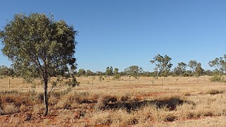
Barkly is an outback locality in the City of Mount Isa, Queensland, Australia. The locality is on the Queensland border with Northern Territory. In the 2016 census Barkly had a population of 28 people.

The Gap is a suburb of the town of Mount Isa in the City of Mount Isa, Queensland, Australia. In the 2016 census, The Gap had a population of 818 people.

Miles End is a suburb in the City of Mount Isa, Queensland, Australia. In the 2016 census, Miles End had a population of 265 people.

Soldiers Hill is a suburb in the City of Mount Isa, Queensland, Australia. In the 2016 census, Soldiers Hill had a population of 1962 people.

Mount Isa is a rural locality in the City of Mount Isa, Queensland, Australia. It is the land that surrounds the suburbs of Mount Isa. In the 2016 census, the locality of Mount Isa had a population of 118 people.

References

  1. 1 2 3 4 Australian Bureau of Statistics (27 June 2017). "Gunpowder (SSC)". 2016 Census QuickStats. Retrieved 20 October 2018. OOjs UI icon edit-ltr-progressive.svg
  2. "Gunpowder – town in City of Mount Isa (entry 15091)". Queensland Place Names. Queensland Government . Retrieved 19 September 2020.
  3. "Gunpowder – locality in City of Mount Isa (entry 42313)". Queensland Place Names. Queensland Government . Retrieved 19 September 2020.
  4. "Waggabundi – locality unbounded in City of Mount Isa (entry 36139)". Queensland Place Names. Queensland Government . Retrieved 19 December 2020.
  5. 1 2 3 4 5 6 7 8 9 10 11 12 "Mount Oxide Mine Remediation Project". Mine remediation projects. Queensland Government. Archived from the original on 21 December 2020. Retrieved 21 December 2020.
  6. "Mountain ranges beaches and sea passages - Queensland". Queensland Open Data. Queensland Government. 12 November 2020. Archived from the original on 25 November 2020. Retrieved 25 November 2020.
  7. 1 2 3 4 5 6 "Mountain peaks and capes - Queensland". Queensland Open Data. Queensland Government. 12 November 2020. Archived from the original on 25 November 2020. Retrieved 25 November 2020.
  8. "Kangaroo Pt – mountain in Mount Isa City (entry 17697)". Queensland Place Names. Queensland Government . Retrieved 25 November 2020.
  9. "Mount Gordon – mountain in Mount Isa City (entry 14388)". Queensland Place Names. Queensland Government . Retrieved 25 November 2020.
  10. "Mount Oxide – mountain in Mount Isa City (entry 25694)". Queensland Place Names. Queensland Government . Retrieved 25 November 2020.
  11. "Waggaboonyah Dam – dam wall in City of Mount Isa (entry 50132)". Queensland Place Names. Queensland Government . Retrieved 19 December 2020.
  12. "Waggaboonyah Lake – lake in the City of Mount Isa (entry 36137)". Queensland Place Names. Queensland Government . Retrieved 21 December 2020.
  13. 1 2 3 "Queensland Globe". State of Queensland . Retrieved 21 December 2020.
  14. Queensland Family History Society (2010), Queensland schools past and present (Version 1.01 ed.), Queensland Family History Society, ISBN   978-1-921171-26-0
  15. "Queensland state school - centre closures" (PDF). Queensland Government . 20 August 2013. Archived (PDF) from the original on 20 March 2022. Retrieved 7 April 2022.
  16. "Homesteads - Queensland". Queensland Open Data. Queensland Government. 18 November 2020. Archived from the original on 24 November 2020. Retrieved 24 November 2020.

Attribution

This Wikipedia article contains material from Mount Oxide Mine Remediation Project, published on 31 May 2018 by The State of Queensland under CC-BY-4.0 licence, accessed on 21 December 2020, archived on 21 December 2020.