Sunset, Queensland

Last updated

Map all coordinates using: OpenStreetMap
Sunset
Queensland
Sunset State School, 2012.jpg
Sunset State School, 2012
Australia Queensland location map.svg
Red pog.svg
Sunset
Coordinates 20°42′41″S139°30′43″E / 20.7113°S 139.5119°E / -20.7113; 139.5119 (Sunset (centre of suburb))
Population2,188 (2016 census) [1]
 • Density1,094/km2 (2,830/sq mi)
Postcode(s) 4825
Area2.0 km2 (0.8 sq mi)
Time zone AEST (UTC+10:00)
Location
LGA(s) City of Mount Isa
State electorate(s) Traeger
Federal division(s) Kennedy
Suburbs around Sunset:
Ryan Mount Isa (locality) Mount Isa (locality)
Ryan Sunset Mount Isa (locality)
Winston Pioneer Fisher

Sunset is a suburb of Mount Isa in the City of Mount Isa, Queensland, Australia. [2] In the 2016 census, Sunset had a population of 2,188 people. [1]

Contents

Geography

The Leichhard River flows north–south through the town of Mount Isa, dividing the suburbs of the town into "mineside" (west of the Leichhardt River) and "townside" (east of the Leichhardt River). [3] [4] Sunset is a "townside" suburb. [5]

Sunset is bounded on the east by Sunset Drive and to the south by an unnamed creek (a tributary of the Leichhardt River). The western part of the suburb is mostly flat (approximately 360 metres above sea level) and is used for residential purposes. To the east of the suburban development, the land rises to two local prominences (420 metres above sea level). [5]

History

The suburb of Sunset is named because it is on the western side of a slope with views of the sunset. [2]

Sunset State School opened on 30 January 1968. [6]

In the 2016 census, Sunset had a population of 2,188 people. [1]

Education

Sunset State School is a government primary (Prep-6) school for boys and girls at Abel Smith Parade ( 20°42′32″S139°30′37″E / 20.7089°S 139.5103°E / -20.7089; 139.5103 (Sunset State School) ). [7] [8] In 2016, the school had an enrolment of 253 students (of whom 195 identify as Indigenous) with 24 teachers (23 full-time equivalent) and 19 non-teaching staff (14 full-time equivalent). [9] In 2018, the school had an enrolment of 252 students with 25 teachers (24 full-time equivalent) and 12 non-teaching staff (9 full-time equivalent). [10] It includes a special education program. [7]

Mount Isa Flexible Learning Centre is a Catholic secondary (7-12) school for boys and girls at 74 Abel Smith Parade ( 20°42′45″S139°30′39″E / 20.7126°S 139.5107°E / -20.7126; 139.5107 (Mount Isa Flexible Learning Centre) ). [7] [11] The school provides individual support for students unsuited to mainstream schooling to improve their education and assist them in gaining employment. [12] In 2018, the school had an enrolment of 42 students with 5 teachers (4 full-time equivalent) and 12 non-teaching staff (7 full-time equivalent). [10]

There is no mainstream secondary school in Sunset. The nearest government secondary school is Spinifex State College which has its junior campus in Parkside to the south-west and its senior campus in neighbouring Pioneer to the south. [5]

Amenities

There are a number of parks in the area:

Related Research Articles

<span class="mw-page-title-main">Mount Isa</span> City in Queensland, Australia

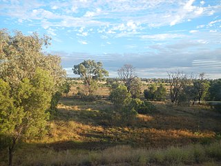
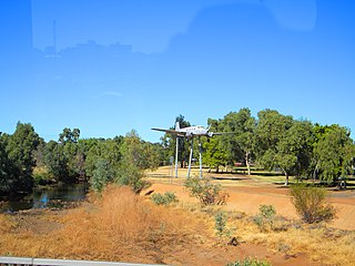
Mount Isa is a city in the Gulf Country region of Queensland, Australia. It came into existence because of the vast mineral deposits found in the area. Mount Isa Mines (MIM) is one of the most productive single mines in world history, based on combined production of lead, silver, copper and zinc.

Parkside is a suburb of Mount Isa in the City of Mount Isa, Queensland, Australia. In the 2016 census, Parkside had a population of 1,532 people.

<span class="mw-page-title-main">Mornington, Queensland</span> Suburb of Mount Isa, Queensland, Australia

Mornington is a suburb of the town of Mount Isa in the City of Mount Isa, Queensland, Australia. In the 2016 census Mornington had a population of 1,764 people.

Pioneer is a suburb of Mount Isa in the City of Mount Isa, Queensland, Australia. In the 2016 census, Pioneer had a population of 2,176 people.

<span class="mw-page-title-main">Townview, Queensland</span> Suburb of Mount Isa, Queensland, Australia

Townview is a suburb of Mount Isa in the City of Mount Isa, Queensland, Australia. In the 2016 census, Townview had a population of 2,062 people.

Happy Valley is a suburb of Mount Isa in the City of Mount Isa, Queensland, Australia. In the 2021 census, Happy Valley had a population of 733 people.

Healy is a suburb of Mount Isa in the City of Mount Isa, Queensland, Australia. In the 2016 census, Healy had a population of 1,878 people.

<span class="mw-page-title-main">Kalkadoon, Queensland</span> Suburb of Mount Isa, Queensland, Australia

Kalkadoon is a suburb of Mount Isa in the City of Mount Isa, Queensland, Australia. In the 2016 census, Kalkadoon had a population of 29 people.

<span class="mw-page-title-main">Mount Isa City, Queensland</span> Suburb of Mount Isa, Queensland, Australia

Mount Isa City is the central suburb and central business district of Mount Isa in the City of Mount Isa, Queensland, Australia. In the 2016 census, Mount Isa City had a population of 95 people.

The Gap is a suburb of the town of Mount Isa in the City of Mount Isa, Queensland, Australia. In the 2016 census, The Gap had a population of 818 people.

Menzies is a suburb in the City of Mount Isa, Queensland, Australia. In the 2021 census, Menzies had a population of 824 people.

<span class="mw-page-title-main">Miles End, Queensland</span> Suburb of City of Mount Isa, Queensland, Australia

Miles End is a suburb in the City of Mount Isa, Queensland, Australia. In the 2021 census, Miles End had a population of 280 people.

Soldiers Hill is a suburb in the City of Mount Isa, Queensland, Australia. In the 2016 census, Soldiers Hill had a population of 1962 people.

Winston is a suburb in the City of Mount Isa, Queensland, Australia. In the 2016 census, Winston had a population of 1,134 people.

Ryan is a suburb in the City of Mount Isa, Queensland, Australia. In the 2016 census, Ryan had a population of 141 people.

Lanskey is a suburb in the City of Mount Isa, Queensland, Australia. In the 2021 census, Lanskey had a population of 101 people.

Fisher is a suburb in the City of Mount Isa, Queensland, Australia. In the 2021 census, Fisher had a population of 65 people.

Spreadborough is a suburb in the City of Mount Isa, Queensland, Australia. In the 2016 census, Spreadborough had a population of 20 people.

Mica Creek is a suburb in the City of Mount Isa, Queensland, Australia. In the 2021 census, Mica Creek had a population of 182 people.

Breakaway is a suburb in the City of Mount Isa, Queensland, Australia. In the 2021 census, Breakaway had a population of 187 people.

References

  1. 1 2 3 Australian Bureau of Statistics (27 June 2017). "Sunset (SSC)". 2016 Census QuickStats. Retrieved 20 October 2018. OOjs UI icon edit-ltr-progressive.svg
  2. 1 2 "Sunset – suburb in City of Mount Isa (entry 49821)". Queensland Place Names. Queensland Government . Retrieved 13 February 2022.
  3. "Mount Isa". Australian Broadcasting Corporation . 2 January 2017. Archived from the original on 19 December 2020. Retrieved 19 December 2020.
  4. "This Mining Life: Mount Isa, QLD". Mining People International. Archived from the original on 19 December 2020. Retrieved 19 December 2020.
  5. 1 2 3 "Queensland Globe". State of Queensland . Retrieved 3 March 2022.
  6. Queensland Family History Society (2010), Queensland schools past and present (Version 1.01 ed.), Queensland Family History Society, ISBN   978-1-921171-26-0
  7. 1 2 3 "State and non-state school details". Queensland Government. 9 July 2018. Archived from the original on 21 November 2018. Retrieved 21 November 2018.
  8. "Sunset State School". Sunset State School. 10 March 2020. Archived from the original on 27 March 2020. Retrieved 3 March 2022.
  9. "2016 Annual Report" (PDF). Sunset State School. Archived (PDF) from the original on 9 November 2017. Retrieved 9 November 2017.
  10. 1 2 "ACARA School Profile 2018". Australian Curriculum, Assessment and Reporting Authority. Archived from the original on 27 August 2020. Retrieved 28 January 2020.
  11. "Mount Isa Flexible Learning Centre". Archived from the original on 23 November 2018. Retrieved 21 November 2018.
  12. "What is a Flexible Learning Centre?". EREA Flexible Schools Networks. Archived from the original on 6 March 2021. Retrieved 3 March 2022.
  13. 1 2 3 4 "Land for public recreation - Queensland". Queensland Open Data. Queensland Government. 20 November 2020. Archived from the original on 22 November 2020. Retrieved 22 November 2020.