Parkside is a suburb of the town of Mount Isa in the City of Mount Isa, Queensland, Australia. In the 2021 census, Parkside had a population of 1,530 people.

Mornington is a suburb of the town of Mount Isa in the City of Mount Isa, Queensland, Australia. In the 2021 census, Mornington had a population of 1,846 people.

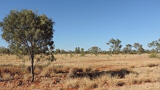
Waverley is an outback locality in the Shire of Boulia, Queensland, Australia. In the 2021 census, Waverley had a population of 6 people.
Pioneer is a suburb of the town of Mount Isa in the City of Mount Isa, Queensland, Australia. In the 2021 census, Pioneer had a population of 2,346 people.

Townview is a suburb of the town of Mount Isa in the City of Mount Isa, Queensland, Australia. In the 2021 census, Townview had a population of 2,067 people.
Happy Valley is a suburb of the town of Mount Isa in the City of Mount Isa, Queensland, Australia. In the 2021 census, Happy Valley had a population of 733 people.
Healy is a suburb of Mount Isa in the City of Mount Isa, Queensland, Australia. In the 2021 census, Healy had a population of 1,824 people.

Sunset is a suburb of the town of Mount Isa in the City of Mount Isa, Queensland, Australia. In the 2021 census, Sunset had a population of 2,137 people.

Kalkadoon is a suburb of the town of Mount Isa in the City of Mount Isa, Queensland, Australia. In the 2021 census, Kalkadoon had a population of 27 people.

Mount Isa City is the central suburb and central business district of the town of Mount Isa in the City of Mount Isa, Queensland, Australia. In the 2021 census, Mount Isa City had a population of 170 people.

The Gap is a suburb of the town of Mount Isa in the City of Mount Isa, Queensland, Australia. In the 2021 census, The Gap had a population of 817 people.
Menzies is a suburb of the town of Mount Isa in the City of Mount Isa, Queensland, Australia. In the 2021 census, Menzies had a population of 824 people.

Miles End is a suburb of the town of Mount Isa in the City of Mount Isa, Queensland, Australia. In the 2021 census, Miles End had a population of 280 people.

Soldiers Hill is a suburb of the town of Mount Isa in the City of Mount Isa, Queensland, Australia. In the 2021 census, Soldiers Hill had a population of 1,796 people.
Winston is a suburb of the town of Mount Isa in the City of Mount Isa, Queensland, Australia. In the 2021 census, Winston had a population of 1,084 people.
Lanskey is a suburb of the town of Mount Isa in the City of Mount Isa, Queensland, Australia. In the 2021 census, Lanskey had a population of 101 people.
Fisher is a suburb of the town of Mount Isa in the City of Mount Isa, Queensland, Australia. In the 2021 census, Fisher had a population of 65 people.
Spreadborough is a suburb of the town of Mount Isa in the City of Mount Isa, Queensland, Australia. In the 2021 census, Spreadborough had a population of 55 people.
Mica Creek is a suburb of the town of Mount Isa in the City of Mount Isa, Queensland, Australia. In the 2021 census, Mica Creek had a population of 182 people.
Breakaway is a suburb of the town of Mount Isa in the City of Mount Isa, Queensland, Australia. In the 2021 census, Breakaway had a population of 187 people.


