Bedourie is a town and a locality in the Shire of Diamantina, Queensland, Australia. It is on the border with the Northern Territory. In the 2016 census, Bedourie had a population of 122 people.

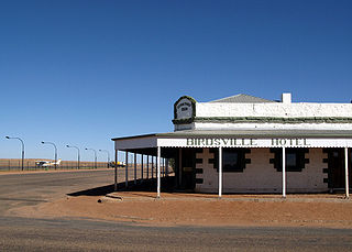
Birdsville is a rural town and locality in the Shire of Diamantina, Queensland, Australia. The locality is on the Queensland border with both the Northern Territory and South Australia. The town is situated 10 kilometres (6 mi) north of the South Australian border. In the 2021 census, the locality of Birdsville had a population of 110 people.

Normanton is an outback town and coastal locality in the Shire of Carpentaria, Queensland, Australia. At the 2021 census, the locality of Normanton had a population of 1,391 people, and the town of Normanton had a population of 1,326 people.

Croydon is an outback town and locality within the Shire of Croydon in Queensland, Australia. It is a terminus for the Normanton to Croydon railway line, which operates the Gulflander tourist train. At the 2016 census, Croydon had a population of 258 people.
Doomadgee is a town and a locality in the Aboriginal Shire of Doomadgee, Queensland, Australia. It is a mostly Indigenous community, situated about 140 kilometres (87 mi) from the Northern Territory border, and 93 kilometres (58 mi) west of Burketown.

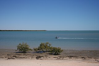
Karumba is a town and a coastal locality in the Shire of Carpentaria, Queensland, Australia. In the 2016 census, the locality of Karumba had a population of 531 people.

Burketown is an isolated outback town and coastal locality in the Shire of Burke, Queensland, Australia. In the 2016 census, the locality of Burketown had a population of 238 people.

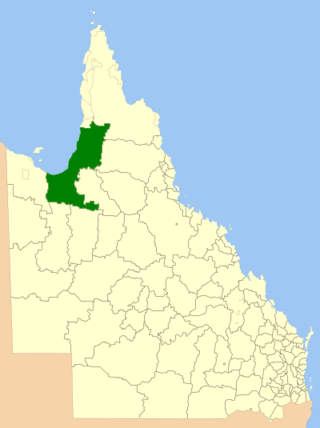
The Shire of Carpentaria is a local government area in Far North Queensland, Australia on the Gulf of Carpentaria, for which it is named.

The Shire of Burke is a local government area in North West Queensland, Australia. The shire lies on the south coast of the Gulf of Carpentaria and abuts the border with the Northern Territory. It covers an area of 39,864 square kilometres (15,391.6 sq mi), and has existed as a local government entity since 1885. The major town and administrative centre of the shire is Burketown.

Dululu is a rural town and locality in the Shire of Banana, Queensland, Australia. In the 2016 census, the locality of Dululu had a population of 126 people.

Comet is a historically-rich rural town and locality in the Central Highlands Region, Queensland, Australia. In the 2016 census, the locality of Comet had a population of 498 people.

Duchess is a rural town and locality in the Shire of Cloncurry, Queensland, Australia. In the 2016 census, Duchess had a population of 23 people.
Gilberton is a rural locality in the Shire of Etheridge, Queensland, Australia. In the 2016 census, Gilberton had a population of 4 people.

Four Ways is an outback locality in the Shire of Cloncurry, Queensland, Australia. In the 2016 census, Four Ways had a population of 15 people.

Blackbull is a rural locality in the Shire of Croydon, Queensland, Australia. In the 2016 census Blackbull had a population of 3 people.

Stokes is an outback locality in the Shire of Carpentaria, Queensland, Australia. In the 2021 census, Stokes had a population of 75 people.

Howitt is a coastal locality in the Shire of Carpentaria, Queensland, Australia. In the 2021 census, Howitt had a population of 48 people.
Fielding is a locality in the Shire of Carpentaria, Queensland, Australia. In the 2016 census, Fielding had a population of 6 people.
Yagoonya is a coastal locality in the Shire of Carpentaria, Queensland, Australia. In the 2016 census, Yagoonya had a population of 25 people.
Gangalidda is a coastal locality in the Aboriginal Shire of Doomadgee, Queensland, Australia, on the Gulf of Carpentaria. In the 2021 census, Gangalidda had "no people or a very low population".


