Grizzlie Place | |
---|---|
Unincorporated community | |
Coordinates: 41°54′04″N120°38′26″W / 41.90111°N 120.64056°W Coordinates: 41°54′04″N120°38′26″W / 41.90111°N 120.64056°W | |
Country | United States |
State | California |
County | Modoc County |
Elevation [1] | 5,223 ft (1,592 m) |
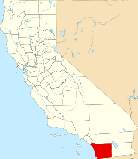
Grizzlie Place is an unincorporated community in Modoc County, California. [1] It lies at an elevation of 5223 feet (1592 m). [1]
In law, an unincorporated area is a region of land that is not governed by a local municipal corporation; similarly an unincorporated community is a settlement that is not governed by its own local municipal corporation, but rather is administered as part of larger administrative divisions, such as a township, parish, borough, county, city, canton, state, province or country. Occasionally, municipalities dissolve or disincorporate, which may happen if they become fiscally insolvent, and services become the responsibility of a higher administration. Widespread unincorporated communities and areas are a distinguishing feature of the United States and Canada. In most other countries of the world, there are either no unincorporated areas at all, or these are very rare; typically remote, outlying, sparsely populated or uninhabited areas.
Modoc County is a county in the far northeast corner of the U.S. state of California. As of the 2010 census, the population was 9,686. making it the third-least populous county in California. The county seat and only incorporated city is Alturas. Previous county seats include Lake City and Centerville; the latter is now a ghost town. The county borders Nevada and Oregon.
California is a state in the Pacific Region of the United States. With 39.6 million residents, California is the most populous U.S. state and the third-largest by area. The state capital is Sacramento. The Greater Los Angeles Area and the San Francisco Bay Area are the nation's second and fifth most populous urban regions, with 18.7 million and 9.7 million residents respectively. Los Angeles is California's most populous city, and the country's second most populous, after New York City. California also has the nation's most populous county, Los Angeles County, and its largest county by area, San Bernardino County. The City and County of San Francisco is both the country's second-most densely populated major city after New York City and the fifth-most densely populated county, behind only four of the five New York City boroughs.
Los Angeles, officially the City of Los Angeles and often known by its initials L.A., is the most populous city in California, the second most populous city in the United States, after New York City, and the third most populous city in North America. With an estimated population of four million, Los Angeles is the cultural, financial, and commercial center of Southern California. The city is known for its Mediterranean climate, ethnic diversity, Hollywood and the entertainment industry, and its sprawling metropolis. Los Angeles is the largest city on the West Coast of North America.
A ZIP Code is a postal code used by the United States Postal Service (USPS) in a system it introduced in 1963. The term ZIP is an acronym for Zone Improvement Plan; it was chosen to suggest that the mail travels more efficiently and quickly when senders use the code in the postal address. The basic format consists of five digits. An extended ZIP+4 code was introduced in 1983 which includes the five digits of the ZIP Code, followed by a hyphen and four additional digits that reference a more specific location.
The California Gold Rush (1848–1855) began on January 24, 1848, when gold was found by James W. Marshall at Sutter's Mill in Coloma, California. The news of gold brought approximately 300,000 people to California from the rest of the United States and abroad. The sudden influx of gold into the money supply reinvigorated the American economy, and the sudden population increase allowed California to go rapidly to statehood, in the Compromise of 1850. The Gold Rush had severe effects on Native Californians and resulted in a precipitous population decline from disease, genocide and starvation. By the time it ended, California had gone from a thinly populated ex-Mexican territory, to having one of its first two U.S. Senators, John C. Frémont, selected to be the first presidential nominee for the new Republican Party, in 1856.
Placer County, officially the County of Placer, is a county in the U.S. state of California. As of the 2010 census, the population was 348,432. The county seat is Auburn.
Riverside is a city in Riverside County, California, United States, located in the Inland Empire metropolitan area. Riverside is the county seat of the eponymous county and named for its location beside the Santa Ana River. It is the most populous city in the Inland Empire and in Riverside County, and is located about 55 miles (89 km) east of downtown Los Angeles. It is also part of the Greater Los Angeles area. Riverside is the 59th most populous city in the United States and 12th most populous city in California. As of the 2010 Census, Riverside had a population of 303,871.
California is a North American place name used by the U.S. state of California and the Mexican states of Baja California and Baja California Sur. Collectively, these three areas constitute the region formerly referred to as The Californias. The name California is shared by many other places in other parts of the world, whose names derive from the same original.
The California State Capitol is home to the government of the U.S. state of California. The building houses the bicameral state legislature and the office of the governor. The grounds of the capitol form the Capitol Park.
California Historical Landmarks (CHLs) are buildings, structures, sites, or places in the U.S. state of California that have been determined to have statewide historical landmark significance.
Buildings, sites, districts, and objects in California listed on the National Register of Historic Places:
This is a list of the National Register of Historic Places listings in San Francisco, California.
This is a list of the National Register of Historic Places listings in San Diego County, California.
The following is a list of lists of the cities, towns and villages of the United States separated by state, territory or district name.
The 2012 United States presidential election in California took place on November 6, 2012, as part of the 2012 general election in which all 50 states plus The District of Columbia participated. California voters chose 55 electors, the most out of any state, to represent them in the Electoral College via a popular vote pitting incumbent Democratic President Barack Obama and his running mate, Vice President Joe Biden, against Republican challenger and former Massachusetts Governor Mitt Romney and his running mate, Congressman Paul Ryan.
The 2018 California State Senate elections were held on Tuesday, November 6, 2018, with the primary election being held on June 5, 2018. Voters in the 20 even-numbered districts of the California State Senate elected their representatives. The elections coincided with the elections of other offices, including for governor and the California State Assembly.
This Modoc County, California-related article is a stub. You can help Wikipedia by expanding it. |