Moraga is a town in Contra Costa County, California, in the San Francisco Bay Area. The town is named in honor of Joaquín Moraga, member of the famed Californio family, son of Gabriel Moraga, and grandson of José Joaquín Moraga, famous 18th century expeditionaries of the Californias. Moraga incorporated in 1974, when the communities of Moraga Town, Rheem, and Rheem Valley, united into one town.

San Jacinto is a city in Riverside County, California. It was named after Saint Hyacinth and is located at the north end of the San Jacinto Valley, with Hemet to its south and Beaumont, California, to its north. The mountains associated with the valley are the San Jacinto Mountains. The population was 44,199 at the 2010 census. The city was founded in 1870 and incorporated on April 20, 1888, making it one of the oldest cities in Riverside County.

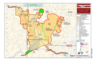
The Black Rock Desert is a semi-arid region (in the Great Basin shrub steppe eco-region), of lava beds and playa, or alkali flats, situated in the Black Rock Desert–High Rock Canyon Emigrant Trails National Conservation Area, a silt playa 100 miles (160 km) north of Reno, Nevada that encompasses more than 300,000 acres (120,000 ha) of land and contains more than 120 miles (200 km) of historic trails. It is in the northern Nevada section of the Great Basin with a lakebed that is a dry remnant of Pleistocene Lake Lahontan.

Rough and Ready is a village located in Upper Mahantongo Township, Schuylkill County, Pennsylvania, along Route 125 near the confluence of Little Mahantango Creek and Mahantango Creek, which flows west into the Susquehanna River. It uses the Klingerstown, Pennsylvania ZIP Code of 17941. The village was named for the gold-rush town of Rough and Ready, California, which in turn was named by a mining company also named in honor of Zachary Taylor's nickname, "Old Rough and Ready."

Pozo is an Unincorporated community in along the former Butterfield Overland Mail stagecoach route, in San Luis Obispo County, California. The closest communities appearing on road maps are California Valley and Santa Margarita. A USGS-provided set of coordinates for the town are on the Santa Margarita Lake 7.5-minute quadrangle.

The name of the city of Pittsburgh, Pennsylvania, has a complicated history. Pittsburgh is one of the few U.S. cities or towns to be spelled with an h at the end of a burg suffix.

Arrowbear Lake is an unincorporated community in San Bernardino County, California, United States. Its altitude is 6,086 feet (1,855 m), in the San Bernardino Mountains.

Lost Lake is a desert community located along the west shore of the Colorado River. It also lies along U.S. Route 95 near the northeast extent of Riverside County. Official U.S. Geological Survey feature ID is 245216 and NAD27 coordinates for the community are 34°00′44″N114°28′27″W. The community lies at the foot of Riverside Mountain, 34°00′49″N114°30′45″W, with a summit measuring 2,127 feet. The community is named for a lake, Lost Lake, located at 34°01′20″N114°28′21″W.

Silverwood Lake is a large reservoir in San Bernardino County, California, United States, located on the West Fork Mojave River, a tributary of the Mojave River in the San Bernardino Mountains. It was created in 1971 as part of the State Water Project by the construction of the Cedar Springs Dam as a forebay on the 444-mile (715 km) long California Aqueduct, and has a capacity of 73,000 acre feet (90,000,000 m3).

Petersburg is a former settlement in Kern County, California. It was located on Greenhorn Creek 4.5 miles (7.2 km) west-northwest of Miracle Hot Springs, at an elevation of 4731 feet. Petersburg still appeared on maps as of 1956.

Fluhr is a former settlement in Kern County, California. It was located on the Atchison, Topeka and Santa Fe Railroad 2 miles (3.2 km) north-northwest of Edwards, at an elevation of 2372 feet. Fluhr still appeared on maps as of 1942.

Gulf is an unincorporated community in Kern County, California. It is located on the Sunset Railroad 2 miles (3.2 km) east of Millux, at an elevation of 292 feet (89 m).

Kayandee is an unincorporated community in Kern County, California. It is located on the Southern Pacific Railroad 2 miles (3.2 km) south of downtown Bakersfield, at an elevation of 397 feet (121 m).

Neufeld is an unincorporated community in Kern County, California. It is located on the Atchison, Topeka and Santa Fe Railroad 2 miles (3.2 km) north of Wasco, at an elevation of 325 feet (99 m).

Rancho Seco is an unincorporated community in Kern County, California. It is located 2 miles (3.2 km) south-southwest of Cantil, at an elevation of 2,028 feet (618 m).

Twin Oaks is an unincorporated community in Kern County, California. It is located 1.5 miles (2.4 km) east-northeast of Loraine, at an elevation of 2,825 feet (861 m).

Wallace Center is an unincorporated community in Kern County, California. It is located 2 miles (3.2 km) north-northwest of Taft, at an elevation of 860 feet.

Borden is an unincorporated community in Madera County, California. It is located on the Southern Pacific Railroad 3 miles (4.8 km) southeast of Madera, at an elevation of 272 feet.
Midlakes is a former settlement in Lake County, California. It was located 1 mile (1.6 km) northwest of Laurel Dell.

Callahan is an unincorporated community in Siskiyou County, California, United States. Callahan is located on California State Route 3 11.5 miles (18.5 km) south-southeast of Etna. Callahan has a post office with ZIP code 96014.


