Guigneville

Last updated • 1 min readFrom Wikipedia, The Free Encyclopedia

Guigneville
CP Guigneville, Loiret, France. La Place.jpg
An old postcard view of Guigneville
Location of Guigneville
Guigneville
France location map-Regions and departements-2016.svg
Red pog.svg
Guigneville
Centre-Val de Loire region location map.svg
Red pog.svg
Guigneville
Coordinates: 48°12′25″N2°10′41″E / 48.2069°N 2.1781°E / 48.2069; 2.1781 Coordinates: 48°12′25″N2°10′41″E / 48.2069°N 2.1781°E / 48.2069; 2.1781
Country France
Region Centre-Val de Loire
Department Loiret
Arrondissement Pithiviers
Canton Pithiviers
Intercommunality Pithiverais
Government
  Mayor (20202026) Jérémie Amiard [1]
Area
1
32.01 km2 (12.36 sq mi)
Population
 (Jan. 2019) [2]
524
  Density16/km2 (42/sq mi)
Demonym Guignevillois
Time zone UTC+01:00 (CET)
  Summer (DST) UTC+02:00 (CEST)
INSEE/Postal code
45162 /45300
Elevation117–141 m (384–463 ft)
1 French Land Register data, which excludes lakes, ponds, glaciers > 1 km2 (0.386 sq mi or 247 acres) and river estuaries.

Guigneville (French pronunciation:  [ɡiɲvil] ) is a commune in the Loiret department in north-central France.

Contents

Geography

The commune is in the north of the department, in the Beauce, large cereal area with a gentle slope. It is located 7 km northwest of Pithiviers, and 40 km northeast of Orléans. The departmental roads 22, 23 et 134 cross the territory of the commune.

Heritage

Saint-Hilaire church was built in several stages between the 12th and 16th century. It is a listed historic monument since 6 March 1928. [3] It is holding a copy of a 17th century painting by Jean Jouvenet representing the Visitation of the Virgin created for the choir of the cathedral Notre-Dame de Paris. This copy was originally created for the Abbey of Saint-Benoît-sur-Loire, and was classified as a historic object on 5 December 1908. [4]

See also

Related Research Articles

<span class="mw-page-title-main">Saint-Manvieu-Norrey</span> Commune in Normandy, France

Saint-Manvieu-Norrey is a commune in the Calvados department in the Normandy region in northwestern France.

<span class="mw-page-title-main">Saint-Hilaire-des-Landes</span> Commune in Brittany, France

Saint-Hilaire-des-Landes is a commune in the Ille-et-Vilaine department in Brittany in northwestern France.

<span class="mw-page-title-main">Le Tiercent</span> Commune in Brittany, France

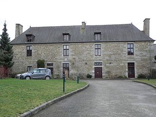
Le Tiercent is a commune in the Ille-et-Vilaine department in Brittany in northwestern France.

<span class="mw-page-title-main">Saint-Ouen-des-Alleux</span> Commune in Brittany, France

Saint-Ouen-des-Alleux is a commune in the Ille-et-Vilaine department in Brittany in northwestern France.

<span class="mw-page-title-main">La Chapelle-Glain</span> Commune in Pays de la Loire, France

La Chapelle-Glain is a commune in the Loire-Atlantique département in western France.

<span class="mw-page-title-main">Curemonte</span> Commune in Nouvelle-Aquitaine, France

Curemonte is a commune in the Corrèze department in central France. It is a medieval village characterised by its three castles. In a fortified position on a ridge overlooking a valley on both its eastern and western flanks, the village has historically had a strategic importance in the area. Its inhabitants are called Curemontois.

<span class="mw-page-title-main">Chaintreaux</span> Commune in Île-de-France, France

Chaintreaux is a commune in the Seine-et-Marne department in the Île-de-France region in north-central France about one hour south of Paris. It is part of the Canton of Château-Landon and borders the Department of Loiret in the southern part. Agriculture is the main activity in this rural commune with about twenty mixed purpose farms. The cereals produced are wheat, barley and rapeseed.

<span class="mw-page-title-main">Arrosès</span> Commune in Nouvelle-Aquitaine, France

Arrosès is a commune in the Pyrénées-Atlantiques department in the Nouvelle-Aquitaine region of south-western France.

<span class="mw-page-title-main">Saint-Léonard, Pas-de-Calais</span> Commune in Hauts-de-France, France

Saint-Léonard is a commune in the Pas-de-Calais department in the Hauts-de-France region of France.

<span class="mw-page-title-main">Altillac</span> Commune in Nouvelle-Aquitaine, France

Altillac is a commune in the Corrèze department in the Nouvelle-Aquitaine region of central France.

<span class="mw-page-title-main">Plogonnec</span> Commune in Brittany, France

Plogonnec is a commune and small town in the Finistère department of Brittany in north-western France. It is about 13 km (8 mi) north west of Quimper and 10 km (6 mi) east of Douarnenez. The town is twinned with Llandysul in Wales.

<span class="mw-page-title-main">Arrelles</span> Commune in Grand Est, France

Arrelles is a commune in the Aube department in the Grand Est region of northern-central France.

<span class="mw-page-title-main">Lozay</span> Commune in Nouvelle-Aquitaine, France

Lozay is a commune in the Charente-Maritime department in southwestern France.

<span class="mw-page-title-main">Bengy-sur-Craon</span> Commune in Centre-Val de Loire, France

Bengy-sur-Craon is a commune in the Cher department in the Centre-Val de Loire region of France.

Clairavaux is a commune in the Creuse department in the Nouvelle-Aquitaine region in central France.

<span class="mw-page-title-main">Les Terres-de-Chaux</span> Commune in Bourgogne-Franche-Comté, France

Les Terres-de-Chaux is a commune in the Doubs department in the Bourgogne-Franche-Comté region in eastern France.

<span class="mw-page-title-main">Saint-Berthevin</span> Commune in Pays de la Loire, France

Saint-Berthevin is a commune in the Mayenne department in north-western France.

<span class="mw-page-title-main">Vignory</span> Commune in Grand Est, France

Vignory is a commune in the Haute-Marne département in north-eastern France.

<span class="mw-page-title-main">Sargé-sur-Braye</span> Commune in Centre-Val de Loire, France

Sargé-sur-Braye is a commune in the French department of Loir-et-Cher, administrative region of Centre-Val de Loire, France.

<span class="mw-page-title-main">Saint-Céré</span> Commune in Occitania, France

Saint-Céré is a commune in the Lot department, southern France. Its population is 3,414 (2019). The commune includes within its borders the castle of Saint-Laurent-les-Tours, where the artist Jean Lurçat lived and worked for many years, and from which he operated a secret radio for the French Resistance. The castle still houses a collection of his works.

References

  1. "Répertoire national des élus: les maires" (in French). data.gouv.fr, Plateforme ouverte des données publiques françaises. 4 May 2022.
  2. "Populations légales 2019". The National Institute of Statistics and Economic Studies. 29 December 2021.
  3. Base Mérimée : Eglise Saint-Hilaire , Ministère français de la Culture. (in French)
  4. Base Palissy : Tableau: la Visitation , Ministère français de la Culture. (in French)