Related Research Articles
The Federal Information Processing Standards (FIPS) of the United States are a set of publicly announced standards that the National Institute of Standards and Technology (NIST) has developed for use in computer systems of non-military, American government agencies and contractors. FIPS standards establish requirements for ensuring computer security and interoperability, and are intended for cases in which suitable industry standards do not already exist. Many FIPS specifications are modified versions of standards the technical communities use, such as the American National Standards Institute (ANSI), the Institute of Electrical and Electronics Engineers (IEEE), and the International Organization for Standardization (ISO).

Denton is a town in Caroline County, Maryland, United States. The population of Denton was 4,418 as of the 2010 United States Census, and it is the county seat of Caroline County.

The Kiskiminetas River is a tributary of the Allegheny River, approximately 27 miles (43 km) long, in Western Pennsylvania in the United States. The region stretching from the northern side of Harmar Township, Pennsylvania to the Kiskiminetas towns is often referred to by the locals as the Alle-Kiski Valley after the rivers.

Red Mountain is a set of three peaks in the San Juan Mountains of western Colorado in the United States, about five miles (8.0 km) south of Ouray. The mountains get their name from the reddish iron ore rocks that cover the surface. Several other peaks in the San Juan Mountains likewise have prominent reddish coloration from iron ore and are also called "Red Mountain".

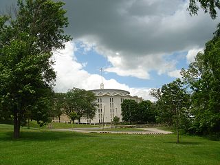
Sinsinawa is an unincorporated community in Grant County, Wisconsin, United States. The community is in the towns of Jamestown and Hazel Green, one mile north of the border with Illinois. The community is 7+1⁄2 miles (12.1 km) east of Dubuque, Iowa, and 6+1⁄2 miles (10.5 km) west of the village of Hazel Green, Wisconsin. The town is best known for being the mother house of the Sinsinawa Dominican Sisters.

Somis is an unincorporated community in Ventura County, California. It was established in 1892 by Thomas Bard and D.T. Perkins on a portion of the Rancho Las Posas Mexican land grant. Somis is in the Las Posas Valley on the south bank of Fox Barranca, just west of Arroyo Las Posas. For statistical purposes, the United States Census Bureau has defined Somis as a census-designated place (CDP).

Halls Stream or Rivière Hall is a 25.2-mile-long (40.6 km) tributary of the Connecticut River in eastern North America. For most of its length, it forms the Canada–United States border, with the province of Quebec (Canada) to its west and the state of New Hampshire to its east.

Redbank Creek is a tributary of the Allegheny River in Clarion, Armstrong, and Jefferson counties, Pennsylvania in the United States.
Pentress is a census-designated place (CDP) in northern Monongalia County, West Virginia, United States. It lies along West Virginia Route 7 northwest of the city of Morgantown, the county seat of Monongalia County. Its elevation is 951 feet (290 m). "Pentress" is not the only name the community has had; at various times in its history, it has been known as Minors Mills, New Brownsville, Pentrees, Pentress Junction, Statler Town, Statlers Town, Statlersville, and Stradlerstown. The present name of Pentress was selected by an early settler who reportedly wanted a Welsh name. It has a post office with the ZIP Code of 26544. As of the 2010 census, its population was 175.
Fowlerville is a small hamlet in the town of Concord, in southern Erie County, New York, United States.
Millgrove is a hamlet in the town of Alden in Erie County, New York, United States.

The Pine River is a 103-mile-long (166 km) river in the Lower Peninsula of the U.S. state of Michigan. The Pine River is a tributary of the Chippewa River and is thus part of the Saginaw River drainage basin.

Henderson Lake is a lake in the Adirondack mountains in the town of Newcomb, Essex County, New York in the United States. It was named in 1826 after David Henderson, one of the founders of the Elba Iron Works near Lake Placid, New York, and of the Upper Works at Tahawus, New York. The lake is mainly cited by cartographers as the place where the Hudson River as named officially begins, flowing out of the eastern end and outlet of the lake. Unofficially, the source of the river is traced up Indian Pass Brook and other watercourses to Lake Tear of the Clouds.
Bluerock Mountain is a mountain in Western North Carolina, near the community of Bat Cave. It is split between Henderson and Rutherford counties, it is home of the Bat Cave Preserve and part of Chimney Rock State Park. Its elevation reaches 2,835 feet (864 m).
Fowlerville is a hamlet and census-designated place (CDP) in the town of York in Livingston County, New York, United States. The population of the CDP was 227 at the 2010 census.
Heaton is a populated place situated in Pinal County, Arizona, United States. Originally called Maricopa Station, it served as a stop on the railroad line, where passengers transferred to stagecoach. The post office at this location was simply named Maricopa. During a land boom in the late 1880s, it was thought that this stop would become a railway stop on the line directly connecting to Phoenix. As expansion into a town was being considered if the planned rail connection became reality, the expanded community was to be named Maricopaville. In 1887, when the rail line connection went to Maricopa Junction instead, the town's expansion was abandoned, and the name of the town was changed to its current Heaton. It has an estimated elevation of 1,197 feet (365 m) above sea level.
References
- ↑ Town of Haggai
- ↑ "Haggai (historical)". Geographic Names Information System. United States Geological Survey. Retrieved January 20, 2014.
