Related Research Articles
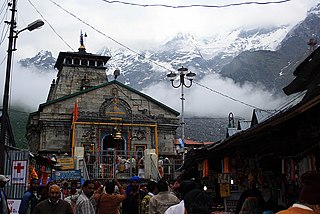

Pauri is a town and a municipal board in Pauri Garhwal district in the Indian state of Uttarakhand. Pauri is the seat of the Divisional Commissioner of the Garhwal Division.
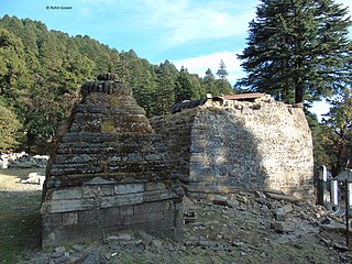
Pauri Garhwal is a district in the Indian state of Uttarakhand. Its headquarters is in the town of Pauri. It is sometimes referred to simply as Garhwal district, though it should not be confused with the larger Garhwal region of which it is only a part of.

Tehri Garhwal is a district in the hill state of Uttarakhand, India. Its administrative headquarters is at New Tehri. The district has a population of 618, 931, a 2.35% increase over the previous decade. It is surrounded by Rudraprayag District in the east, Dehradun District in the west, Uttarkashi District in the north, and Pauri Garhwal District in the south. Tehri Garhwal is a part of the Himalayas.

Rudraprayag is a district of the state of Uttarakhand of northern India. The district occupies an area of 1984 km2. The town of Rudraprayag is the administrative headquarters of the district. The district is bounded by Uttarkashi District on the north, Chamoli District on the east, Pauri Garhwal District on the south, and Tehri Garhwal District on the west.
Chandpur is a town and a municipal board in Bijnor district in the Indian state of Uttar Pradesh, India.
Dugadda, sometimes spelled Dogadda, is a town and a municipal board in Pauri Garhwal district in the state of Uttarakhand, India. Dugadda is a small town which is surrounded by mountains and situated on the banks of Khoh.

Gauchar is a Hill Town sort of a valley town located in Karnaprayag tehsil within Chamoli district of Uttarakhand state in India. Gauchar is situated on the left bank of river Alaknanda and is en route to the celebrated holy destination of Badrinath. It is well known for being one of the cleanest place in country. It has previously topped Swachta sarvekshan best ganga town award. Situated at an altitude of 800 metres (2,620 ft) above the sea level, Gauchar is surrounded by seven mountains. Gauchar is well known for its historic trade fair and airstrip. Gauchar town known for its great work to curb loss of lives in 2013 flood disaster of Uttarakhand. This town is unique in terms of its geographical location and topography. Gauchar is located on one of the largest pieces of flatland in this mountainous region of Uttarakhand. Education institution in Gauchar includes a beautiful Kendriya Vidyalaya adjacent to the main playground.
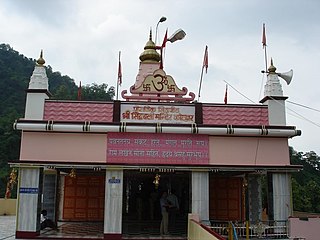
Kotdwar is a city, municipal corporation in Pauri Garhwal district of Uttarakhand, India. It's just 101 km from Pauri town, the district headquarter. It is the eighth-largest city in Uttarakhand. Its old name was "Kootdwar", which means the gateway of the high hill koot as Chitra koot ' since it is located on the bank of river Khoh. It is situated in the southwestern part of the state and is one of the main entrance points in the state of Uttarakhand.so called gate to hills kootdwar later on it became kotdwar

Srinagar is a city and municipal corporation in Pauri Garhwal district in the Indian state of Uttarakhand. It is located about 33 km from Pauri town, the administrative headquarters of Pauri Garhwal district, Uttarakhand, India.

Matkunda is a village in the Thalisain tehsil of Bironkhal block in Pauri Garhwal district, Uttarakhand, India.

Thalisain is a town and tehsil of Pauri Garhwal district in the North Indian state of Uttarakhand. At an elevation of 1690 metres from sea level, it is situated on a gentle slope above the right bank of Nayaar (East) river. It is in the southwestern foothills of Dudhatoli Range and at a distance of 83 kilometers from Pauri town and 95 kilometers from Gairsain, the future capital of Uttarakhand.
Kimsar is a village, in Yamkeshwar Block of Pauri Garhwal district, Uttarakhand, India.

Veer Chandra Singh Garhwali Uttarakhand University of Horticulture & Forestry, formerly Uttarakhand University of Horticulture and Forestry, is a state agricultural university located in North Indian state of Uttarakhand. The University has two campuses, one is in Bharsar town of Pauri Garhwal district and other is in Ranichauri town of Tehri Garhwal district.
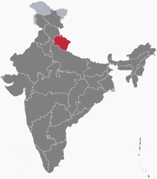
The following outline is provided as an overview of and topical guide to Uttarakhand:
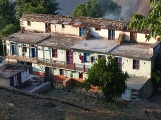
Lee is a small village located in Pauri Tehsil of Pauri Garhwal district, Uttarakhand India.
Ekeshwar is a block in Pauri Garhwal district of Uttarakhand. It is 59 km (37 mi) from district headquarter Pauri, at an altitude of 1,820 metres (5,970 ft) in a rural region and surrounded by forest. Ekeshwar falls is in Chaubattakhal. There are 283 villages in Ekeshwar.
Gadkhark is a village in the Thalisain tehsil of Bironkhal block in Pauri Garhwal district, Uttarakhand, India.
Bironkhal Tehsil is a administrative division located in the Pauri Garhwal district of the Indian state of Uttarakhand.It is one of the 14 tehsils in the district and is headquartered in the town of Syunsi. It was created in 2016 with 367 villages taken from Dhumakot, Chaubattakhal and Thalisain tehsils. The main languages spoken in the area are Hindi and Garhwali.
Rikhanikhal is a sub-Tehsil in the district Pauri Garhwal in the state of Uttarakhand. The sub-tehsil was created in the year 2016 and has 190 villages.
References
- 1 2 3 "Haldukhata Malla Village Population - Kotdwara - Pauri Garhwal, Uttarakhand". www.census2011.co.in. Retrieved 14 July 2023.
- ↑ PinCodeArea. "Postal Code: HALDUKHATA MALLA, Post Jhandichaur BO (Pauri Garhwal, Uttarakhand)". PinCodeArea. Retrieved 14 July 2023.