KotriSain is a small village in the Pauri Garhwal district of the Indian state of Uttarakhand. The population of KotriSain is around 500. It covers a wide geographical area, which is hilly and a valley surrounded by Corbett Tiger Reserve.
The main source of income is agriculture. The village has a primary and secondary school. Few children attend the school because of migration of citizens to nearby towns and cities like Kotdwar and sometimes further to Delhi, which is 300 kilometres (190mi) away. Children go to Rikhnikhal/Barkhet for senior schooling.
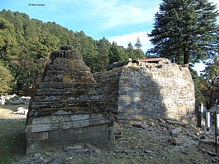
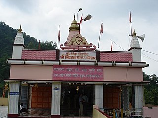
There are few temples nearby: Dhontiyal, which is about 2 kilometres (1.2mi) from the town, and PaniSain Nausainna Devi, located about 4 kilometres (2.5mi) from the town. About 25 kilometres (16mi) away, there is a famous temple called Tarkeshwar Mahadev. Kotdwar is about 80 kilometres (50mi) from KotriSain.
Taliparamba is a Municipality in Taliparamba taluk of Kannur district, Kerala, India. The municipal town spreads over an area of 18.96 square kilometres (7.32 sq mi) and is inhabited by 44,247 number of people.
Pauri Garhwal is a district in the Indian state of Uttarakhand. Its headquarters is in the town of Pauri. It is sometimes referred to simply as Garhwal district, though it should not be confused with the larger Garhwal region of which it is only a part of.
Parippally is a village in Kalluvathukal Panchayath of Kollam district, Kerala, India. Paripally village is situated 22 kilometres (14 mi) South of Kollam City along NH66 and 44 kilometres (27 mi) North of Trivandrum along NH66. Kollam Govt. Medical College is situated in Parippally. The nearest town Chathannor is located 3 kilometres (1.9 mi) away, Kottiyam is another major town located near Parippally.
Dapoli is a town in Ratnagiri district, Maharashtra which is also a coastal hill station. It lies 215 km (134 mi) south of the state capital of Mumbai. the town is also known as Camp Dapoli, as the British had set their camps here. Many high-ranking British officers' graves are found in this town. There is also an abandoned church from the time of the British Raj. Dapoli is administered by a Municipal Council.
Kotdwar is a city, municipal corporation in Pauri Garhwal district of Uttarakhand, India. It is just 101 km from Pauri town, the district headquarter. It is the eighth-largest city in Uttarakhand. Its old name was "Kootdwar", which means the gateway of the high hill koot as Chitra koot , since it is located on the bank of river Khoh. It is situated in the southwestern part of the state and is one of the main entrance points in the state of Uttarakhand.
Mundaragi is a municipal town in Gadag district in the Indian state of Karnataka. Mundargi is close to two district headquarters, being 36 kilometres (22 mi) from Gadag and 50 kilometres (31 mi) from Koppal. It is 99 kilometers from Gajendragad. Mundargi is also the taluka headquarter of the same name. Pin code of Mundaragi is 582118.
Srisailam is a census town in Nandyal district of the Indian state of Andhra Pradesh. It is the mandal headquarters of Srisailam mandal in Atmakur revenue division. It is located about 160 kilometres (99 mi) from the district headquarters Nandyal, 180 kilometres (112 mi) from Kurnool, and it is located about 264 kilometres (164 mi) from Vijayawada. The town is famous for Mallikarjuna Jyotirlinga Temple and is one of the holy pilgrimage sites for Saivism and Shaktism sects of Hinduism. The town is classified as both Jyotirlinga and Shakti Peetha.
Warisaliganj is a Community Development block and a Municipal Council in Nawada district in the Indian state of Bihar.
Sreekandapuram is a municipality in Kannur district, in the Indian state of Kerala.
Inkollu is a small town located in the Bapatla district of the Indian state of Andhra Pradesh. It serves as the seat of Inkollu Mandal, an administrative district and is part of the chirala revenue division of Bapatla district. The nearest cities are Chirala, Bapatla, Guntur,Ongole, Addanki and Chilakaliripeta.
Sasthamkotta or Sasthamcotta is a village in the Kunnathoor Tehsil of Kollam district in the state of Kerala, India. Kunnathoor taluk headquarters is located at Sasthamkotta. The Sasthamkotta freshwater lake is the largest freshwater lake in Kerala.
Satpuli is a town on the Meerut-Pauri highway, located approximately 50 kilometers from Kotdwar and 50 kilometers from Pauri, in Pauri Garhwal district of Uttarakhand.
Poladpur-Naneghol is a small village in Raigad District, Maharashtra, India.
Bijaya Dhanurjaya Pur Sasan is a Census town near Bellaguntha of Ganjam district in Odisha, India. It is located 108 km towards North from District Headquarters Chhatrapur. 149 km from State capital Bhubaneswar .It is named by King Dhananjay Bhanja.
Ranota Kathumar is a town and tehsil of Alwar district in the Indian state of Rajasthan.
Golia is a village located in the Ganjam District of the Indian state of Odisha. It is governed by a panchayat, which also governs several nearby villages, and is famous for the large number of turtles in Nelia Pond beside the temple of Shiva. Golia is 76 kilometres (47 mi) away from the city of Brahampur and 159 kilometres (99 mi) away from the state capital, Bhubaneswar.
Mendhar is a tehsil in the Poonch district of the Indian union territory of Jammu and Kashmir. It is located in the foothills of Pir Panjal range within the Himalayas. The Mendhar Tehsil headquarters is in Mendhar town. It is located 60 km (37 mi) south of the Poonch district headquarters and 210 km (130 mi) from the state winter capital Jammu. It has a total area of 425 km2.
Apra also known as The Golden City Apra is a census town in Phillaur Tehsil in Jalandhar district of Punjab State, India. The town is known for gold jewelry and paddy crops which are produced in large amounts. It is located 46 kilometres (29 mi) towards East from Jalandhar, 12 kilometres (7.5 mi) from Phillaur and 110 kilometres (68 mi) from Chandigarh. Apra is the largest town as compared to other surrounding villages and has the main marketplace. The town is administrated by Sarpanch an elected representative of the village.
Sotran is a village in Shaheed Bhagat Singh Nagar district of Punjab State, India. It is located 9.2 kilometres (5.7 mi) away Mukandpur, 1.8 kilometres (1.1 mi) from Banga, 12 kilometres (7.5 mi) from district headquarters Shaheed Bhagat Singh Nagar and 105 kilometres (65 mi) from the state capital Chandigarh. The village is administrated by Sarpanch an elected representative of the village.
Chandpur Rurki is a village in Shaheed Bhagat Singh Nagar district of Punjab State, India. It is located 5.1 kilometres (3.2 mi) away postal head office Saroa, 27.4 kilometres (17.0 mi) from Banga, 31 kilometres (19 mi) from district headquarter Shaheed Bhagat Singh Nagar and 95.6 kilometres (59.4 mi) from state capital Chandigarh. The village is administrated by Sarpanch an elected representative of the village.
This page is based on this Wikipedia article Text is available under the CC BY-SA 4.0 license; additional terms may apply. Images, videos and audio are available under their respective licenses.