Banghat is a town which is close to seela (inhabited by the Kalas) and 6kms from Satpuli and situated near Nayar river bank.It also gives way for the banghat road and is connected with the villages seela and bilkhet The place is located in Pauri Garhwal district of Uttarakhand in India. It is uniquely identified by its bridge, which is one of the oldest in that part of Pauri. This bridge was recently repaired by the government due to it being weak due to many heavy vehicles commuting on it
Banghat was an important place between Dugadda and Pauri Garhwal during the British Raj. It had a dak bungalow. It is the centre place for nearby villages like Bunga, Seela, Bilkhet, Chamolisain, Garigaon. It is main junction between district headquarters (Pauri) and Main Mandi Duggada before the existence of Kotdwara as a business hub. It was having Jhula Pul (Bridge) to connect Langoor patti and Maniyar Patti before the construction of the new Iron Bridge. PWD used to collect toll tax for the bridge. Recently people rallied against the toll tax and in 2012 the government removed the toll tax.
It has numerous shops . Banghat and the adjoining villages (seela) mostly have a hindu population. The main language spoken is garhwali and there is also a tourist camp nearby
The village has a unique system for transport , There are many taxis on commute for the route from Ghandiyal to satpuli, with seela and banghat coming in between. The taxis mainly include Boleros, mahindra maxxes, tata sumos and commander jeep . People here are very friendly and are involved in many activities like animal husbandry, arming,shopkeeping,transport,etc. The most common creed here is the Kalas .
Carpooling is the sharing of car journeys so that more than one person travels in a car, and prevents the need for others to have to drive to a location themselves. Carpooling is considered a Demand-Responsive Transport (DRT) service.
Garhwal is one of the two administrative divisions of the Indian state of Uttarakhand. Lying in the Himalayas, it is bounded on the north by Tibet, on the east by Kumaon, on the south by Uttar Pradesh state, and on the northwest by Himachal Pradesh state. It includes the districts of Chamoli, Dehradun, Haridwar, Pauri Garhwal, Rudraprayag, Tehri Garhwal, and Uttarkashi. The people of Garhwal are known as Garhwali and speak the Garhwali language. The administrative center for Garhwal division is the town of Pauri. The Divisional Commissioner is the administrative head of the Division, and is a senior Indian Administrative Service officer. As the administrative head of the division, the Commissioner is overall incharge of the 7 districts in the Garhwal region of Uttarakhand, and is aided in his duties by an additional commissioner and the district magistrates. Sushil Kumar is the divisional commissioner of the Garhwal Division since December 2021.
Chamoli district is a district of the Uttarakhand state of India. It is bounded by the Tibet region to the north, and by the Uttarakhand districts of Pithoragarh and Bageshwar to the east, Almora to the south, Pauri Garhwal to the southwest, Rudraprayag to the west, and Uttarkashi to the northwest. The administrative headquarters of Chamoli district is in Gopeshwar.
Pauri is a town and a municipal board in Pauri Garhwal district in the Indian state of Uttarakhand. Pauri is the seat of the Divisional Commissioner of the Garhwal Division.
Pauri Garhwal is a district in the Indian state of Uttarakhand. Its headquarters is in the town of Pauri. It is sometimes referred to simply as Garhwal district, though it should not be confused with the larger Garhwal region of which it is only a part of.
Kotdwar is a city, municipal corporation in Pauri Garhwal district of Uttarakhand, India. It is just 101 km from Pauri, the district headquarter. It is the eighth-largest city in Uttarakhand. Its old name was "Kootdwar", which means the gateway of the high hill koot as Chitra koot, since it is located on the bank of river Khoh. It is situated in the southwestern part of the state and is one of the main entrance points in the state of Uttarakhand.
Srinagar is a city and municipal corporation in Pauri Garhwal district in the Indian state of Uttarakhand. It is located about 33 km from Pauri town, the administrative headquarters of Pauri Garhwal district, Uttarakhand, India.
The 1999 Chamoli earthquake occurred on 29 March in the Chamoli district in the Indian state of Uttar Pradesh. Approximately 103 people died in the earthquake.
The Garhwali people are an Indian ethnolinguistic group native to the Garhwal, in the Indian state of Uttarakhand, who speak Garhwali, an Indo-Aryan language.
Satpuli is a town on the Meerut-Pauri highway, located approximately 50 kilometers from Kotdwar and 50 kilometers from Pauri, in Pauri Garhwal district of Uttarakhand.
Lakshman Jhula is a suspension bridge across the river Ganges. This is a very famous and older bridge on river ganga and has been closed from 2020. Lakshman Jhula was built in the time of the East India Company.
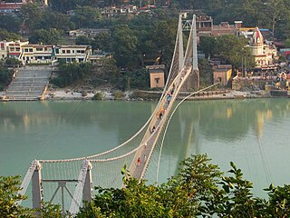
Ram Jhula is an iron suspension bridge across the river Ganges, located 3 kilometres (1.9 mi) north-east from the town Rishikesh in the Indian state of Uttarakhand. The bridge connects the Sivananda Nagar area of Muni Ki Reti in Tehri Garhwal district to Swargashram in Pauri Garhwal district, crossing the river from west to east. Built in the year 1986, the bridge is one of the iconic landmarks of Rishikesh.
Maroda is a village located in the Pauri Garhwal district of Uttarakhand, India.
Thalisain is a town and tehsil of Pauri Garhwal district in the North Indian state of Uttarakhand. At an elevation of 1690 metres from sea level, it is situated on a gentle slope above the right bank of Nayaar (East) river. It is in the southwestern foothills of Dudhatoli Range and at a distance of 83 kilometers from Pauri town and 95 kilometers from Gairsain, the future capital of Uttarakhand.
Thantoli is a village in Pauri Garhwal district in the Indian state of Uttarakhand.
Jeet Singh Negi was a music composer, singer, lyricist, writer and director from the Garhwal region of Uttarakhand, India. He is considered to be the father of modern Garhwali folk music.
Badol Gaon is a small village in Kotdwara tehsil, Pauri Garhwal district in Uttarakhand State of India. Village has barely 13 houses with a population of 45 (mostly belonging to Kala community. It is administered by a Sarpanch who is an elected head of the village.
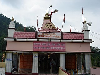
The hill temple of Kalinka is situated in Bironkhal block of Pauri Garhwal district, Uttarakhand in northern India. The temple complex lies close to the border with the Almora district and is dedicated to Goddess Kali. The temple has been in existence for centuries but the new structure has been renovated a couple of times in the last decade. It is often confused with Bunkhal kalinka, which is near Malund village of Raath region in Thalisain.
Dudhatoli is a middle Himalayan mountain range/forest running approximately 25 km in a north–south direction, starting near Thalisain tehsil of Pauri Garhwal district in Uttarakhand, with Gairsain in Chamoli district being its western limit and Syoli-Khand region in Pauri its northernmost spur.
This page is based on this Wikipedia article Text is available under the CC BY-SA 4.0 license; additional terms may apply. Images, videos and audio are available under their respective licenses.