Haodlon Island

Last updated
Haodlon Island
Geography
Location Coronation Gulf
Coordinates 68°02′N113°18′W / 68.033°N 113.300°W / 68.033; -113.300 (Haodlon Island) Coordinates: 68°02′N113°18′W / 68.033°N 113.300°W / 68.033; -113.300 (Haodlon Island)
Archipelago Canadian Arctic Archipelago
Administration
Territory Nunavut
Region Kitikmeot
Demographics
PopulationUninhabited

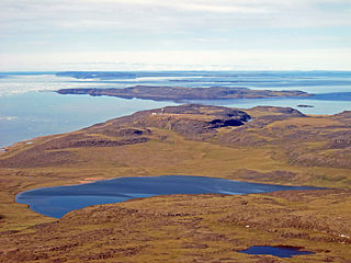
Haodlon Island is an island located within Coronation Gulf, south of Victoria Island, in the Kitikmeot Region, Nunavut, Canada. It is situated at an elevation of 9 m (30 ft) above sea level. [1]

Coronation Gulf bay

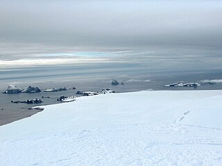
Coronation Gulf lies between Victoria Island and mainland Nunavut in Canada. To the northwest it connects with Dolphin and Union Strait and thence the Beaufort Sea and Arctic Ocean; to the northeast it connects with Dease Strait and thence Queen Maud Gulf.

Victoria Island (Canada) island in arctic Canada

Victoria Island is a large island in the Canadian Arctic Archipelago that straddles the boundary between Nunavut and the Northwest Territories of Canada. It is the eighth largest island in the world, and at 217,291 km2 (83,897 sq mi) in area, it is Canada's second largest island. It is nearly double the size of Newfoundland (111,390 km2 [43,008 sq mi]), and is slightly larger than the island of Great Britain (209,331 km2 [80,823 sq mi]) but smaller than Honshu (225,800 km2 [87,182 sq mi]). It contains the world's largest island within an island within an island. The western third of the island belongs to the Inuvik Region in the Northwest Territories; the remainder is part of Nunavut's Kitikmeot Region.

Nunavut Territory of Canada

Nunavut is the newest, largest, and most northerly territory of Canada. It was separated officially from the Northwest Territories on April 1, 1999, via the Nunavut Act and the Nunavut Land Claims Agreement Act, though the boundaries had been drawn in 1993. The creation of Nunavut resulted in the first major change to Canada's political map since the incorporation of the province of Newfoundland in 1949.

Other islands in the vicinity include Anchor Island, Hatoayok Island, Hokagon Island, Kabviukvik Island, Mangak Island, Nanortut Island, and Nanukton Island, as well as the Berens Islands, Black Berry Islands, Deadman Islands, Home Islands, Lawford Islands, Leo Islands, and Sir Graham Moore Islands. The community of Kugkluktuk (formerly Coppermine) is located on the mainland, 83.5 km (51.9 mi) to the south. [2]

Anchor Island (Nunavut) island in Canada

Anchor Island is an island located within Coronation Gulf, south of Victoria Island, in the Kitikmeot Region, Nunavut, Canada.

Hatoayok Island is an island located within Coronation Gulf, south of Victoria Island, in the Kitikmeot Region, Nunavut, Canada.

Hokagon Island is an island located within Coronation Gulf, south of Victoria Island, in the Kitikmeot Region, Nunavut, Canada.

Related Research Articles

Charleston County, South Carolina County in the United States

Charleston County is located in the U.S. state of South Carolina along the Atlantic coast. As of the 2010 census, its population was 350,209, making it the third most populous county in South Carolina. Its county seat is Charleston. The county was created in 1901 by an act of the South Carolina State Legislature.

Flinders Chase National Park Protected area in South Australia

Flinders Chase National Park is a protected area in the Australian state of South Australia located at the west end of Kangaroo Island about 177 kilometres west-south west of the state capital of Adelaide and 110 kilometres west of the municipal seat of Kingscote. It is a sanctuary for endangered species and home to a few geological phenomena. It was the second national park to be declared in South Australia.

Cozumel island in Quintana Roo, Mexico

Cozumel is an island and municipality in the Caribbean Sea off the eastern coast of Mexico's Yucatán Peninsula, opposite Playa del Carmen, and close to the Yucatán Channel. The municipality is part of the state of Quintana Roo, Mexico.

Rekareka island in French Polynesia

Rekareka, Tehuata or Tu-henua, is an atoll of the Tuamotu Archipelago in French Polynesia. It is located in the Centre East of the group, 83 km southeast from Raroia, and lies 70 km NW of Tauere, its nearest neighbor. The shoal water of this small atoll extends 0.8 km seaward from its northern, western, and southern sides, and about 1.3 km from its south-eastern side. Rekareka has no fresh water and is uninhabited.

Sakkiak Island island in Nunavut, Canada

Sakkiak Island is one of the uninhabited Canadian arctic islands located in Hudson Strait, Nunavut, Canada. It is a Baffin Island offshore island in Qikiqtaaluk Region, separated by deep water from Cape Dorset, Nunavut, 1.5 mi (2.4 km) to the south-southwest. The island is approximately 6 km2 (2.3 sq mi) in size, 2.25 mi (3.62 km) long, and 1 mi (1.6 km) wide. The elevation is approximately 65 m (213 ft) above sea level.

The Couper Islands are an island group located inside western Coronation Gulf, south of Victoria Island, in the Kitikmeot Region, Nunavut, Canada. Other island groups in the vicinity include the Berens Islands, Black Berry Islands, Deadman Islands, Lawford Islands, Leo Islands, and Sir Graham Moore Islands.

Blaze Island island in Canada

Blaze Island is an island located within western Coronation Gulf's Richardson Bay, south of Victoria Island, in the Kitikmeot Region, Nunavut, Canada.

Kabviukvik Island is an island located within Coronation Gulf, south of Victoria Island, in the Kitikmeot Region, Nunavut, Canada.

Mangak Island is an island located within Coronation Gulf, south of Victoria Island, in the Kitikmeot Region, Nunavut, Canada. It is situated at an elevation of 30 m (98 ft) above sea level.

Nanortut Island is an island located within Coronation Gulf, south of Victoria Island, in the Kitikmeot Region, Nunavut, Canada. It is situated at an elevation of 41 m (135 ft) above sea level.

Nanukton Island is an island located within Coronation Gulf, south of Victoria Island, in the Kitikmeot Region, Nunavut, Canada. It is situated at an elevation of 30 m (98 ft) above sea level.

Kingak Island is an island located within Coronation Gulf, south of Victoria Island, in the Kitikmeot Region, Nunavut, Canada. Its highest point is 40 m (130 ft) above sea level.

Takhoalok Island is an island located within Coronation Gulf, south of Victoria Island, in the Kitikmeot Region, Nunavut, Canada. Its highest point is 48 m (157 ft) above sea level.

Doak Island is an island located within Coronation Gulf, south of Victoria Island, in the Kitikmeot Region, Nunavut, Canada. It is approximately 4 m (13 ft) above sea level.

Edinburgh Island island in Nunavut, Canada

Edinburgh Island is an island located within Coronation Gulf, south of Victoria Island, in the Kitikmeot Region, Nunavut, Canada. It is approximately 103 m (338 ft) above sea level.

The uninhabited Cheyne Islands are members of the Queen Elizabeth Islands and the Canadian Arctic Archipelago in the Qikiqtaaluk Region of Nunavut, Canada. The group is made up of three islands known as North Island, Middle Island, and South Island. Located approximately 5 km (3.1 mi) off eastern Bathurst Island, they are situated near Reindeer Bay within western Penny Strait.

Libby Island Light lighthouse in Maine, United States

Libby Island Light is a lighthouse on Libby Island, marking the mouth of Machias Bay, in Machiasport, Maine. The light station was established in 1817 and is an active aid to navigation; the present granite tower was built in 1823 and improved in 1848. Libby Island Light was listed on the National Register of Historic Places as Libby Island Light Station on June 18, 1976.

Pyramid Island, South Shetland Islands island of the South Shetland Islands

Pyramid Island is a conspicuous, pillar-shaped rocky island rising to 205 m (673 ft) off the north entrance to McFarlane Strait in the South Shetland Islands, Antarctica. Its surface area is 9 hectares. Cone Rock
(62°25′56.9″S60°06′08.3″W) is rising to 6 m (19.7 ft) 1.33 km (0.83 mi) south of the island,
2.03 km (1.26 mi) north-northwest of Meade Islands, 2.8 km (1.7 mi) northeast of Williams Point and
1.65 km (1.03 mi) east of Koshava Island, Zed Islands. The vicinity of Pyramid Island was visited on 19 February 1819 during the discovery of the South Shetlands by Captain William Smith in the British brig Williams, and later by early 19th century sealers.

References

  1. "Haodlon Island ca. 9 m". geonames.org. Retrieved 2009-03-16.
  2. "Haodlon Island". travelingluck.com. Retrieved 2009-03-16.