Oak Island is a 57-hectare (140-acre) privately owned island in Lunenburg County on the south shore of Nova Scotia, Canada. The tree-covered island is one of about 360 small islands in Mahone Bay and rises to a maximum of 11 metres above sea level. The island is located 200 metres from shore and connected to the mainland by a causeway and gate. The nearest community is the rural community of Western Shore which faces the island, while the nearest village is Chester. The island is best known for various theories about possible buried treasure or historical artifacts, and the associated exploration.

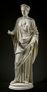
John Cheere (1709–1787) was an English sculptor, born in London. Brother of the sculptor Sir Henry Cheere, he was originally apprenticed as a haberdasher from 1725 to 1732.
Sir Henry Cheere, 1st Baronet was a renowned English sculptor and monumental mason of the eighteenth century, and older brother of John Cheere, also a notable sculptor.

Harper Islands is a small uninhabited island group with an area of 8 km2 (3.1 sq mi), which is part of the Baffin Island group located in the Canadian Arctic Archipelago in the territory of Nunavut. The group lies at the confluence of Frobisher Bay and the Labrador Sea. Other islands also in the immediate vicinity of the tip of Hall Peninsula, but further north, include Lefferts, Bear, Little Hall, and Hudson islands.
The Findlay Group is a group of islands in the Canadian Arctic Archipelago in Qikiqtaaluk Region, Nunavut. This Arctic Ocean group consists of Lougheed Island, Stupart Island, Edmund Walker Island, Grosvenor Island and Patterson Island.
Edmund Walker Island is one of the Canadian arctic islands in Nunavut, Canada. It lies in the Arctic Ocean, south-east of Lougheed Island and north-west of Grosvenor Island. It is part of the Findlay Group.
Grosvenor Island is one of the Canadian arctic islands in Nunavut, Canada. It lies in the Arctic Ocean, south-east of Edmund Walker Island and north-west of Patterson Island. It is part of the Findlay Group.
Patterson Island is one of the uninhabited Canadian arctic islands in Nunavut, Canada. It lies in the Arctic Ocean, south-east of Grosvenor Island. It is the most southerly island of the Findlay Group.
The Cheere Baronetcy, of St Margaret's in the City of Westminster, was a title in the Baronetage of Great Britain. It was created on 19 July 1766 for the sculptor and civic official Sir Henry Cheere. The title became extinct on the death of the second Baronet in 1808.
The Sheer Islands are Canadian arctic islands that are located in Qikiqtaaluk Region, Nunavut, Canada. They are a Baffin Island offshore island group in Hudson Strait. The islands are situated approximately 1 mi (1.6 km) north of Cape Tanfield and form part of the north side of Itivirk Bay.
The Piercey Islands are an island group located in Coronation Gulf, south of Victoria Island, west of the Kent Peninsula, in the Kitikmeot Region, Nunavut, Canada. Other island groups in the vicinity include the Breakwater Islands, Chapman Islands, Cheere Islands, Cockburn Islands, Porden Islands, Stockport Islands, Triple Islands, and Wilmot Islands.
The Breakwater Islands are an island group located in Coronation Gulf, south of Victoria Island, west of the Kent Peninsula, in the Kitikmeot Region, Nunavut, Canada. Other island groups in the vicinity include the Chapman Islands, Cheere Islands, Cockburn Islands, Piercey Islands, Porden Islands, Stockport Islands, Triple Islands, and Wilmot Islands.
The Cockburn Islands are an island group located in Coronation Gulf, south of Victoria Island, west of the Kent Peninsula, in the Kitikmeot Region, Nunavut, Canada. Other island groups in the vicinity include the Breakwater Islands, Cheere Islands, Piercey Islands, Porden Islands, Stockport Islands, Triple Islands, and Wilmot Islands.
The Gretha Islands are an uninhabited island group located in the Qikiqtaaluk Region of Nunavut, Canada. They are situated in Eureka Sound at the confluence of Bay Fjord, north of Ellesmere Island's Raanes Peninsula, and east of Stor Island. They are members of the Sverdrup Islands group, Queen Elizabeth Islands, and the Canadian Arctic Archipelago.
Hat Island is an uninhabited island located in the Qikiqtaaluk Region of Nunavut, Canada. It is situated in Eureka Sound at the confluence of Bay Fjord, east of Ellesmere Island's Raanes Peninsula, and 19.6 km (12.2 mi) west of Stor Island. It is a member of the Sverdrup Islands group and the Canadian Arctic Archipelago. It is also a member of the Queen Elizabeth Islands and the Canadian Arctic Archipelago.

Bradbury Island is an uninhabited island in the Qikiqtaaluk Region, Nunavut, Canada. Located in Hudson Bay's, it is a member of the Belcher Islands group. Long and thin, it lies in Omarolluk Sound, between Flaherty Island and Tukarak Island. Other islands in the immediate vicinity include:
Bun Island is an uninhabited island in the Qikiqtaaluk Region, Nunavut, Canada. Located in Hudson Bay, it is a member of the Bakers Dozen Islands archipelago of the Belcher Islands group. Other islands in the immediate vicinity include:
The Berkeley Islands are an uninhabited island group in the Qikiqtaaluk Region of northern Canada's territory of Nunavut. They are located at the head of Young Inlet off northern Bathurst Island. The Berkeley Group is part of the Canadian Arctic Archipelago and is a member of the Parry Islands subgroup. It is composed of the Hosken Islands, as well as Allard Island, Harwood Island, Ricards Island, Seymour Island, and Sherard Osborn Island. It is named in honor of Maurice Berkeley, 1st Baron FitzHardinge, Royal Navy First Sea Lord.


