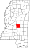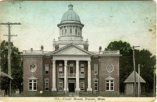
Scott County is a county located in the U.S. state of Mississippi. As of the 2020 census, the population was 27,990. Its county seat is Forest. The county is named for Abram M. Scott, the Governor of Mississippi from 1832 to 1833.

Dublin, also known as Hopson Bayou, is a census-designated place and unincorporated community located along U.S. Route 49 in southeastern Coahoma County, Mississippi, United States. Dublin is located on the Mississippi Delta Railroad. Dublin has a ZIP code of 38739. A post office first began operation under the name Dublin in 1875.

Rena Lara is a census-designated place and unincorporated community located along Mississippi Highway 1 in southwestern Coahoma County, Mississippi, United States. Rena Lara is located on the former Riverside Division of the Yazoo and Mississippi Valley Railroad. Rena Lara was once home to two general stores, two grocery stores, and the Richardson and May Land & Planting Company.
Ovett is a census-designated place and unincorporated community in southeastern Jones County, Mississippi. Ovett is part of the Laurel Micropolitan Statistical Area.
Solon Mills is an unincorporated community and census-designated place in McHenry County, Illinois, United States. Solon Mills is located on U.S. Route 12, 2 miles (3.2 km) southwest of Spring Grove. Solon Mills is part of ZIP code 60071; it once had its own post office with ZIP code 60080 before it closed on September 28, 2002. It was named a CDP before the 2020 census, at which time it had a population of 133.
Lamar is a census-designated place and unincorporated community in Benton County, Mississippi, United States. It is located along Mississippi Highway 7 in western Benton County. Lamar has a post office with the ZIP code 38642. The nearly abandoned Mississippi Central Railroad runs through Lamar, and is only used rarely for freight trafficking. Lamar shares its ZIP code with the nearby community of Slayden.
Van Vleet is a census-designated place and unincorporated community in Chickasaw County, Mississippi, United States. Van Vleet is located at the junction of Mississippi Highway 32 and Mississippi Highway 385, 8 miles (13 km) northeast of Houston. Van Vleet has a post office with ZIP code 38877.
Boles is an unincorporated community and census-designated place (CDP) in Scott County, Arkansas, United States. It was first listed as a CDP in the 2020 census with a population of 166.
Buckatunna is a census-designated place (CDP) and unincorporated community located in Wayne County, Mississippi, United States. The population was 383 at the 2020 census. Buckatunna is located in the southeast corner of Wayne County, just west of the Alabama state line. Buckatunna has a post office with the zip code 39322.
Nicholson is an unincorporated community and census-designated place (CDP) in Pearl River County, Mississippi, United States. As of the 2020 census, its population was 2,833. Its ZIP code is 39463.
Wheeler is a census-designated place and unincorporated community in Prentiss County, Mississippi. It first appeared in the 2020 United States census with a population of 274. Its ZIP code is 38880.
New Site is a census-designated place and unincorporated community in Prentiss County, Mississippi, United States. Its population was 851 at the 2010 U.S. Census. Its ZIP code is 38859.
Fernwood is a census-designated place and unincorporated community in Pike County, Mississippi, United States. Its ZIP code is 39635.

Toomsuba is a census-designated place (CDP) and unincorporated community in Lauderdale County, Mississippi, United States. Its population was 778 as of the 2020 census. Its ZIP code is 39364.
Pattison, also known as Martin, is a census-designated place and unincorporated community in Claiborne County, Mississippi, United States. Its ZIP code is 39144.
Hillsboro is an unincorporated community and census-designated place (CDP) in Scott County, Mississippi, United States. Its population was 1,130 as of the 2010 census. Hillsboro has a post office with ZIP code 39087.
Bethlehem is a census-designated place and unincorporated community in Marshall County, Mississippi, United States. Its ZIP code is 38659.
La France is an unincorporated community and census-designated place (CDP) in Anderson County, South Carolina. It was first listed as a CDP in the 2020 census with a population of 476.
Echo is an unincorporated community and census-designated place (CDP) in Rapides Parish, Louisiana, United States. It was first listed as a CDP in the 2020 census with a population of 352.
Paulina is an unincorporated community and census-designated place in St. James Parish, Louisiana, United States. It was first listed in the 2010 census with a population of 1,178. The community is located on the east bank of the Mississippi River in the eastern part of the parish, west of Lutcher and across the river from Vacherie. Paulina has a post office with ZIP code 70763.