Heathrow timeline

Last updated

This is an event timeline and minor geographical information about Heathrow hamlet.

Contents

Map of Heathrow and around in the late 1930s Heathrow Before World War II Map.jpg
Map of Heathrow and around in the late 1930s
Map of Heathrow and around in 1948 Heathrow 1948.jpg
Map of Heathrow and around in 1948

Founding and early history

A sizeable Neolithic settlement is believed to have been in the Heathrow area. Many artefacts have been found in the gravel around what is now the airport, and the Colne Valley. [1] Waste pits filled with struck flint, arrowheads and fragments of pottery were also found in the area, indicating a settlement, though none other remains of such a settlement. [2]

Until about 1930, there was only one building (part of Bath Road Farm) on the north side of Bath Road between The Magpies (an area around and opposite the north exit of the recent Heathrow Road), and Longford; other buildings were built afterwards there before World War II, including three factories (Technicolor and Penguin Books and Black+Decker). By 1944, there were no buildings on the south side of Bath Road between The Magpies and Longford.

Heathrow was away from main roads and further away from railways; that kept it secluded and quiet although near London. As Middlesex changed to market gardening and fruit growing to supply expanding London, parts of Heathrow held on to old-type mixed farming, and thus was chosen for Middlesex area horse-drawn ploughing competitions, which needed land which was under stubble after harvest.

The ford where High Tree Lane crossed the Duke of Northumberland's River was a scenic spot used sometimes for picnics and courting couples. There was a footpath along beside the river from the ford to Longford.

Development

Agriculture became the main source of income for residents in the hamlet, as the brickearth soil in the area made farming ideal (it held manure well and did not go sticky when wet), so Heathrow became part of the west Middlesex market gardening industry. Many residents grew fruit, vegetables, and flowers, [3] which they would travel with into London to sell, on the return journey collecting manure for farming. [4] As the coming of motor vehicles made urban horse manure (from stables and cleaned off roads) much less, they started instead using sewage sludge (up to 50 tons per acre) from the Perry Oaks sewage works as fertiliser.

The Middlesex Agricultural and Growers' Association held annual ploughing matches in Heathrow, until the last, the 99th, was held on 28 September 1937; [5] the 100th match (in 1938) was postponed to 1939 due to severe drought, and in 1939 it was cancelled because World War II had started.

The Royal Commission on Historic Monuments listed 28 historically significant buildings in the parish of Harmondsworth, a third of which were in Heathrow. [6] Notable buildings included Heathrow Hall, a late 18th-century farmhouse, which was on Heathrow Road, [7] and Perry Oaks farm, which was Elizabethan.

In the 19th century much brickearth-type land in west Middlesex, including in Heathrow, was used for orchards of fruit trees, often several sorts mixed in one orchard. Much soft fruit was grown, often in the orchards under the fruit trees. Sometimes vegetables, or flowers for cutting, were grown under the fruit trees. An author in 1907 [8] reported "thousands and thousands" of plum, cherry, apple, pear, and damson trees, and innumerable currant and gooseberry bushes, round Harmondsworth and Sipson and Harlington and Heathrow. [9] After World War I the amount of fruit growing in the area decreased due to competition from imports and demand for more market-gardening land, and by 1939 less than 10% of the orchard area was left.

Produce was taken to Covent Garden market, or by smaller growers to Brentford market, which was nearer but less profitable. From the Three Magpies lane junction near Heathrow to Covent Garden is 14 miles by road, which was about 6 hours at laden horse-and-wagon speed, so goods to market had to set off at 10 pm the day before to reach the market when it opened at 4 am, [10] until motor trucks came. Lighter produce such as strawberries where freshness was important could reach Covent Garden Market in an hour and a half in a light vehicle behind a light fast horse.

An 11.93-acre field fronting on the south side of the Bath Road, about 600 yards east of Heathrow Road, was shown as allotment gardens on a map dated 1935, [11] and it appears to be allotment gardens in the 1940 Luftwaffe air survey. [12]

In the 1930s Heathrow Hall and Perry Oaks were mixed farms with wheat and cattle and sheep and pigs, and the other farms were largely market gardening and fruit growing. Photographs from early in the 20th century show milk cattle (about 22 in the photograph) at Cain's Farm and the yearly horse ploughing competition held along Cain's Lane, in the southeast of Heathrow; later photographs show ploughing competitions in the north near Tithe Barn Lane on land belonging to Heathrow Hall. Sipson Farm at the north end of Sipson may have owned land in Heathrow.

Timeline

13th century

14th century

15th century

16th century

17th century

18th century

19th century

20th century

Notable buildings

See File:Heathrow Before World War II Map.jpg#Road names for the names of the roads.

Heathrow Road

Starting at the north end:

Cain's Lane

Starting at the north end:

[28]

Tithe Barn Lane

Related Research Articles

Harlington, London Human settlement in England

Harlington is a district of Hayes the London Borough of Hillingdon and one of five historic parishes partly developed into London Heathrow Airport and associated businesses, the one most heavily developed being Harmondsworth. It is centred 13.6 miles (21.9 km) west of Charing Cross. The district adjoins Hayes to the north and shares a railway station with the larger district, which is its post town, on the Great Western Main Line. It is in the south-west corner of the historic county of Middlesex.

Harmondsworth Human settlement in England

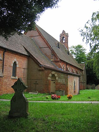
Harmondsworth is a village in the London Borough of Hillingdon in the historic county of Middlesex with a short border to the south onto London Heathrow Airport. The village has no railway stations, but adjoins the M4 motorway and the A4 road. Harmondsworth is an ancient parish that once included the large hamlets of Heathrow, Longford and Sipson. Longford and Sipson have modern signposts and facilities as separate villages, remaining to a degree interdependent such as for schooling. Its Great Barn and its church are well-repaired medieval buildings in the village. The largest proportion of land in commercial use is related to air transport and hospitality. The village includes public parkland with footpaths and abuts the River Colne and biodiverse land in its Regional Park to the west, once the grazing meadows and woodlands used for hogs of Colnbrook.

Heathrow (hamlet) Former hamlet in Harmondsworth, Middlesex, England, site of Heathrow Airport

Heathrow or Heath Row was a wayside hamlet along a minor country lane called Heathrow Road in the ancient parish of Harmondsworth, Middlesex, England, on the outskirts of what is now Greater London. Its buildings and all associated holdings were demolished, along with almost all of the often grouped locality of The Magpies in 1944 for the construction of Heathrow Airport.

Sipson Human settlement in England

Sipson is a village in the London Borough of Hillingdon, the westernmost borough of Greater London, England. It is 14.3 miles (23 km) west of Charing Cross and near the north perimeter of London Heathrow Airport.

London Borough of Hillingdon London borough in United Kingdom

The London Borough of Hillingdon is a large borough in West London, England. It was formed from the districts of Hayes and Harlington, Ruislip-Northwood, Uxbridge, and Yiewsley and West Drayton in the ceremonial county of Middlesex. Today, Hillingdon is home to Heathrow Airport and Brunel University, and is the second largest of the 32 London boroughs by area.
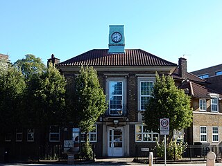
Earl of Strafford Earldom in the Peerage of Great Britain

Earl of Strafford is a title that has been created three times in English and British history.

West Drayton Area of the London Borough of Hillingdon

West Drayton is a suburban town in the London Borough of Hillingdon. It was an ancient parish in the county of Middlesex and from 1929 was part of the Yiewsley and West Drayton Urban District, which became part of Greater London in 1965. The settlement is near the Colne Valley Regional Park and its centre lies 1.9 miles (3 km) north of Heathrow Airport.

Easterton Human settlement in England

Easterton is a village and civil parish in Wiltshire, England, 4 miles (6.4 km) south of Devizes. The parish includes the hamlets of Easterton Sands and Eastcott.

Stanwell Human settlement in England

Stanwell is a village close to two of the three main towns in the Borough of Spelthorne, Surrey, about 16 miles (26 km) west of central London. A small corner of its land is vital industrial land serving Heathrow Airport – most of the rest is residential/recreational, and the housing ranges from suburban homes with gardens to low- to mid-rise urban apartment blocks. Historically part of the county of Middlesex, it has, like the rest of Spelthorne, been in Surrey since 1965. The village is to the south of the cargo-handling area of Heathrow Airport and to the east of the Staines Reservoirs.

Longford, London Human settlement in England

Longford is a suburban village in the London borough of Hillingdon, England. It is immediately northwest of London Heathrow Airport, which is in the same borough. It is the westernmost settlement in Greater London, close to the borders of Berkshire and Surrey.

River Crane, London

The River Crane, a tributary of the Thames, runs 8.5 miles (13.6 km) in Middlesex, England. It is in effect the lower course of the Yeading Brook. It adjoins or bisects three London boroughs: Hillingdon, Hounslow and Richmond upon Thames. The drainage basin is heavily urbanised but many of the Hayes to Whitton flood-meadows have been conserved, forming a narrow, green vale, opening out to what remains of Hounslow Heath in the centre – a near-continuous belt of semi-natural habitat.

Hatton, London Human settlement in England

Hatton including Hatton Cross is a small settlement and locality in the historic County of Middlesex and the London boroughs of Hillingdon and Hounslow, on the south-eastern edge of London Heathrow Airport and straddling the A30 road.

Elthorne Hundred

Elthorne was a hundred of the historic county of Middlesex, England.

Yiewsley and West Drayton Urban District


Yiewsley and West Drayton was a local government district in Middlesex, England from 1929 to 1965. Its area became the south-west of the London Borough of Hillingdon.

George Byng, 3rd Earl of Strafford

George Henry Charles Byng, 3rd Earl of Strafford, styled Viscount Enfield between 1860 and 1886, was a British Liberal politician.

Great West Aerodrome Grass airfield, operational 1930 - 1944 on the site of the current Heathrow Airport

The Great West Aerodrome, also known as Harmondsworth Aerodrome or Heathrow Aerodrome, was a grass airfield, operational between 1930 and 1944. It was on the southeast edge of the hamlet of Heathrow, in the parish of Harmondsworth. The Fairey Aviation Company owned and operated it, for assembly and flight testing of Fairey-manufactured aircraft. The area was to later be the site of London Heathrow Airport.

In its early years what is now Heathrow Airport was the Great West Aerodrome, sometimes known as Heathrow Aerodrome.

Harmondsworth Great Barn Grade I listed building in Harmondsworth, UK

Harmondsworth Great Barn is a medieval barn on the former Manor Farm in the village of Harmondsworth, in the London Borough of Hillingdon, England. It is north-west of fields and the A4 next to Heathrow Airport. Built in the early 15th century by Winchester College, it is the largest timber-framed building in England and is regarded as an outstanding example of medieval carpentry. It was described by the English poet John Betjeman as the "Cathedral of Middlesex". A similar though smaller barn is part of the Manor Farm complex in Ruislip.

1874 Dissolution Honours

The 1874 Dissolution Honours List was issued in February 1874 prior to the general election at the advice of the outgoing Prime Minister, William Gladstone.

References

  1. Cotton, Mills & Clegg 1986, p. 34
  2. Cotton, Mills & Clegg 1986, p. 36
  3. "The Lost Villages Around Heathrow". BBC News. 15 January 2009. Retrieved 18 January 2009.. The page includes an image of a half-timbered cottage in Heathrow village.
  4. Sherwood 1990, p. 18; Sherwood 2009, p. 32
  5. Sherwood 1990, p. 20; Sherwood 2009, p. 33
  6. Sherwood 1990, p. 33
  7. Sherwood 2006, p.14
  8. Stephen Springall, Country Rambles round Uxbridge , 1907
  9. Sherwood 2009, p. 31
  10. Sherwood 2009, p. 33
  11. Old 1:2500 scale Ordnance Survey maps, reproduced at about 15 inches = 1 mile, publ. Alan Godfrey Maps:-
  12. Sherwood 2009, p.14
  13. 1 2 3 4 5 "Harmondsworth: Introduction - British History Online". British-history.ac.uk.
  14. For full information and references see Anglo-French Survey (1784–1790)
  15. 1 2 3 4 Sherwood, 1993, pages 46-53
  16. Sherwood, Philip 2009, p21
  17. "The London Gazette". London-gazette.co.uk. 15 November 1845. p. 4404.
  18. "The London Gazette". London-gazette.co.uk. 15 November 1845. p. 4405.
  19. "London Gazette". London-gazette.co.uk. 13 September 1872. p. 4025. Retrieved 19 August 2017.
  20. 1 2 Sherwood, Philip 2006, p29
  21. "Full text of "Proceedings"". Archive.org. 1869. Retrieved 18 August 2017.
  22. Information from Philip Sherwood, with thanks.
  23. "London Gazette". London-gazette.co.uk. 8 December 1906. p. 8847. Retrieved 19 August 2017.
  24. "London Gazette". London-gazette.co.uk. 13 November 1908. p. 8370. Retrieved 19 August 2017.
  25. "WHEELS OF INDUSTRY. - 18th March 1924 - The Commercial Motor Archive". Archive.commercialmotor.com. Retrieved 18 August 2017.
  26. "Stanwell: Introduction - British History Online". British-history.ac.uk. Retrieved 18 August 2017.
  27. 1 2 Old 1:2500 scale Ordnance Survey maps, reproduced at about 15 inches = 1 mile, publ. Alan Godfrey Maps:-
  28. Sherwood, Philip 1990, p.68, including quotation from The Aeroplane magazine, issue of 8 May 1935
  29. "Environmental Protection Unit Contaminated Land Inspection Strategy" (PDF). Hillingdon.gov.uk. Archived from the original (PDF) on 30 August 2012. Retrieved 18 August 2017.
  30. Sherwood, Philip 1990, p.69
  31. "London Gazette". London-gazette.co.uk. 1 September 1939. p. 5996. Retrieved 19 August 2017.
  32. Sherwood, Philip 2012, p.77
  33. http://www.london-gazette.co.uk/issues/35065/pages/707 [ bare URL ]
  34. http://www.london-gazette.co.uk/issues/35339/pages/6473 [ bare URL ]
  35. http://www.london-gazette.co.uk/issues/36082/pages/3064 [ bare URL ]
  36. NameBright – Coming Soon
  37. Sherwood, Philip 1990, pp. 13–15; Sherwood 2009, pp. 25–28
  38. Sherwood 2009, p.85
  39. Sherwood 2009, p.86
  40. Sherwood 2009, p.81
  41. "BBC NEWS - England - London - The lost villages around Heathrow". News.bbc.co.uk. 15 January 2009. Retrieved 18 August 2017.
  42. Sherwood, Philip 2012, p6
  43. "London Gazette". London-gazette.co.uk. 25 January 1949. p. 454. Retrieved 19 August 2017.
  44. Sherwood, Philip 2009, p35
  45. Sherwood, Philip 2006, p20; Sherwood, Philip 2009, p35