
County Wicklow is a county in Ireland. The last of the traditional 32 counties, having been formed as late as 1606, it is part of the Eastern and Midland Region and the province of Leinster. It is bordered by the Irish Sea to the east and the counties of Wexford to the south, Carlow to the southwest, Kildare to the west, and Dublin to the north.
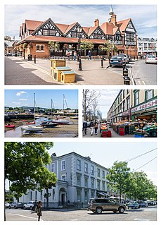
Bray is a coastal town in north County Wicklow, Ireland. It is situated about twenty kilometres (12 mi) south of Dublin city centre on the east coast. It has a population of 32,600 making it the ninth largest urban area within Ireland. Bray is home to Ardmore Studios, and some light industry is located in the town, with some business and retail parks on its southern periphery. Commuter links between Bray and Dublin are provided by rail, Dublin Bus and the M11 and M50 motorways. Small parts of the town's northern outskirts are in County Dublin.

Arklow is a town in County Wicklow on the southeast coast of Ireland. The town is overlooked by Ballymoyle Hill. It was founded by the Vikings in the ninth century. Arklow was the site of one of the bloodiest battles of the 1798 rebellion. Its proximity to Dublin led to it becoming a commuter town with a population of 13,163 as of the 2016 census.
Blanchardstown is a large outer suburb of Dublin in the modern county of Fingal, Ireland. Located ten kilometres (6 mi) northwest of Dublin city centre, it has developed since the 1960s from a small village to a point where Greater Blanchardstown is the largest urban area in Fingal.
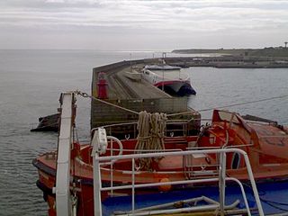
The village of Rosslare Harbour, also known as Ballygeary, grew up to serve the needs of the harbour of the same name, first developed in 1906 by the Great Western Railway and the Great Southern and Western Railway to accommodate steamferry traffic between Great Britain and Ireland. This port also serves France and Spain, traffic is mainly roll-on roll-off (RoRo). Rosslare Harbour railway station opened on 30 August 1906.

Foxrock is a suburb of Dublin, Ireland. It is within the county of Dún Laoghaire–Rathdown, in the postal district of Dublin 18 and in the Roman Catholic parish of Foxrock.
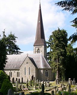
Enniskerry is a village in County Wicklow, Ireland. The population was 1,889 at the 2016 census.

Blessington, historically known as Ballycomeen, is a town on the River Liffey in County Wicklow, Ireland, near the border with County Kildare. It is around 25 km south-west of Dublin, and is situated on the N81 road, which connects Dublin to Tullow.
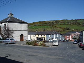
Tinahely is a village in County Wicklow in Ireland. It is a market town in the valley of the River Derry, a tributary of the River Slaney.
Greenhills is a suburb of Dublin in Ireland. It lies between Kimmage, Tallaght, Ballymount, Templeogue, Terenure and Walkinstown, and includes a number of residential developments. Most of the roads in Greenhills are named after saints. Some of the main roads are Saint Peter's Road, Saint James Road, Saint Joseph's Road and Saint Patrick's Road. Greenhills is in the Dublin 12 postal area of County Dublin and is a part of South Dublin County Council.

Newtownmountkennedy is a small town in County Wicklow, Ireland. It developed within the historic townland of Ballygarny, although all that remains is a motte where a church, graveyard and a castle or tower house once stood just 0.85 km (0.53 mi) north of the town. It acquired its present name in the mid-seventeenth-century, when Sir Robert Kennedy, M.P. for Kildare, made it his principal residence. It is just off the N11 road to Wexford, just south of Kilpedder and south-west of Greystones. It is about 15 km (9.3 mi) north of Wicklow town, 15 km (9.3 mi) south of Bray and approximately 35 km (22 mi) from Dublin. The R772 regional road passes through the village. This was the main Dublin-Wexford route, the N11, but the village was bypassed by the new N11 dual carriageway in 1990. This town has one of the longest place names in Ireland.

Woodenbridge is a small village in County Wicklow, Ireland. It lies between Arklow and Avoca, at the meeting of the Avoca, Aughrim and Goldmine rivers. The village is located at the junction of the R747 and R752 roads. The R747 crosses the Aughrim on the stone bridge which is still called "Wooden Bridge".

Ashford, historically known as Ballymacahara, is a village in County Wicklow, Ireland. It lies on the River Vartry and at the meeting of the R772, R763 and R764 regional roads. The village was formerly on the main Dublin–Wexford route, the N11, but was bypassed by the new N11 in 2004. As of the 2016 census, the village had a population of 1,425 people.
Flagmount is a combination of two townlands located within the barony of Gowran and on the R712 National primary road, in County Kilkenny, Ireland. It is located in Gowran civil parish.
Charlesland is a townland and residential development located on the southside of Greystones in County Wicklow, Ireland. It is about 25 kilometres from Dublin city centre. As of the 2011 census, the townland of Charlesland had a population of 3,130 people.
Valleymount is a small village in western County Wicklow, Ireland.

Aghavannagh is a small village and townland in south County Wicklow, Ireland. It is located in the barony of Ballinacor South on the Military Road originally constructed between 1804 and 1809, in the wake of the 1798 rebellion. It is so remote that inhabitants say that "Aghavannagh is the last place God made".

Ballyknockan or Ballynockan is a village and townland in County Wicklow, Ireland.
Ballycullen is a townland and suburb of Dublin, Ireland.

Kilbride, or Manor Kilbride, is a village, civil parish and District electoral division in County Wicklow, Ireland, located at the western edge of the Wicklow Mountains in the barony of Talbotstown Lower.

