The Little Don River also known as the Porter, is a tributary of the River Don in South Yorkshire, England. Arising on the Langsett Moors in the northern Peak District, the Little Don River feeds the Langsett and Underbank Reservoirs. It runs through the town of Stocksbridge before joining the River Don.

Yorkshire Water is a water supply and treatment utility company servicing West Yorkshire, South Yorkshire, the East Riding of Yorkshire, part of North Lincolnshire, most of North Yorkshire and part of Derbyshire, in England. The company has its origins in the Yorkshire Water Authority, one of ten regional water authorities created by the Water Act 1973, and privatised under the terms of the Water Act 1989, when Yorkshire Water plc, the parent company of the Yorkshire Water business, was floated on the London Stock Exchange. The parent company was Kelda Group in 1999. In February 2008, Kelda Group was bought by a consortium of infrastructure funds.

Angram Reservoir is the first of three reservoirs on the River Nidd in Upper Nidderdale, North Yorkshire, England, the others being Scar House Reservoir and finally the compensation reservoir Gouthwaite Reservoir. It is located at OS map reference SE040759. Between them they attract around 150,000 visitors a year.
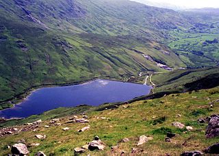
Kentmere Reservoir is a water storage facility situated in the Kentmere valley in the county of Cumbria, England. It is located 10.5 kilometres (6.5 mi) north-northeast of the town of Windermere. The reservoir is fed by the streams which form the headwaters of the River Kent which rise 1.5 kilometres (0.93 mi) to the north in Hall Cove on the southern slopes of a mountainous ridge called High Street, which is named after the nearby Roman road. It is also fed by Lingmell Gill, which drains the large corrie on the western side of Harter Fell beneath the Nan Bield Pass.
Harden is a civil parish and village within the City of Bradford Metropolitan District, West Yorkshire, England, 2 miles (3.2 km) west of Bingley. It had a population of 1,615 in the 2001 census, but by 2011 this had risen to 1,900.
Nidd Valley Light Railway was a light railway in upper Nidderdale in the West Riding of Yorkshire, England. It was owned by Bradford Corporation Waterworks Department and the corporation also operated its public passenger services. Power & Traction Ltd of London obtained a Light Railway Order for the 6.5-mile (10.5 km) railway from Pateley Bridge to Lofthouse in 1900, but these powers were taken over by Bradford Corporation. A contract to build Angram Reservoir was awarded to John Best & Son in 1903, and he also won the contract to build the public railway and a 6.5-mile (10.5 km) private extension to the reservoir site. This was initially built to 3 ft gauge but was converted to standard gauge by 1907, when the public railway opened. Best had his own locomotives, and Bradford Corporation equipped the public railway with second hand locomotives and carriages from the Metropolitan Railway.

The Eller Beck is a small river in North Yorkshire, England, that flows through the town of Skipton and is a tributary of the River Aire. Its channel was heavily modified to supply water to mills in the 18th and 19th centuries, and although all the mills have closed, the water now supplies power to the National Grid, generated by a turbine at High Corn Mill. The beck flows through several underground culverts in Skipton that contribute to the flood risk. To alleviate flooding in Skipton town centre, a scheme involving two flood water storage reservoirs was designed and eventually completed in 2017.

Bowling Tunnel is a railway Tunnel on the Calder Valley line, south of Bradford in West Yorkshire, England. The Tunnel was completed in 1850 after some difficulty in construction, and allowed trains from the south to access the second railway terminus in the town of Bradford. The Tunnel remains open to railway traffic with trains between Halifax and Bradford Interchange using it.

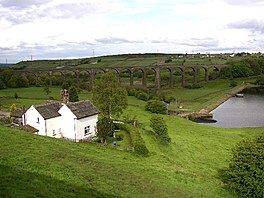
The Nidd Aqueduct is an aqueduct or man-made watercourse in North Yorkshire, England. It feeds water from Angram and Scar House reservoirs in upper Nidderdale, North Yorkshire 32 mi (51 km) to Bradford in West Yorkshire. The aqueduct supplies 21,000,000 imp gal (95,000 m3) of water per day to Chellow Heights water treatment works. The aqueduct and the reservoirs it connects to are all maintained by Yorkshire Water.

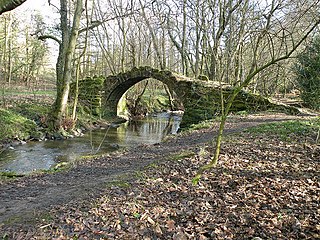
Harden Beck is a stream that flows from Hewenden Reservoir, over Goit Stock Waterfall to the River Aire in Bingley, West Yorkshire. The route starts out further up the valley as Denholme Beck, Hewenden Beck and Hallas Beck. Its waters are fed by Thornton Moor Reservoir, Stubden Reservoir, Doe Park Reservoir and Hewenden Reservoir.
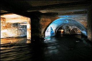
Bradford Beck is a river that flows through Bradford, West Yorkshire, England, and on to the River Aire at Shipley. As it reaches Bradford city centre it runs underground after being built over in the 19th century. It is culverted as it runs from Bradford city centre to Queen's Road after which it runs mostly in an open channel to Shipley. The beck used to be known as the filthiest river in England.
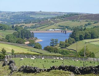
Lower Laithe Reservoir is a man-made upland reservoir that lies 1.2 miles (2 km) west of Haworth, West Yorkshire, England. The reservoir was initially approved under the Keighley Waterworks and Improvement Act of 1869 but work did not begin on its construction until 1911 and even then was delayed because of the First World War. The reservoir was officially opened in August 1925 in front of a crowd of over 8,000 people. Its final tally on cost was £500,000. The reservoir lies in the Sladen Valley and was often referred to as Sladen Valley Reservoir.

Bradford Dale, is a side valley of Airedale that feeds water from Bradford Beck across the City of Bradford into the River Aire at Shipley in West Yorkshire, England. Whilst it is in Yorkshire and a dale, it is not part of the Yorkshire Dales and has more in common with Lower Nidderdale and Lower Airedale for its industrialisation.

Winscar Reservoir, is a compensation reservoir on the headwaters of the River Don in South Yorkshire, England. The reservoir is located at Dunford Bridge, 25 miles (40 km) northwest of Sheffield, and is just inside the Peak District National Park on the Pennine watershed. The reservoir was built on an existing dam and has suffered from leaking which necessitated a new membrane being installed at the dam head in the years 2000 and 2001.

Ponden Reservoir is an artificial upland lake in the Worth Valley, near Stanbury, West Yorkshire, England. Ponden was built as a compensation reservoir after the nearby Watersheddles Reservoir (upstream) was used to divert water away from the River Worth. Ponden was needed to regulate the flow of water down the river into the downstream mills in the valley.

The Worth Valley is a geographic area in West Yorkshire, England, that extends eastwards from Crow Hill and Oxenhope Moor, providing drainage for the River Worth for nearly 10 miles (16 km) to the River Aire. It is a side valley to Airedale, with the River Worth being a major tributary of the River Aire. The Worth Valley was important for its contribution to the textiles industry of the West Riding of Yorkshire and was furnished with several reservoirs to allow mills to operate within the valley. Most of the reservoirs are still in use into the modern day.

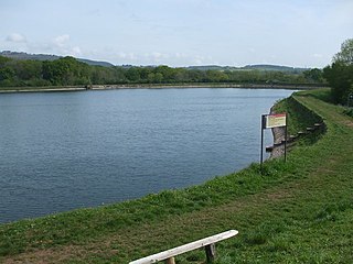
Watersheddles Reservoir is an upland artificial lake in Lancashire, England. The reservoir was opened in 1877 by the Keighley Corporation Water Works, and is now owned by Yorkshire Water. It supplies water to the Worth Valley and Keighley area and compounds several streams at the source of the River Worth.
Cardiff Corporation Waterworks, its predecessors and successors have provided a public water supply and sewerage and sewage treatment services to the Welsh city of Cardiff since 1850.

Upper Barden Reservoir is an upland fresh water reservoir, one of two reservoirs that collect water from Barden Moor, and dam Barden Beck, a tributary of the River Wharfe in the Yorkshire Dales, North Yorkshire, England. The reservoir was opened in 1882 and also supplies fresh water to the Nidd Aqueduct, which transports it to Bradford. Upper Barden Reservoir was the second of the reservoirs to be built,.
Oak Beck is a watercourse that flows eastwards across the northern part of Harrogate in North Yorkshire, England. The beck flows through a broad V-shaped valley, before emptying into the River Nidd at Bilton, just upstream from the Nidd Gorge Viaduct. Water from Oak Beck has been used as a water supply for Harrogate and also for industrial purposes further downstream.