A dam is a barrier that stops or restricts the flow of surface water or underground streams. Reservoirs created by dams not only suppress floods but also provide water for activities such as irrigation, human consumption, industrial use, aquaculture, and navigability. Hydropower is often used in conjunction with dams to generate electricity. A dam can also be used to collect or store water which can be evenly distributed between locations. Dams generally serve the primary purpose of retaining water, while other structures such as floodgates or levees are used to manage or prevent water flow into specific land regions. The earliest known dam is the Jawa Dam in Jordan, dating to 3,000 BC.

Keepit Dam is a major gated mass concrete gravity dam with an earth fill abutment and a central gated concrete overflow crest and six radial gate spillways across the Namoi River upstream of its junction with the Peel River in the North West Slopes region of New South Wales, Australia. The dam's purpose includes flood mitigation, hydro-power, irrigation, water supply and conservation. The impounded reservoir is called Lake Keepit.

A spillway is a structure used to provide the controlled release of water from a dam or levee downstream, typically into the riverbed of the dammed river itself. In the United Kingdom, they may be known as overflow channels. Spillways ensure that water does not damage parts of the structure not designed to convey water.

Oroville Dam is an earthfill embankment dam on the Feather River east of the city of Oroville, California, in the Sierra Nevada foothills east of the Sacramento Valley. At 770 feet (235 m) high, it is the tallest dam in the U.S. and serves mainly for water supply, hydroelectricity generation and flood control. The dam impounds Lake Oroville, the second largest man-made lake in the state of California, capable of storing more than 3.5 million acre-feet.

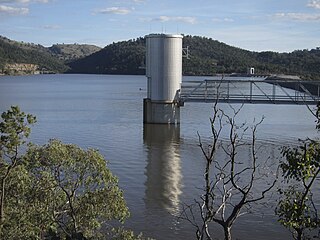
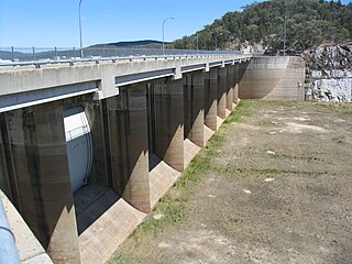
Wyangala Dam is a major gated rock fill with clay core embankment and gravity dam with eight radial gates and a concrete chute spillway across the Lachlan River, located in the south-western slopes region of New South Wales, Australia. The dam's purpose includes flood mitigation, hydro-power, irrigation, water supply and conservation. The impounded reservoir is called Lake Wyangala.

Table Rock Lake is an artificial lake or reservoir in the Ozarks of southwestern Missouri and northwestern Arkansas in the United States. Designed, built and operated by the U.S. Army Corps of Engineers, the lake is impounded by Table Rock Dam, which was constructed from 1954 to 1958 on the White River.

Copeton Dam is a major clay core and rock fill embankment dam with nine radial gates and a gated concrete chute spillway across the Gwydir River upstream of Bingara in the New England region of New South Wales, Australia. The dam's purpose includes environmental flows, hydro-electric power generation, irrigation, and water supply. The impounded reservoir is called Lake Copeton.

The Blowering Dam is a major ungated rock fill with clay core embankment dam with concrete chute spillway impounding a reservoir under the same name. It is located on the Tumut River upstream of Tumut in the Snowy Mountains region of New South Wales, Australia. Purposes for the dam include flood mitigation, hydro-power, irrigation, water supply and conservation. The dam is part of the Snowy Mountains Scheme, a vast hydroelectricity and irrigation complex constructed in south-east Australia between 1949 and 1974 and now run by Snowy Hydro.

The Wivenhoe Dam is a rock and earth-fill embankment dam with a concrete spillway across the Brisbane River in South East Queensland, Australia. The dam wall is located about 80 kilometres (50 mi) by road from the centre of Brisbane. The primary purpose of the dam is the supply of potable water for the Brisbane and Ipswich regions. In addition, the dam also provides for flood mitigation control, hydroelectricity and for recreation. The impounded reservoir is called Lake Wivenhoe and the dam, the lake and a narrow strip of surrounding land forms a locality also called Lake Wivenhoe.
Isabella Dam is an embankment dam located in the Kern River Valley, about halfway down the Kern River course, between the towns of Kernville and Lake Isabella in Kern County, California.

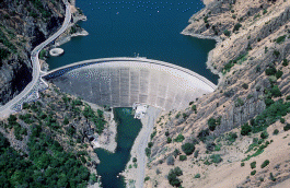
Monticello Dam is a 304-foot (93 m) high concrete arch dam in Napa County, California, United States, constructed between 1953 and 1957. The dam impounded Putah Creek to create Lake Berryessa in the Vaca Mountains.

Swinsty Reservoir is a reservoir in the Washburn valley north of Otley and west of Harrogate in Yorkshire, England. Construction began in 1871 and was completed in 1878. The capacity is about 866 million gallons, with a surface area of 63 hectares. It can be found from the A59 road.

The River Washburn is a river in Yorkshire, England. It originates high in the Yorkshire Dales and ends where it meets the River Wharfe. It lies within the Nidderdale Area of Outstanding Natural Beauty.

New Exchequer Dam is a concrete–faced, rock-fill dam on the Merced River in central California in the United States. It forms Lake McClure, which impounds the river for irrigation and hydroelectric power production and has a capacity of more than 1,000,000 acre-feet (1.2 km3). The Merced Irrigation District (MID) operates the dam and was also responsible for its construction.

The Sweetwater Dam is a dam across the Sweetwater River in San Diego County, California. It is located approximately 12 miles (19 km) east of San Diego, 9 miles (14 km) and borders Bonita to the southwest and La Presa to the northeast. The 108-foot (33 m)-high masonry arch dam impounds 960-acre (390 ha) Sweetwater Reservoir.

Amistad Dam is a major embankment dam across the Rio Grande between Texas, United States, and Coahuila, Mexico. Built to provide irrigation water storage, flood control, and hydropower generation, it is the largest dam along the international boundary reach of the Rio Grande. The dam is over 6 miles (9.7 km) long, lies mostly on the Mexican side of the border, and forms Amistad Reservoir. It supplies water for irrigation in the Rio Grande Valley, 574 miles (924 km) upstream of the Rio Grande's mouth on the Gulf of Mexico at Brownsville, Texas/Matamoros, Tamaulipas.

Pactola Dam is an embankment dam on Rapid Creek in Pennington County, South Dakota, about 10 miles (16 km) west of Rapid City. The dam was completed in 1956 by the U.S. Bureau of Reclamation to provide flood control, water supply and recreation. Along with the nearby Deerfield Dam, it is part of the Rapid Valley Unit of the Pick-Sloan Missouri Basin Program. U.S. Route 385 runs along the crest of the dam. The dam forms Pactola Lake, which at over 1,200 acres (490 ha) is the largest and deepest body of water in the Black Hills.

Camanche Dam is an earthfill Dam on the Mokelumne River in the central California, about 20 mi (32 km) from East Lodi. The dam and reservoir lie in the Sierra Nevada foothills in San Joaquin County. Construction of Camanche Dam was started in 1963 and completed in 1964. East Bay Municipal Utilities District (EBMUD) owns and operates it. The purpose of Camanche Dam and reservoir is to provide flood control, water flows for agriculture, habitat for fisheries and recreation for community.

Elizabeth Garnett was a British missionary to navvies and an author. She was a founder and leading force of the Navvy Mission Society.

Upper Barden Reservoir is an upland fresh water reservoir, one of two reservoirs that collect water from Barden Moor, and dam Barden Beck, a tributary of the River Wharfe in the Yorkshire Dales, North Yorkshire, England. The reservoir was opened in 1882 and also supplies fresh water to the Nidd Aqueduct, which transports it to Bradford. Upper Barden Reservoir was the second of the reservoirs to be built,.


