This article needs additional citations for verification . (February 2016) (Learn how and when to remove this template message) |
Hidden Valleys is a name, coined in 2004,[ citation needed ] used to describe an area of interesting historical and scenic value between the city of Nottingham and the town of Mansfield in the English ceremonial county of Nottinghamshire. Promotional literature and tourist information for the Hidden Valleys were created to encourage tourism in an area that had been blighted by industrial decline. Partners in the project were: Ashfield District Council; Gedling Borough Council; the East Midlands Development Agency; Nottinghamshire County Council; and the Coalfields Regeneration Trust. It was intended by the partners that the name would help the Ashfield area compete with the Peak District and Sherwood Forest. [1]
Nottingham is a city and unitary authority area in Nottinghamshire, England, 128 miles (206 km) north of London, 45 miles (72 km) northeast of Birmingham and 56 miles (90 km) southeast of Manchester, in the East Midlands.
Mansfield is a market town in Nottinghamshire, England, the main town in the District of Mansfield and Mansfield Urban Area. Nestling in the Maun Valley surrounded by hills, it lies 12 miles (19 km) north of Nottingham in a largely urban district, most of whose 106,556 population live in Mansfield, with Market Warsop a secondary centre. It is adjacent to the urban area of Sutton-in-Ashfield. Mansfield is the only major sub-regional centre in the county, covering an area of 30 square miles. It is the county's one local authority area directly to elect its Mayor. The district has been influenced by its industrial past of coal mining and textiles, which thrived into the 1990s. Today's Mansfield has 20.2 per cent (12,890) of its working-age population seeking key out-of-work benefits. The population has fallen over the last century along with this industrial base, despite some diversification.
This section does not cite any sources . (January 2019) (Learn how and when to remove this template message) |
The area boasts links with the poet Lord Byron, his daughter Ada Lovelace, the romantic novelist D. H. Lawrence, bodyline fast bowlers Harold Larwood and Bill Voce and the composer Eric Coates as well as links to the legend of Robin Hood.
George Gordon Byron, 6th Baron Byron, known simply as Lord Byron, was a British poet, peer, politician, and leading figure in the Romantic movement. He is regarded as one of the greatest British poets and remains widely read and influential. Among his best-known works are the lengthy narrative poems Don Juan and Childe Harold's Pilgrimage; many of his shorter lyrics in Hebrew Melodies also became popular.
Augusta Ada King, Countess of Lovelace was an English mathematician and writer, chiefly known for her work on Charles Babbage's proposed mechanical general-purpose computer, the Analytical Engine. She was the first to recognise that the machine had applications beyond pure calculation, and published the first algorithm intended to be carried out by such a machine. As a result, she is sometimes regarded as the first to recognise the full potential of a "computing machine" and one of the first computer programmers.
David Herbert Lawrence was an English writer and poet. His collected works represent, among other things, an extended reflection upon the dehumanising effects of modernity and industrialisation. Some of the issues Lawrence explores are sexuality, emotional health, vitality, spontaneity, and instinct.
Annesley Hall, Nottinghamshire and Newstead Abbey are two stately homes within the area. Historical religious buildings include: Felley Priory; St. Helen's Church in Selston, one of the county's oldest churches;[ citation needed ] and the Church of St. Mary Magdalene, Hucknall, the resting place of the Byron family and home to a fine collection of stained glass by the acclaimed artist Charles Eamer Kempe.
Annesley Hall is a Grade II listed country house near Annesley in Nottinghamshire, England and the ancestral home of the Chaworth-Musters family. The 13t-century park, 17th-century terraces and 19th-century pleasure gardens and walled gardens of the hall are Grade II* listed on the Register of Historic Parks and Gardens.
Newstead Abbey, in Nottinghamshire, England, was formerly an Augustinian priory. Converted to a domestic home following the Dissolution of the Monasteries, it is now best known as the ancestral home of Lord Byron.
Felley Priory is a former priory, located in the village of Felley, Nottinghamshire. It was established by Augustinians in 1156 and dissolved in 1536. A domestic house, which still exists today, was built upon the former monastic site soon afterwards.
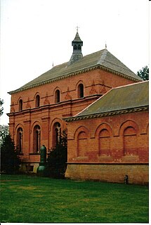
Papplewick Pumping Station is a fine example of a Victorian waterworks and houses an industrial museum. Bestwood Pumping Station is nearby.
Papplewick Pumping Station, situated in open agricultural land approximately 3 miles (4.8 km) by road from the Nottinghamshire village of Papplewick, was built by Nottingham Corporation Water Department between 1881 and 1884 to pump water from the Bunter sandstone to provide drinking water to the City of Nottingham, in England. Two beam engines, supplied with steam by six Lancashire boilers, were housed in Gothic Revival buildings. Apart from changes to the boiler grates, the equipment remained in its original form until the station was decommissioned in 1969, when it was replaced by four submersible electric pumps.
Bestwood Pumping Station was a water pumping station operating in Nottinghamshire from 1874 until 1964.
The D. H. Lawrence Birthplace Museum is located in Eastwood.
The D. H. Lawrence Birthplace Museum is a writer's home museum dedicated to the writer D. H. Lawrence situated in Eastwood, near Nottingham. It is the house in which he was born in 1885, and one of the four houses the family occupied in Eastwood. Now a museum, visitors can visit the building via guided or self-guided tour.
Eastwood is a former coal mining town in the Broxtowe district of Nottinghamshire, England, 8 miles (13 km) northwest of Nottingham and 10 miles (16 km) northeast of Derby on the border between Nottinghamshire and Derbyshire. Mentioned in Domesday Book, it expanded rapidly during the Industrial Revolution. The Midland Railway was formed here, and it is the birthplace of D. H. Lawrence. Eastwood is one of the few places where the distinctive dialect of East Midlands English is extensively spoken, in which the name is pronounced.
The East Midlands is one of nine official regions of England at the first level of NUTS for statistical purposes. It consists of Derbyshire, Leicestershire, Lincolnshire, Northamptonshire, Nottinghamshire and Rutland. The region has an area of 15,627 km2 (6,034 sq mi), with a population over 4.5 million in 2011. There are five main urban centres, Derby, Leicester, Lincoln, Northampton and Nottingham. Others include Boston, Skegness, Chesterfield, Corby, Grantham, Hinckley, Kettering, Loughborough, Mansfield, Newark-on-Trent and Wellingborough.
Nottinghamshire is a county in the East Midlands region of England, bordering South Yorkshire to the north-west, Lincolnshire to the east, Leicestershire to the south, and Derbyshire to the west. The traditional county town is Nottingham, though the county council is based in West Bridgford in the borough of Rushcliffe, at a site facing Nottingham over the River Trent.
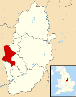
Ashfield is a local government district in western Nottinghamshire, England. According to the 2001 UK census, it has a population of 111,387, increasing to 119,497 at the 2011 Census. The district is mostly urban and contains parts of both the Nottingham Urban Area and the Mansfield Urban Area. The area has a tradition of coal mining. There are three towns in the district; the largest being Sutton-in-Ashfield. Settlements in the district include the following:
Hucknall, formerly Hucknall Torkard, is an English town in the district of Ashfield, Nottinghamshire. It was historically a centre for framework knitting and then for mining, but is now a focus for other industries and a dormitory town for Nottingham. It was the site where Rolls-Royce made the first demonstration of a vertical take-off plane. It is also the final resting place of Lord Byron in 1824 and of his estranged daughter, the mathematician and pioneer computer programmer Ada Lovelace in 1852.
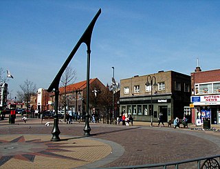
Sutton-in-Ashfield is a market town in the Ashfield district of Nottinghamshire, England, with a population of around 45,804. It is situated four miles west of Mansfield, two miles from the Derbyshire border and twelve miles north of Nottingham.
Kirkby-in-Ashfield is a market town in Nottinghamshire, England, with a population of 25,265, falling to 20,672 for the total of the 3 Ashfield Wards taken at the 2011 census. It is a part of the Mansfield Urban Area. The Head Offices of Ashfield District Council are located on Urban Road in the town centre.
The River Erewash is a river in England, a tributary of the River Trent that flows roughly southwards through Derbyshire, close to its eastern border with Nottinghamshire.
Jacksdale is a small former mining village situated in the local government district of Ashfield, part of the English county of Nottinghamshire. The population of the ward within the Ashfield Council was 3,158 as taken at the 2011 census. Lying close to the Derbyshire border, Jacksdale is the most westerly place within the county. Neighbouring villages include Selston, Brinsley, Pye Hill and Ironville. Jacksdale and Westwood are interlinking villages, although houses in Westwood are usually referred to as being newer, with 86 per cent of the housing in Jacksdale built before 1918.
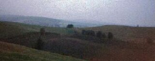
The Misk Hills consist of a gently undulating sandstone plateau between Hucknall and Annesley in the county of Nottinghamshire in the North East Midlands of England. They offer views Southwards across the town of Hucknall, and the City of Nottingham. They are locally considered to be the first hills in the Pennine Chain, and rise to a high point of 170 metres above sea level from the flat plains to the east. The hills are the source of three minor watercourses, the Gilt Brook, the Whyburn and Farleys Brook. They separate the Leen Valley from the Erewash Valley.
Underwood is a hilltop village within the civil parish of Selston in the English ceremonial county of Nottinghamshire. The village is a ward of Ashfield with a population of 2,953 taken at the 2011 Census. It stands in a former coal mining area in the Hidden Valleys and is in the local government district of Ashfield. The village offers views across the Erewash Valley towards the Southern Pennines. It is situated near to junction 27 of the M1 and is bordered by Bagthorpe and Selston, and Brinsley and Moorgreen to the south. The gardens of Felley Priory are accessible from the village. It is part of Nottinghamshire's 'Hidden Valleys' area.
Rainworth is a village which is split between the Newark and Sherwood and the Mansfield districts of Nottinghamshire, England.

Ashfield School is a secondary school with academy status located in Kirkby-in-Ashfield, Nottinghamshire, England, which educates children ages 11-19.
St Wilfrid's Church, Kirkby-in-Ashfield is a parish church in the Church of England in Kirkby-in-Ashfield, Nottinghamshire.
St John the Evangelist's Church, Kirkby-in-Ashfield is a parish church in the Church of England in Kirkby Woodhouse, Nottinghamshire.
Annesley Old Church or the Church of All Saints, Annesley Park, is a disused church in a ruinous condition which stands on a mound near to Annesley Hall, Nottinghamshire. The building remains are Grade I listed and are surrounded by a graveyard. The site is scheduled as an ancient monument.
Nottingham Industrial Museum is situated in part of the 17th-century stables block of Wollaton Hall, located in a suburb of the city of Nottingham. The museum won the Nottinghamshire Heritage Site of the Year Award 2012, a local accolade issued by Experience Nottinghamshire, an organisation funded variously by Nottingham City Council, Nottinghamshire County Council and other sources.
Coordinates: 53°04′N1°12′W / 53.06°N 1.20°W
A geographic coordinate system is a coordinate system that enables every location on Earth to be specified by a set of numbers, letters or symbols. The coordinates are often chosen such that one of the numbers represents a vertical position and two or three of the numbers represent a horizontal position; alternatively, a geographic position may be expressed in a combined three-dimensional Cartesian vector. A common choice of coordinates is latitude, longitude and elevation. To specify a location on a plane requires a map projection.