
Lakeshore West is one of the seven train lines of the GO Transit system in the Greater Toronto Area, Ontario, Canada. It extends from Union Station in Toronto to Burlington, with rush hour service extending to Hamilton, St. Catharines and Niagara Falls.

The Milton line is one of the seven train lines of the GO Transit system in the Greater Toronto Area, Ontario, Canada. It extends from Union Station in Toronto to Milton, by way of Mississauga.
The Relief Line is a proposed rapid transit line for the Toronto subway system, intended to provide capacity relief to the Yonge segment of Line 1 and Bloor–Yonge station and extend subway service coverage. Several routes are being considered. Several plans for an east–west downtown subway date back to the early 20th century, most of which ran along Queen Street. Since the early 21st century, studies propose a line that would run south from Line 2 Bloor–Danforth at a point east of the Don River, before bending westward along Queen Street into Downtown Toronto. Potential extensions could be made northward from its Line 2 connection in the east, as well as westward and northward from downtown to form a wide U-shape.

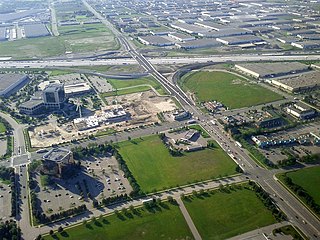
The Mississauga Transitway is a bus rapid transit (BRT) system in Mississauga, Ontario, Canada. It comprises a series of newly-constructed bus-only roadways, as well as reserved lanes on both existing city streets and portions of Highway 403, that together form a continuous 18 km (11 mi) route spanning most of the city from Winston Churchill Boulevard in the west to the junction of Highways 401 and 427 in the east, located within Etobicoke, part of the neighbouring city of Toronto. Service on the Transitway is provided by MiWay and GO Transit, some stations have connections to Brampton Transit and Toronto Transit Commission bus services.

The Big Move is the regional transportation plan (RTP) published by Metrolinx for the Greater Toronto and Hamilton Area (GTHA) in Ontario, Canada. It makes specific recommendations for transit projects, resulting from seven "green papers" and two "white papers" released for public discussion. A draft RTP was released alongside draft investment strategy in September 2008. After a series of stakeholder consultations and public meetings, the final RTP was approved and published by Metrolinx on November 28, 2008.
MoveOntario 2020 was a plan proposed by the Government of Ontario that would fund 52 rapid-transit projects throughout the Greater Toronto and Hamilton Area in Ontario, Canada. It was succeeded by The Big Move and GO Transit's Go 2020.
The Hurontario LRT is a planned light rail line in Mississauga, Ontario, Canada, that extends into Brampton, Ontario. This line will run along Hurontario Street. Due to the involvement of two transit agencies in this project, it is currently unclear which agency will operate the line; however, it is likely that Metrolinx will own the line.

The BLAST network is a plan for a frequent rapid transit system in the city of Hamilton, Ontario, Canada. The system consists of 5 routes, and includes two light rail lines (LRT). It was conceived as part of the city's 2007 transportation master plan. It was later incorporated by Metrolinx as part of its regional transportation plan, The Big Move. The B-Line LRT and A-Line are among the plan's prioritized transit expansion projects and were funding by the Government of Ontario in May 2015.

Bus rapid transit in New Jersey comprises limited-stop bus service, exclusive bus lanes (XBL) and bus bypass shoulders (BBS). Under the banner Next Generation Bus New Jersey Transit (NJT), the New Jersey Department of Transportation (NJDOT), and the metropolitan planning organizations of New Jersey (MPO) which recommend and authorize transportation projects are undertaking the creation of several additional bus rapid transit systems (BRT) in the state. In 2011, NJT announced that it would equip its entire bus fleet with devices for real-time locating, thus creating the basis for "next bus" scheduling information at bus shelters. The introduction and expanded use of bus rapid transit in Garden State is part of worldwide phenomenon to bring mass transit to heavily trafficked corridors in both high and medium density areas as a cost-saving, and sometimes more flexible, alternative to rail transportation, thus reducing automobile dependency and traffic congestion.

The A-Line is a planned bus rapid transit line running along James Street in downtown and Upper James Street on the escarpment in Hamilton, Ontario. It is part of Hamilton's proposed BLAST network, involving four other rapid transit corridors. It is identified by Metrolinx in its regional transportation plan The Big Move as a project to be completed by 2023.

Renforth, referred to during planning as Renforth Gateway, is a bus station on the border of the cities of Mississauga and Toronto, in Ontario, Canada. Located at Eglinton Avenue and Renforth Drive, it is the eastern terminus of the Mississauga Transitway and is close to the interchange between Highway 401 and Highway 427.
Winston Churchill is a bus station in the community of Erin Mills in western Mississauga, Ontario, Canada. It is located northwest of the Winston Churchill Boulevard/Highway 403 interchange and is the western terminus of the Mississauga Transitway.
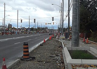
The Yonge Street Rapidway is a bus rapid transit corridor on Yonge Street in York Region, Ontario, Canada. Construction of the Yonge Street portion of the network began in 2014.
Dundas Street Bus Rapid Transit (BRT) is a bus rapid transit corridor proposed by Metrolinx through the regional transportation plan The Big Move. The City of Mississauga is using the brand Dundas Connects during the development phase.
The 407 Transitway is a bus rapid transit system (BRT) being planned along Ontario Highway 407, spanning the Greater Toronto Area between Brant Street in Burlington, and Enfield Road in Durham Region.
A rapid transit corridor is proposed along Steeles Avenue in Toronto, Ontario, Canada, which would be operated by the Toronto Transit Commission. It has not been determined if this corridor would be a bus rapid transit or a light rail transit line. It is identified by Metrolinx in its regional transportation plan The Big Move as a project to be completed in its 25-year plan. In February 2016, City of Toronto and TTC planners recommended implementing the Steeles BRT/LRT within a 15 year horzion.
A rapid transit corridor on Brant Street has been proposed in Burlington, Ontario. Metrolinx has proposed the corridor in their regional transportation plan The Big Move in two separate segments:
The Big Move is a regional transportation plan (RTP) published in 2008 and consisting of 62 rapid transit projects to be implemented across the Greater Toronto and Hamilton Area (GTHA). These rapid transit projects are intended to form a seamlessly integrated regional rapid transit network, which is the first priority action in the regional transportation plan. These projects form two long-term templates with 15 and 25 year horizons. These templates outline broad projects; specific details about technology, alignment, stations and service levels for each project are subsequently determined though a cost–benefit analysis, or an environmental assessment process.
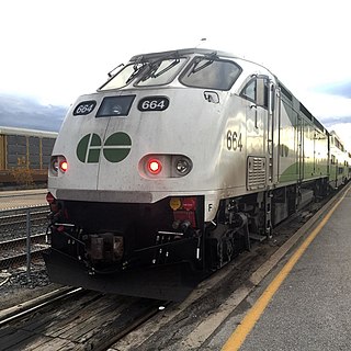
GO Transit rail services are provided throughout the Greater Toronto and Hamilton Area (GTHA) and the Greater Golden Horseshoe.

