Holes Bay is an intertidal embayment off Poole Harbour in the county of Dorset on the south coast of England. It lies mostly within the Borough of Poole and is close to Poole town centre. It is an important wetland bird haven.

Holes Bay is an intertidal embayment off Poole Harbour in the county of Dorset on the south coast of England. It lies mostly within the Borough of Poole and is close to Poole town centre. It is an important wetland bird haven.
Holes Bay lies on the south coast of England within the Borough of Poole, apart from its northwestern shore which is part of Upton. The bay drains the heathlands around Creekmoor and is bounded in the east by Sterte and Stanley Green, in the north by Creekmoor, in the northwest by Upton, in the west and southwest by Hamworthy and in the southeast by the Old Town area of Poole. [1]

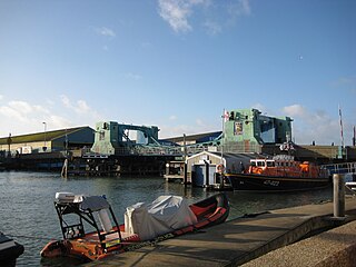
Holes Bay is a tidal inland lake which lies to the north of Poole Harbour. It is a designated harbour quiet area. The exit to the bay is a narrow gat between Lower Hamworthy and Poole Old Town, and runs past the RNLI lifeboat station and part of Poole Quay before entering Poole Harbour itself. Spanning the inlet are two bridges: Poole Bridge and the newer Twin Sails Bridge, opened in 2012. Access to Holes Bay for vessels with a draft greater than 2 metres (6.6 ft) is only possible when the bridges are lifted, which occurs at several fixed times daily and sometimes on request. The new bridge is intended to help reduce traffic jams by ensuring at least one bridge is open to vehicular traffic at any one time.
The northern part of the bay is crossed from west to east by the South West Main Line from London to Weymouth, and Poole railway station is less than one hundred metres from the southeastern corner of the bay. The A350 hugs the eastern shore and the A35 swings past its northern shore. In the northwest is Upton Country Park and Upton House, a public facility owned by the Borough of Poole. There is a marina on the western shore, south of the railway line. [1]
There is a wooded islet, Pergins Island in the north of the bay which is not open to the public. [1] [2]
Holes Bay is the location of the Royal National Lifeboat Institution (RNLI) training school, attached to their Poole headquarters. Uses of the bay include fishing, kayaking and small leisure craft. A large marina known as Cobbs Quay is on the west side of the bay.
The bay has a small tidal range of 0.6 m (2 ft) at neap tides and 1.8 m (6 ft) at spring tides, and a double high water. Maximum monthly temperatures range from an average of 8 °C (46 °F) in January to 27 °C (81 °F) in August; minimums range from 3 °C (37 °F) to 16 °C (61 °F). Ground temperatures on the mudflats can fall below freezing in winter. The prevailing winds are from the west or southwest, but sea breezes can also blow in from the south and southeast. [3]

Holes Bay is home to numerous wetland bird species including avocet, black-tailed godwit, curlew, kingfisher, little egret, oystercatcher, red-breasted merganser, redshank, spoonbill, teal and widgeon. [2]
The bay is used for fishing. Species that occur here include bass, mullet, flounder, corkwing wrasse and gobies. Marine invertebrates such as king ragworm, clams and cockles are also numerous. [2]
The mudflats of Holes Bay were rapidly colonized by cordgrass during the 20th century, covering 63% of the intertidal zone between 1901 and 1924, [4] before receding again between 1924 and 1980 due to erosion and die-back. [5]
Its vegetation includes woodland wild flowers, saltmarsh plants and grassland species including orchids. [2]
In 2015, Poole Borough Council, the Dorset Wildlife Trust and other interested parties established the Holes Bay Nature Park to bring local people closer to nature and to ensure the habitat is managed for the benefit of the great variety of wildlife found within it. [6]

Poole is a coastal town and seaport on the south coast of England in the Bournemouth, Christchurch and Poole borough of Dorset, England. The town is 21 miles (34 km) east of Dorchester and adjoins Bournemouth to the east. Since 1 April 2019, the local authority is Bournemouth, Christchurch and Poole Council. The town had an estimated population of 151,500 making it the second-largest town in the ceremonial county of Dorset. Together with Bournemouth and Christchurch, the conurbation has a total population of nearly 400,000.

Poole Harbour is a large natural harbour in Dorset, southern England, with the town of Poole on its shores. The harbour is a drowned valley (ria) formed at the end of the last ice age and is the estuary of several rivers, the largest being the Frome. The harbour has a long history of human settlement stretching to pre-Roman times. The harbour is extremely shallow, with one main dredged channel through the harbour, from the mouth to Holes Bay.

Upton is a town in south-east Dorset, England. Upton is to the east of Holton Heath and Upton Heath, and to the north of the Poole suburb of Hamworthy. It is the second largest town in the Purbeck Hills.

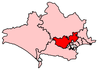
Mid Dorset and North Poole is a constituency represented in the House of Commons of the UK Parliament since 2015 by Michael Tomlinson, a Conservative.

Chichester Harbour is a large natural harbour in West Sussex and Hampshire. It is situated to the south-west of the city of Chichester and to the north of the Solent. The harbour and surrounding land has been designated as an Area of Outstanding Natural Beauty (AONB) and a biological and geological Site of Special Scientific Interest (SSSI). The area is also part of the Solent Maritime Special Area of Conservation, Chichester and Langstone Harbours Ramsar site, Special Protection Area and Nature Conservation Review site, Grade I. Part of it is a Geological Conservation Review site and two areas are Local Nature Reserves.

Hamworthy is a village, parish, peninsula and suburb of Poole in Dorset, England. It is sited on a peninsula of approximately 3 square kilometres (1.2 sq mi) that is bordered by the town of Upton to the north, Poole Harbour to the south, Lytchett Bay to the west and Holes Bay to the east. Poole Bridge, the southern terminus of the A350 road, connects the suburb with the town centre. Hamworthy is the location of the Port of Poole ferry passenger terminal and cargo handling operations.

Poole railway station is on the South West Main Line serving the town of Poole in Dorset, England. It is situated in the town centre next to Holes Bay. It is one of four stations in the Borough of Poole and is 113 miles 62 chains (183.1 km) down the main line from London Waterloo.

Christchurch Harbour is a natural harbour in the county of Dorset, on the south coast of England named after the nearby town of Christchurch. Two rivers, the Avon and the Stour, flow into the Harbour at its northwest corner. The harbour is generally shallow and due to the tidal harmonics in the English Channel has a double high water on each tide. On the north side of the harbour, east of the Avon are Priory Marsh, and to the east of this Stanpit Marsh, a Local Nature Reserve. To the west side of the harbour are Wick Fields, the southern flank of the harbour being bounded by Hengistbury Head, a prominent coastal headland. The harbour flows into the Christchurch Bay and the English Channel through a narrow channel known locally as The Run which rests between Mudeford Quay and Mudeford Spit. Shallow-draught boats can enter from this channel and cruise up stream for 2 miles (3 km) choosing either the Avon or the Stour, the Stour leading up as far as Iford Bridge passing Christchurch Quay and Tuckton.

The Southampton and Dorchester Railway was an English railway company formed to join Southampton in Hampshire with Dorchester in Dorset, with hopes of forming part of a route from London to Exeter. It received Parliamentary authority in 1845 and opened in 1847.
Fleetsbridge is a small area of Poole, Dorset, centred on a busy gyratory and flyover. It lies north of Poole town centre and borders the neighbouring suburbs of Waterloo, Creekmoor, Oakdale and Canford Heath. The use of land varies between residential, retail and some light industry. The area is also home to Parkstone Grammar School when it moved there from Lower Parkstone in 1962. The site of the Tesco at Fleets Corner was, up until the 1980s, the home of Hamworthy Recreation Football Club before the land was sold and the club moved to Canford Magna on the northern extreme of the Borough of Poole. Opposite to Tesco, across Waterloo Road, is the home of the headquarters of the global company, Hamworthy Combustion Engineering. Fleets Industrial Estate lies to the south of the gyratory off Fleets Lane and is adjacent to Wessex Gate Retail Park, which has large retail outlets such as DFS, Currys and PC World.
The history of Poole, a town in Dorset, England, can be traced back to the founding of a settlement around Poole Harbour during the Iron Age. The town now known as Poole was founded on a small peninsula to the north of the harbour. Poole experienced rapid growth as it became an important port following the Norman Conquest of England.

Poole Bridge is a bascule bridge in Poole, Dorset, England. Constructed in 1927, the bridge provides a road link across a busy boating channel. In February 2012 a second bridge was completed intending to operate in conjunction with the existing bridge

Upton Heath is one of the largest remaining fragments of a heath that once stretched across central southern England from Dorchester to Christchurch and beyond. Today it is confined to an area immediately west of Upton and Poole, much of which is protected. From the Heath there are views across Poole Harbour, Corfe Castle and the Isle of Purbeck.

Poole Lifeboat Station is the base for Royal National Lifeboat Institution (RNLI) search and rescue operations at Poole, Dorset in England. The first lifeboat was stationed at Poole Harbour in 1865 and the present station was opened in 1988. Since November 2016 it has operated two inshore lifeboats, an Atlantic 85 and a D class.

Turlin Moor is a suburb of Poole in Dorset, England, located between Hamworthy and Upton.

Holes Bay Nature Park is a protected area, 286 hectares in size, on and around Holes Bay, an embayment of Poole Harbour within the Borough of Poole that is important for wildlife, especially wetland birds. It was designated a nature park in March 2015.

Pergins Island is a small, uninhabited island in Holes Bay, an embayment off Poole Harbour in Dorset on the south coast of England. It is not accessible to the public.

The Poole Harbour Trails comprise six linear walks that enable a complete circuit to be made of Poole Harbour on the south coast of England, which is said to be the second largest natural harbour in the world.
![]() Media related to Holes Bay at Wikimedia Commons
Media related to Holes Bay at Wikimedia Commons